Pacer Path – Aiken, SC
- 3.92 miles
- 3:26 duration
- 194 foot elevation gain
- 8 geocaches found
- 1 souvenir earned
Deban and I traveled to Aiken, SC this weekend for the Heart Show – a family and Aiken tradition. Held annually in February, the Heart Show is a fundraiser for the Aiken Heart Board – promoting heart health and raising funds for heart disease research.
The Heart Show is a musical play that shows to sold-out crowds every year. Deban’s uncle Jim Moore has written and directed the play for 40+ years and her cousins Julie and Jimmy are regular cast members. This year’s play was actually written by Jimmy, and Jim had a co-director for the first time, as he has been experiencing health difficulties over the past year.
Family members of Jim and his wife Caroline from as far away as Pennsylvania, Kentucky and Florida (and of course Tennessee in our case) gather each year to attend the Heart Show, making this time a bit of a family reunion as well.
Deban and I arrived on Friday afternoon, and spent time catching up with family and enjoying dinner together before checking into our inn. While there are several opportunities to attend the play over the weekend, we always go to the Saturday evening show.
As we had driven into Aiken on Friday afternoon I was looking at the geocaching app. I noticed a highly-favorited group of geocaches on the campus of the University of South Carolina – Aiken. I clicked on a mystery cache to see what it was about, and within a couple of minutes had solved the simple puzzle to learn the coordinates for the location of the cache. This looked like a good place to spend some time on Saturday, so I decided that would be my goal for the day.
While Deban visited with family on Saturday, I went geocaching. I wanted to make certain I found at least one cache in order to earn my Leap Day souvenir – a digital badge of honor for finding a cache or attending an event on February 29.
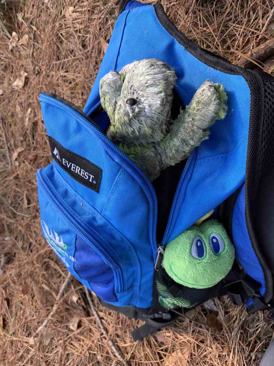
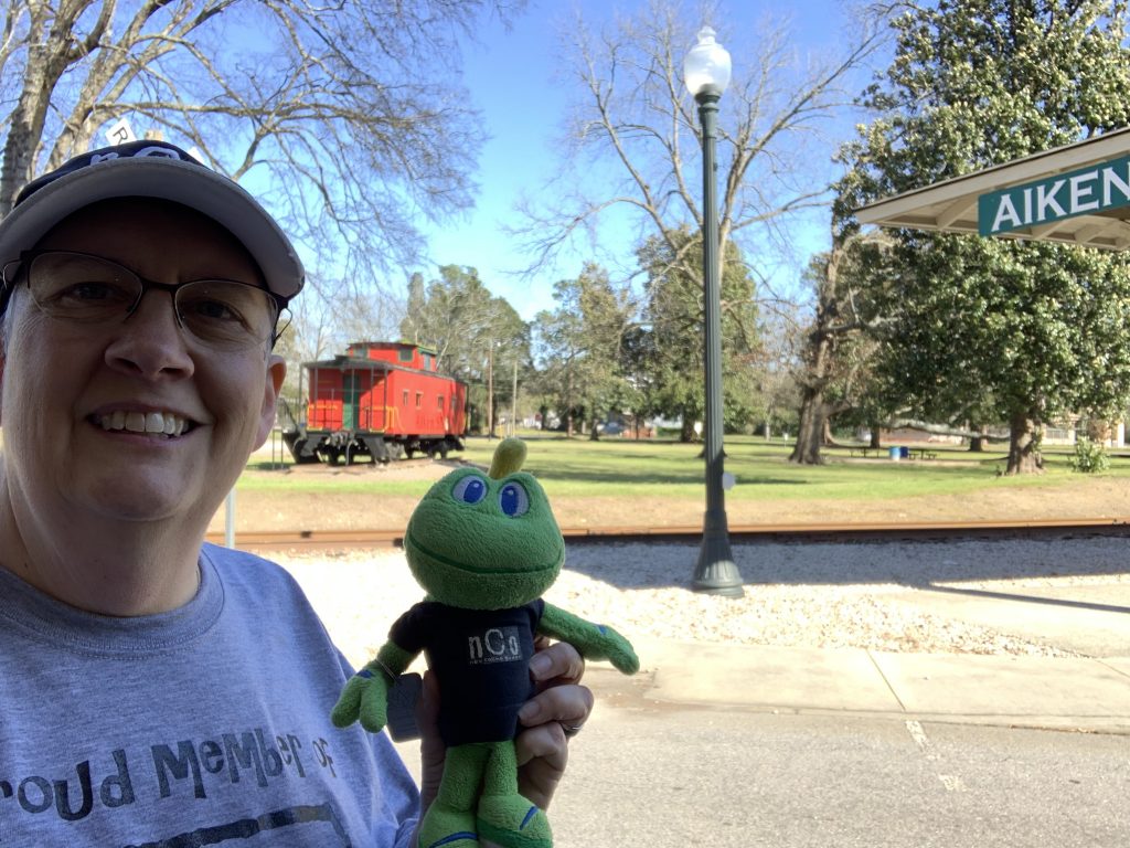
I arrived at the posted parking coordinates at 11:00 am. Across the street from parking was a large sign announcing this was the location of Pacer Path – a four mile set of trails used by local cross-country teams. I missed having my hiking buddies Rob and Andy with me, but I noticed a sign saying that no pets were allowed, so I wouldn’t have been able to bring Andy anyway. I guess Rob would have been allowed, since he is nobody’s pet but Kara (his wife). I did have Signal the Frog with me, and he rode in the side pocket of my day pack as usual.
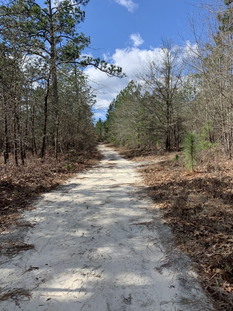
I set off in a counter-clockwise direction on the outside loop of the trails, moving toward the mystery cache that I had solved the afternoon before. The temperature was a moderate 50° but with 16 mph winds it was a tad chilly. I was happy to be wearing my nCo hoodie, and even considered pulling up the hood to protect my ears from the breeze. Once I was moving, it was not quite as chilly, so I didn’t do that. The skies were partly cloudy, with a lot of blue showing and plenty of sunshine. When we had left Tennessee the day before it was snowing, so this felt great!
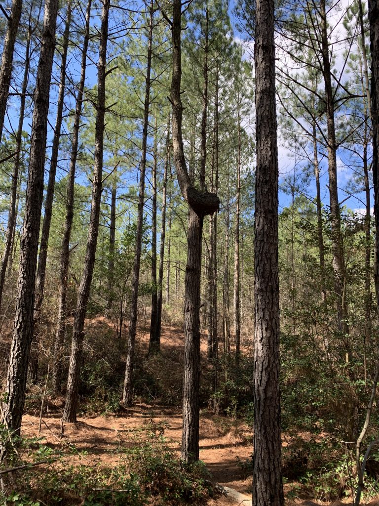
The path was 15 feet wide, and constructed of sandy soil and grass. It was very comfortable to walk on, and I’m sure good for running as well. It was mostly level, with only a few gentle hills on the far end of the loop. Most of it wound through a pine forest that is very different from our hardwood forests back home.
It took about eight minutes of walking to reach that first geocache. It was just off the trail about 20 feet, between the trail and the busy county road. It took me a few minutes to find because it was hidden beneath a layer of pine needles. In fact, the whole forest floor was covered with pine needles, so I just had to look for suspicious lumps to find this and most of the caches today.

The geocache was a “golden” ammo can, hidden in honor of a local geocacher to celebrate their reaching the 1,000 find milestone. This is apparently a tradition of the local geocaching community. There are several of these gold-painted ammo cans scattered around this area, and I have found some of them on previous trips.
After I had signed the log sheet, I checked the geocaching app to decide where I would go next. There were three mystery caches nearby that I had glanced at the night before. Two mentioned needing to first find the third in order to learn their coordinates. Looking at that cache’s description, I had decided it looked too complicated for me to tackle. I looked at them again today, and thought, “Why not? I should at least try.”
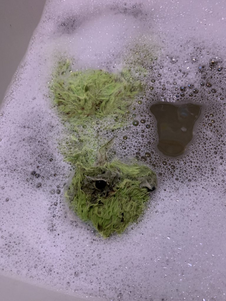
I headed on around the loop toward them, still mentally debating whether I should try those or not. As I was walking, I noticed something green lying about 10 feet off the path. I walked over to see what it was, and found a very disheveled looking stuffed frog. It must have been dropped by a child, but had obviously been lying there for some time based on its condition.

Signal insisted that we couldn’t just leave him lying there all alone, so I picked him up and put him in my backpack. I would take him home and give him a good bath, but for now he was safe and sound after spending who-knows how many nights alone in the wild.

While stopped I again took a moment to look at the cache pages for those mystery caches. It hurt my brain to read the description on the first one. I thought, “I can’t do this. Forget it.” I looked at other caches along the paths, and noticed another golden ammo can mystery.
I looked at its cache page, and although it was a little more complicated to solve than the one I’d done the day before, I felt like it was a possibility. I would just need to spend some time searching Google for answers. I sat down by the trail, dug in my day pack for a small note pad, and a snack. I was thrilled to see that I had placed a container of dark chocolate covered coffee beans in my pack, and helped myself to some of them while I worked on the puzzle. As I was putting the lid back on the container, it slipped through my hands and about eight more coffee beans flew out onto the ground around me. I couldn’t let some unsuspecting wildlife eat them and get sick, so I had extras for my snack.
The cacher that the mystery cache was dedicated to is named Hiking2175. He is apparently an avid hiker, and has hiked the entire Appalachian Trail in sections, thus the 2175 in his name (the original length of the trail in miles). In fact, according to the cache page he was first introduced to geocaching while hiking a section of the trail in Maine. All of the questions had to do with the trail and points along it. I was soon able to find all of the digits I needed to learn the coordinates.
I plugged the coordinates in, and saw that this cache was hidden in the middle of the area I was exploring. I decided to continue on around the perimeter to log some traditional caches on the other side, and then come up the middle to find that cache. Once again I thought about those three mystery caches and since I was near a posted waypoint for the spot to leave the main trail to go to the first one, I considered trying them.
Once I had begun walking again I turned right on the trail that dissects the center of the area. It was a short walk along it to the waypoint, and then a left turn to go toward the first difficult mystery cache. That trail soon started leading away from the posted coordinates, so I gave up once again. It quickly joined back up with the main trail, so I continued following it toward the traditional caches I had seen on the map.
This was the area where the trail became more hilly, and I descended through a couple of gentle turns. I spotted a very interesting tree just off the path, and stopped to take a picture of it. About 20 feet high it has a strange twist, perhaps as the result of damage when it was very young.
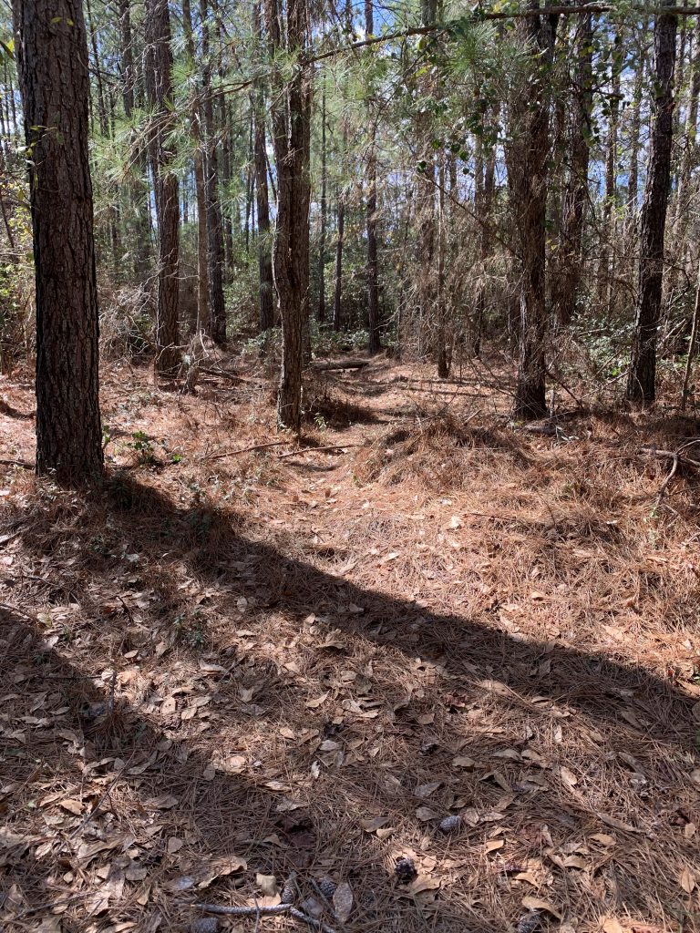
I checked the app and saw that I was now very close to the first traditional I wanted to find. There seemed to be a bit of a pine needle-covered trail leading in that direction, so I began following it.
As I neared the coordinates for the cache, I paused for a moment to look at the hint. It said, “Behind the fan.” What in the world could that mean? A fan in the middle of the woods?
My phone was pointing me into some large shrubs, so I looked for a way to make my way through them. They seemed too thick and impenetrable, so I decided to circle around. As I did, I saw something on the other side and suddenly the hint made sense!
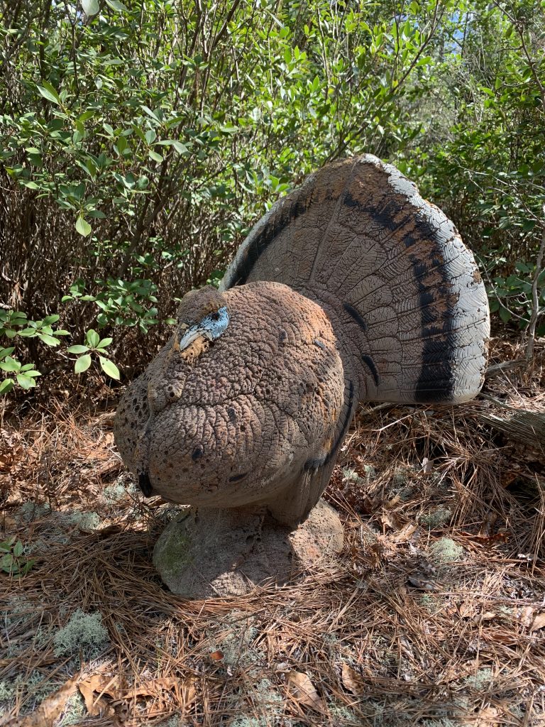
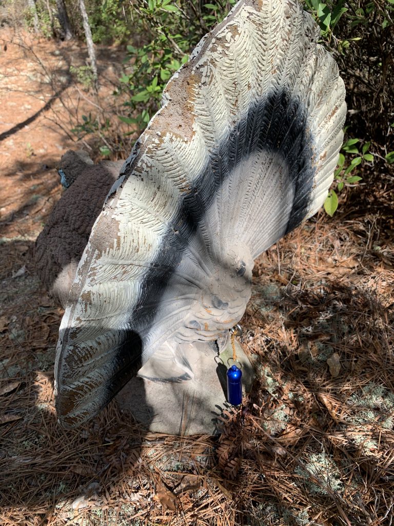
There were only a few names on the log sheet for this cache, and when I looked at the cache page I saw that it was a new cache, just hidden about a month ago. I also saw that the cache description had advised leaving the main trail at the twisted tree for the easiest route to the cache. I had done that without even reading it.
The actual cache container was a bison tube, making this the smallest I would find for the day. All the rest were ammo cans.
Back on the main trail, I continued in the direction of the next cache. It was just about two tenths of a mile away. As I neared the coordinates, I spotted a faint geotrail leading into the woods. I followed it, and then stopped to look at the hint for this cache. “Under pine straw.” Right. That’s very helpful when there are pine needles EVERYWHERE! I spent about ten minutes wandering around poking at piles of pine needles with a stick I had picked up. Finally, I spotted it nearby peeking out from yet another pile.
I signed the log book and dropped off a travel bug. I then had a decision to make: continue on around the loop logging traditional caches, or backtrack and attempt the mystery caches. Yes, I can be quite indecisive at times! I finally decided once and for all to go for the mystery caches.
I got back on the trail and headed back in the direction I had come. After a short distance, I met a young couple walking toward me. We greeted each other, and then the young man said, “Can we get out in this direction?” I told them I didn’t know, and added that I had come the same way they had, but turned around to head back. They looked worried, but I assured them I thought it circled on around and they could continue the direction they were going. That seemed to satisfy them, and we parted ways.
I backtracked about three tenths of a mile, and then left the trail to make my way toward the posted coordinates for the first mystery cache. I thought to myself once again how nice and clear the forest was here, making it easy to move off-trail. I climbed a hill, and then realized I needed to move toward my left as I had overshot the cache.

As I was making my way across, I suddenly found myself faced with a thick mass of vegetation that I could not pass through. So much for that clear forest floor.

I turned and retraced my steps for a hundred feet or so, and then circled around the obstacle. Finally I reached the cache site and found a four inch diameter PVC pipe next to a fallen log.
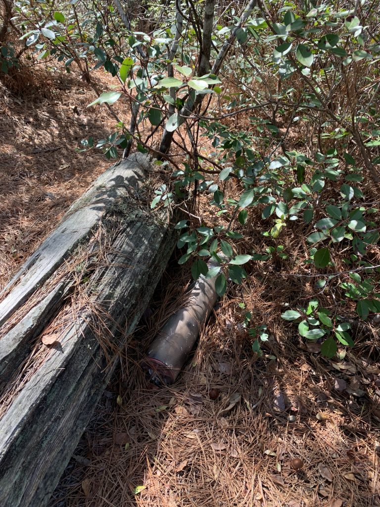
I sat on the log and opened the pipe. Inside were several wooden blocks and a long metal bolt with a nut at one end.

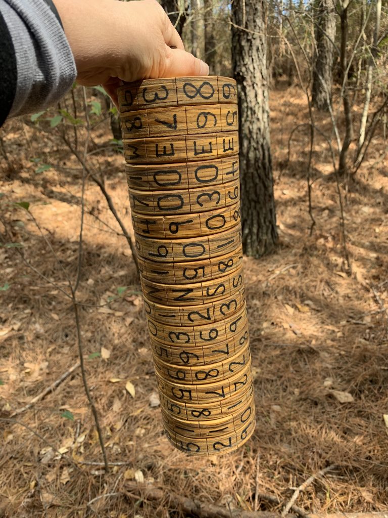
The geocache description explained that Thomas Jefferson had invented The Jefferson Disk which was used to create and decode ciphers. These were used to protect military communications.
The cache page had provided a keyword and a cipher. The letters of the keyword were written on one side of each wooden block, and I was instructed to use them to arrange the blocks on the metal rod in the correct order.
Once I had done that, I was instructed to turn each block so that it spelled out along one side the cipher I had been provided.
I then needed to look at one of the other sides to find the coordinates for the next stage of this cache. A third side provided me with the keyword for my next stage. The fourth side gave me a cipher word for that next stage. This was turning out to be easier than I thought, and was a lot of fun to boot.
I took photos at every stage, but will not publicly post the coordinates or cipher. However, here is a photo of the blocks spelling out the next keyword.

Once I had done all of this, and replaced the blocks and rod back into the tube, I made my way through the woods to the next location, less than one hundred feet away. I had probably walked right past it earlier while looking for stage one.
At the second stage, I found another PVC tube, this time filled with round disks on another rod. They were arranged on the rod in a random order, and held in place by a wing nut. This was a more accurate depiction of The Jefferson Disk than the blocks. The cache page told me that the blocks had been used in stage one to familiarize me with the concept.
I unscrewed the wing nut and placed it in the pocket of my jacket so that I wouldn’t lose it. I then spread the disks out on the ground. On the face of each one was a letter with a small subscript number below it. I used these to spell the keyword that I had learned from the first wheel, and placed the disks on the rod in the correct order.

I then was required to spin the disks in order to line up the letters of the cipher word I had been provided. After I had done that, the line on the disks under the cipher word gave me the coordinates for the final stage.
But, I wasn’t done with the Jefferson Disk yet. I needed to use the disk to learn the coordinates for the two other mystery caches in the area. One dealt with the connection between Thomas Jefferson and John Adams. The other, his connection with Benjamin Franklin. Both of those cache pages included history about the men, and instructions for using the wheel to find the coordinates for those two geocaches.
One of those cache pages instructed me to rearrange the disks on the rod to spell out yet another keyword. To do this, I needed to remove that wing nut again. As I did that, I spun it too hard, and it went flying off the rod. I was sitting on the ground which was covered with pine needles and other forest debris. The rusty wing nut was the same color as the needles. Rather than searching for a needle in a hay stack, I found myself searching for a wing nut in a needle stack. It took me five minutes of sifting through the pine needles before I finally found it.
At last I had all of the info I needed in order to find the final stage of the first mystery cache, the final stage of a second cache, and the second stage of a third cache.

I scrambled the order of the disks on the wheel, being very careful not to lose the wing nut again. I then put everything back in the tube and hid it before setting off to find the cache containers.
The first was just about 90 feet away. The hint for it was “Oak tree” which made it much easier to find since most of the trees in this forest were pines. Much more helpful than the commonly used hint in our area “Cedar tree.” With so many cedars in our forests, that doesn’t narrow it down much.
I happily signed the log book for this cache, and then set off in search of the next. About 120 feet from the cache was a dump area filled with two liters bottles and other trash. I hate seeing something like this in the woods, and wished I had brought along a trash bag or three.

Rather than go back to the trail and follow it to the next cache site, I decided to bushwhack across to it. Thankfully, this section of forest was mostly clear, so it wasn’t too terribly difficult.
I found the next mystery cache a short distance from the trail where I had passed by earlier. As mentioned earlier, this one was dedicated to the relationship between Thomas Jefferson and John Adams. They were good friends, and worked together to create the Declaration of Independence. However, in later years they became bitter rivals when running against each other for president.
They resumed their friendship late in life, and ironically both died within hours of one another, on July 4, 1826, on the fiftieth anniversary of the signing of the Declaration of Independence. I love the things I learn while geocaching!
Once I had signed the log for this cache, I got back on the trail and made my way toward the coordinates for the next stage of the cache dedicated to the relationship between Jefferson and Benjamin Franklin.
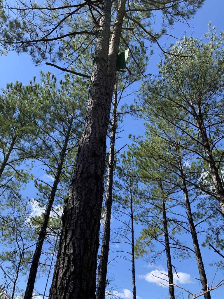
We’ve all heard the story of Benjamin Franklin flying a kite in a storm in order to prove his theory that lightning was an electrical charge. At this stage of the geocache, I had to find Benjamin’s kite with a key attached, and use numbers printed on the key to determine the final coordinates for the hide.
It took me longer than I would like to admit to find the kite. It was high in a tree, and I was not looking high enough. The sun was shining from right behind it at the point where it was most visible in the tree, making spotting it even harder. I finally did find it, and stepped around the tree to find the string running down to the key. There I found the numbers I was searching for.

After putting those numbers in my phone, I saw that the final location was very close. I made my way over and began looking for the cache. Once again, finding an ammo can hidden under pine needles proved more difficult than I would have liked, and it took me a while to spot it. I finally did, signed the log, and then set out to find another cache.
By this time, the battery in my phone was very low since I had been using it so much for navigation, taking photos and Google research. I knew I had very little time left in the woods, but wanted to log two more caches.
I began jogging along the trail and soon reached the location of a traditional cache. This was another ammo can, and thankfully not covered by needles but hiding behind a stump. I was able to locate it quickly and move on to the next.
The last cache was only 528 feet away, on the other side of the trail. I had to do some bushwhacking to make my way over to it, and found the forest a bit thicker here. I had to keep winding back and forth to avoid obstacles, which slowed me down more than I would have liked.
In several places today, I had seen moss that is much different from what we have at home. It was lighter green, and seemed more brittle and lacy.

As I made my way toward through this section of woods, I spotted one little mound of moss that looked like ours at home.

This last cache was the golden ammo can hidden in honor of the hiker/cacher. I had solved for the coordinates early in the day while sitting by the trail having a snack.
I finally grew close and this time found the can at the base of a tree, camouflaged by a pile of sticks rather than pine needles.

I quickly signed the log, replaced everything as I had found it, and navigated through the woods back toward the previous cache, knowing that this would take me back to the trail. I think I found an even more difficult route coming back out than going in, but at last I saw the trail.
By now the temperature had warmed up enough that I shed my sweatshirt as I quickly walked back to the car. I was glad to get back with about 10% charge left on my phone. I plugged it in and sat having a snack and a drink while deciding what to do next.
It would take too long to get enough charge on the phone to tackle the remaining geocaches along the trail, so I decided to leave them for another visit.
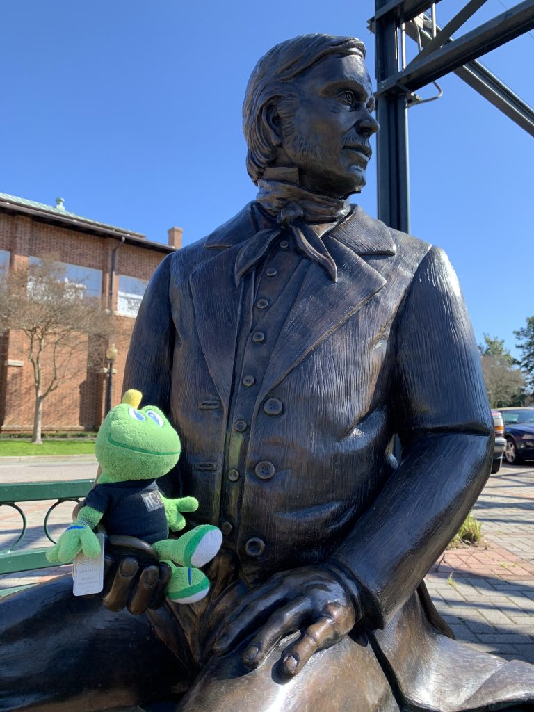
Instead, I drove into downtown Aiken where there is a virtual cache. This is one of the rarer types of geocaches, so I try to log these whenever I notice one is nearby.
This turned out to the be a two-part virtual, requiring me to visit two different locations three tenths of a mile apart. The first location was a statue of William Aiken, for whom the town is named. Here I had to answer questions about the statue.
The second location was at the train museum, and I needed to provide the titles on two signs there.
I enjoyed the scenery as I walked from one location to the other. In all my visits to Aiken, I had never been downtown.

When I returned to the car, I drove to Caroline and Jim’s house where I spent the rest of the afternoon logging my finds online before having supper, going to the inn to shower and dress, and then attending the Heart Show.
It was a very entertaining show and a great way to end a stellar day.
Epilogue:
When we had returned home on Sunday, I went about giving the little frog that Signal and I rescued a spa day. First, he had a long soak in warm, sudsy water in the kitchen sink:
I took Andy for a three mile walk, and when I came back I started the scrubbing process. At first, I was simply scrubbing at the dirt with my bare hands, but then decided to get a hair brush since some of it was pretty stubborn.
After ten to fifteen minutes of scrubbing, I rinsed the little fellow, and drained the dirty water from the sink. It was so thick and muddy it looked like swamp water.
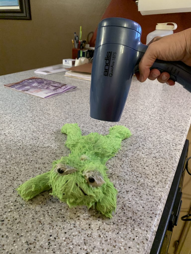
I ran more soapy water and let him soak for another 30 minutes or so before tackling the dirt one more time. I was able to get him cleaned up pretty well, although he still had some staining from mold on his belly. His “fur” was a little thin in some places, and the seam along his back had separated, but other than that, he looked much better than when we found him.
I got the drying process started with a hair dryer…
…and then draped him over the dish drain to dry all night.
By Monday evening, he was dry. After “feeding” him some poly-fiber to plump him up a little, and repairing the tear in his back, I gave him a new necklace, an nCo travel bug tag.
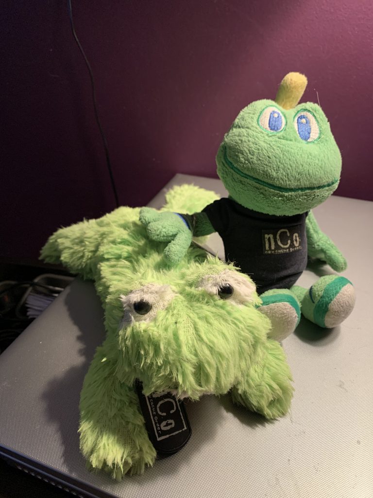
He is now an official geocaching traveler, and will travel with Signal and I around the world. I named him Leaper since we found him on Leap Day. If you are a geocacher and like to discover travel bugs, his code is 511220.

Loved reading about this geocaching adventure. The forest area was very different, my type of terrain there. Pleased you were able to rescue Leaper. Hope him and Signal have many happy and fun geocaching adventures.
Very interesting location.