Lone Oak Trail
- 5.5 distance
- 4:37 duration
- 2,146 foot elevation gain
- 5 geocaches found
- 1 blister
Our geocaching pal BackWoodsAng has been at it again. He has been busy in the first months of 2020 hiding caches and LakeBum (Rob) and I have been following in his footsteps to find them. We have logged quite a few miles, encountered some tough terrain, and had a lot of fun while doing so.
One of his hiding excursions took place on the back side of Buffalo Mountain Park along the Lone Oak Trail in early February. Rob and I had hiked this trail from Lone Oak Road to Tip Top in November 2018.
One of the caches we found on that trip was an ammo can that had been disabled a few months before. Sometimes a cache owner (CO) will disable a cache if someone reports it missing. This gives them the opportunity to go out and check on it, replacing it if necessary. If they don’t do this in a timely manner, the reviewers will send a warning note, and will eventually archive it (removing it from the website) if action is not taken.
Although we had logged that the cache was still in place, the CO never enabled it to show that it was back in play. A year after we found it, the reviewers archived the cache.
In early February, a new cache published called Lone Oak Cache. The player who hid it reported in the cache description that when he was placing it he found another ammo can already hidden there. This is the cache that Rob and I had found in November 2018.
In a quest to be First to Find, Ang hiked up the Lone Oak Trail the next day, only to find that another cacher had found it moments before him. He was also on a mission that day to search for another archived cache – an ammo can that was hidden by local geocaching legend DMFlyer. In 2008 a forest fire devastated the section of Buffalo Mountain where this cache was hidden. Knowing that it was in the area affected by the fire, DMFlyer disabled the cache intending to check on it. Another geocacher found it shortly after and reported that the can was still intact but the contents were mostly a melted mess.
DMFlyer never made it up to the mountain to check on his cache, and never took it off the disabled list. Some time later, the reviewers archived it.
Ang loves to find archived ammo cans, so he decided this would be a good time to hike on past the new cache to this location. He picked up the archived can that had been found at the new cache location and carried it with him to use in case he couldn’t find the one archived in 2008. Along the way, he hid a couple of other caches. There was also another cache along the trail that we had not yet found. This would give us a total of five caches to search for on this excursion.
Rob and I both had early evening plans with family, so we decided to get an early start to the day. He picked Andy and me up at 8:00 am, which felt even earlier than usual because we had “sprung forward” our clocks the night before. Actually, it was a few minutes after 8:00 when he arrived because he first had to scrape the ice off his car. That shows what a cold start to the day we had.
When we reached the trailhead along Lone Oak Road in Washington County, the temperature was 28° and the sun was shining. As we got out of the car and prepared for the hike, Rob lamented the fact that he had forgotten to bring gloves. I must admit I was glad I had mine for the start of the hike, as it was pretty chilly, especially in the shade of the deep valley where the hike began. I also pulled my knit cap out of my backpack and put it on to keep my ears warm. I was dressed in hiking pants, a long sleeve shirt and my down jacket, ready for the cold start, but also prepared to shed a layer later as it warmed up.
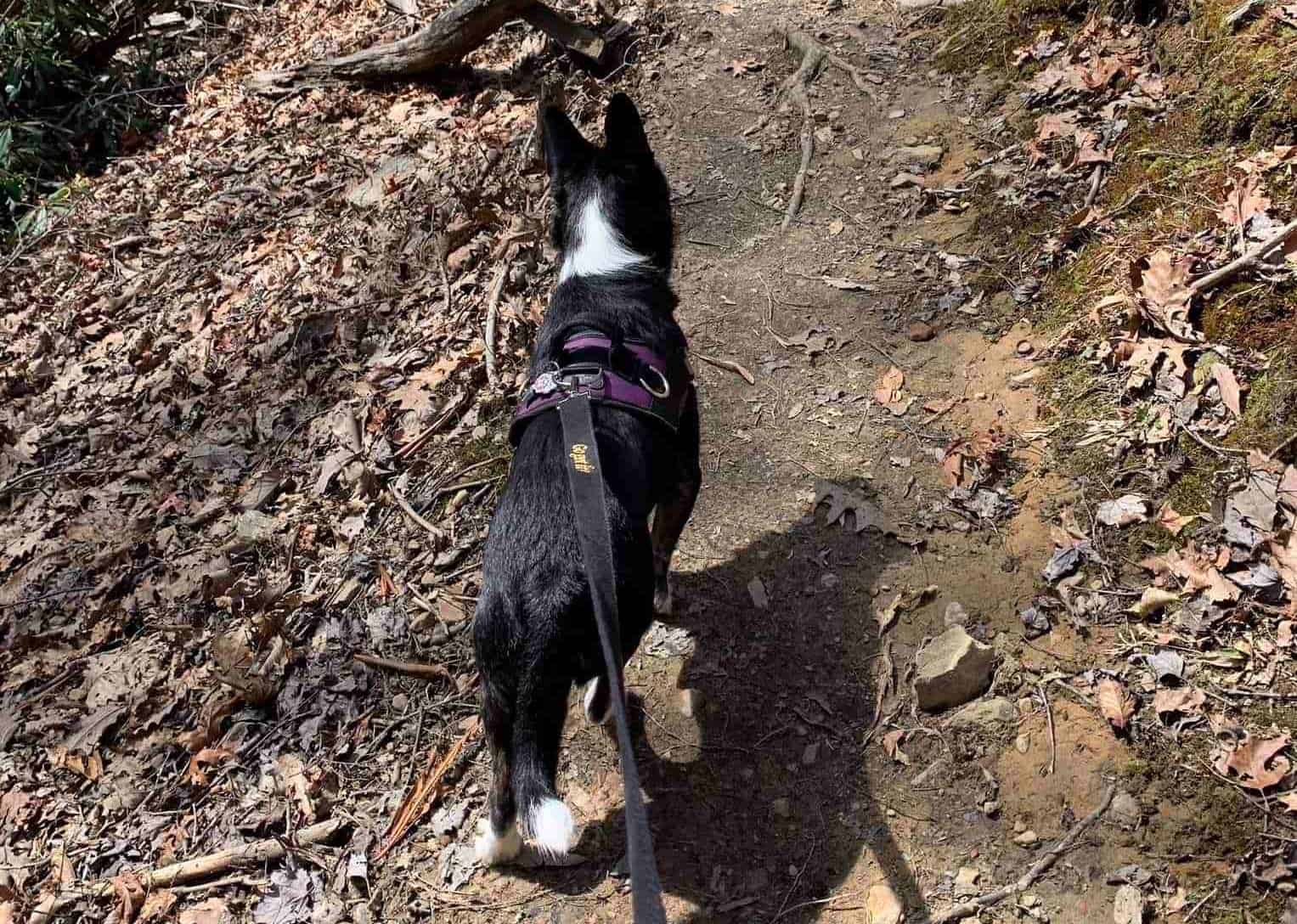
Riding in the side pocket of my backpack was my usual companion, Signal the Frog. For the first time, he was sharing his usual spot with his new buddy Leaper the Frog, who we had found on Leap Day while geocaching in South Carolina.
We crossed the road and started hiking up Lone Oak Trail at 8:43 am. Within two hundred feet of the start of the trail, we reached the first of many switchbacks. We soon saw the first evidence of the 2008 fire, the remains of a burned tree that still stands next to the trail.

After the second switchback, there is a straight stretch of about .1 mile with the trail following right next to the creek.

At this point, the trail follows another switchback, and the climb begins in earnest.
Over the first 3/4 mile of this hike, the trail climbs 470 feet in elevation through a total of 18 switchbacks. It is a tough way to begin a hike, especially on such a cold morning. There is no time to warm up gradually and prepare your muscles for the exertion.
There was evidence along the way that someone had been doing a good bit of trail maintenance. Retaining walls had been fashioned out of whatever materials were available – rocks, limbs, etc. – to prevent the trail from washing out at the switchbacks. There were also numerous drain cuts dug across the trail, to allow the water to flow across the trail rather than along it. Having helped out with trail maintenance at Bays Mountain Park, I have started to notice and appreciate these efforts elsewhere.

By the time we stopped at a picnic table near the first geocache location, we were both ready to shed our outerwear. I was sweating in my down jacket and had long ago taken off my knit hat and carried it. Part of this was because of the exertion from climbing the mountain, but it was also warming up already, especially in the sunnier areas.

As I mentioned earlier, our first stop was to find the new cache hidden by a cacher named MacAlisdair at a location where we had already found a cache in 2018. We knew exactly where to look, so headed into the woods past the picnic table to find it. Rob took a better route than I, so had it in hand by the time I fought my way through the vegetation to it.
Rob did not have a pen with him since I had kind of stolen his the last time we cached together. Or maybe he left it in my truck. Yeah, that’s it. At any rate, I had one in my pocket so he handed me the log book to sign both our names.
Rob replaced the cache where we had found it and we made our way back over to the picnic table. Here we stuffed our outerwear in our backpacks, and swapped warm hats for ball caps. We then headed along the trail.
For a short distance, it remained mostly level before starting to climb slightly. This was a welcome break after the steep start. As we walked along, Rob pointed out Tip Top far above us, and mentioned that we had to climb all the way up there. I told him to shut up. Rude, I know. But sometimes I just don’t want to be reminded of such things.
We had just reached the one mile mark of our hike when Rob pointed ahead and said, “I don’t remember those steps. Do you?” I did not remember the steps fashioned from pieces of timber ahead of us. Nor did I look forward to climbing them.

Before we headed up, Rob checked his phone and announced that we were close to the next cache that we needed to find. I looked as well, and discovered that we had actually passed it up. At first my phone said we were about 60 feet away, but as I headed in that direction it jumped to over 100 feet and then 200. As we backtracked to find it, I told Rob that we probably should have waited until we were on our way back down to log this one rather than doubling back, but by now we were committed. We eventually got within striking distance of the cache, and our phones were pointing off to the side of the trail.
Once again, Rob found the best path in, while I was still struggling to get untangled from Andy’s leash. He quickly had the cache in hand. I stepped close enough to hand him my pen, and he signed our names to the log.
We stepped back on the trail and retraced our steps. I pointed ahead and said, “I don’t remember those steps. Do you?” He replied that he indeed remembered them and that it didn’t seem long at all since he had seen them yet. Yes, our humor is lame.
We made our way up the steps, which seemed to go on and on forever. Eventually the trail leveled out again briefly. We soon passed a side trail that we remembered from our previous hike here. Rob reminded me that it seemed to cut out a fair bit of distance as it cut off a couple of switchbacks. It may have been the original route, but is not as well maintained as the current trail. We passed on by and discussed the possibility of coming back down that way later.
A mile and a half into our hike, we stopped again to look for a cache. Once again, we had passed it up, but only a short distance. Our phones seemed to be pointing up a steep hillside, and the hint said it was hanging in an evergreen. I looked more closely at the cache description and saw that it referred to climbing the steep slope about 20 feet. We saw an evergreen that seemed to be about that distance off the trail and began climbing toward it. It was VERY steep and the ground under our feet was loose. We had to carefully plant our feet with each step, and hope we didn’t slide back down. I neared the tree we had pinpointed, but wasn’t seeing anything. Rob called out that he saw it “way over there.” I looked in the direction he pointed, and finally spotted the bright green bison tube hanging from a tree limb.

I was somewhat rooted in place, unsure if I could move up or down or even across from my precarious position. I handed my pen to Rob again. He was able to make his way over to the cache, even though he had to fight through some thorns to get there. As he signed the log, I took pictures of some interesting moss with red blossoms or fruit on it.

I then started looking around for a way down. I said, “I’m not sure I can get down from here,” but then amended that to say, “Well, I can get down, but don’t know if I can without dying.” Luckily, I was able to slowly pick my way down, sometimes using both hands and feet to keep from sliding. As usual, Andy made it look easy.

Once we were back on the trail, we continued on toward Tip Top. Over the next half mile, we climbed only gradually – about 100 feet in elevation. As we hiked along the shady side of the mountain, the temperature dropped again, but since we were moving I was still comfortable without my jacket.
We also began seeing needle ice along the trail. This is caused when the temperature of the soil is above freezing and the temperature of the air is below freezing. Moisture in the soil is pulled toward the surface where it freezes, forming ice columns.

The trail here is very narrow and at times there is a steep drop off inches from your feet, but again we could see evidence of trail crews’ work. In particular there were some areas that had previously been tricky to navigate because small rocks had washed down the mountain and covered the trail. These had been moved to the side, and someone had covered the trail in mulch. This meant that someone had CARRIED bags of mulch all this way. If you have ever picked up a bag of mulch, you know that it is not only pretty heavy, but also hard to hold on to. We were amazed to think of the effort it must have taken to carry bags all the way up here, and thankful for whoever did it.

Andy was on high alert as we hiked. He kept walking with his head cocked to one side as if he could hear something in the distance. Finally, Rob and I heard voices coming from somewhere on the trail below us, as well as a dog barking from time to time.
The next half mile became steeper as we neared the top of the mountain. In fact, the last tenth of a mile up to Tip Top is very steep, and we had to pause a couple of times to catch our breath and give our legs a break. During one of these rest breaks, a 70-something year old man breezed past us with what seemed minimal effort. I just looked at Rob and shook my head, saying, “He makes us look bad.”
We finally reached the apex, and stopped to enjoy the panoramic view and rest for a bit. The man who had passed us was there, gazing out over the mountain ranges toward the east. To the west you can see much of Johnson City, and in the distance I could spot smoke rising from Eastman, or “the plant” as Rob called it.
I gratefully sat on the bench of the picnic table while we rested. Soon, we heard voices, and the older man stepped over to the trail and looked down. He told us it was a young woman carrying her son and that she had a dog with her.

Soon, she topped the hill, with her son on foot near her. She had been carrying him in a sling, but he had wanted to walk the last little bit. His name was Joe and he was a cute little guy, and very smart and articulate for a two year old.
Andy was not thrilled that we had company, especially the dog that was with Joe and his mom. He growled a few times from under the picnic table before I dragged him out.
The man and woman were looking out over the mountains and trying to identify them. I pulled out my phone and accessed the Peak Finder app. I walked over to show them how it identifies the mountains around you based on your current location and the direction you are pointing, and confirmed that the mountain she was asking about was Unaka.
Andy’s leash was attached to the belt around my waist, and he was doing fairly well around the other dog. But, then the man accidentally stepped on him which sent him into a panic. He wrapped his leash around the legs of the young woman as he tried to get back to my side. I extricated her, and knelt to comfort him. Little Joe asked if he could pet him. Andy was very patient to let Joe first pet him, and then pile rocks on top of his head.
Eventually we parted ways, with the others going back down Lone Oak, and us continuing on down the other side of Tip Top.
The trail down the other side is even steeper than what we had just come up. I was already dreading having to climb back up it on the return trip. We talked about how smart it would have been if we had thought to park a car at Buffalo Mountain Park and do a through hike. Rob even offered to hike on toward the caches and let me go back to get his car, then drive around to meet him. I declined.
After the first very steep section, the trail descended at a more moderate pace. Three tenths of a mile from Tip Top we turned left onto the White Rock Loop Trail. Along this trail, we spotted a very large tree that was bent like a Trail Tree. This may have been a natural deformity, but it was pretty unique looking.

We continued along White Rock Loop Trail, still descending at a fairly gentle rate. The trail on this side was not as well maintained as Lone Oak Trail, but it was in fairly good condition.
We paused along the way to find another geocache that Ang had hidden the month before. I think we were both very happy that it was right next to the trail, so no bushwhacking was involved. Rob was once again the one to reach in and find the cache, and I did the honors by signing our names on the log.
Just after the three mile mark of our hike, we reached the location of our fifth and last cache of the day. This was the ammo can we had found in 2018 at the site of today’s first cache. When Ang was unable to find the old DMFlyer cache, he replaced it with this can in the same spot.
Once again Rob and I took different routes from trail to cache, but this time I was the one who spotted it first. When I pulled it out and opened it, it was very familiar. It still contained all of the swag that had been in the can when we found it in 2018, including the original log book. I signed our names to the log, and then took a picture of our names from the previous find.


Once I had placed the container back in its hiding place we started our trek back. It was 11:20 am and we felt we had timed it right to eat lunch once we reached Tip Top again.
It was a steady climb along the White Rock Loop Trail for a half mile before we reached the intersection that would take us up to Tip Top. As we hiked, Rob said, “We have to go all the way up there,” pointing at the peak. Once again I told him to shut up.

We were now facing a 700+ foot elevation gain over the next three tenths of a mile, with the last few hundred feet being the steepest part. As we stood looking up at the last section to the top, Rob asked how many times I thought we would have to stop on the way up. He guessed three. I predicted two. We were both wrong. He actually made it all the way up without stopping. I stopped once.
Finally at the top, we gladly stopped to eat our lunch. It was about ten minutes before noon, but close enough considering we had the nice table to sit at while we ate. Rob had some soup, but I had been too lazy to thaw out and heat anything up that morning. I had a light meal of turkey snack sticks and cheese. As usual, Andy was not interested in the dog food I had brought him, but was happy to eat a few bites of my turkey snacks. As I finished up with a naval orange, I looked over to see Rob eating something I didn’t recognize. He offered me a bite, and it was delicious. It was a Little Debbie Peanut Butter Cream Pie. Oh my goodness!
As we were eating, Andy growled quietly and looked in the direction we had just come. In a few minutes, we heard voices and eventually saw a couple climbing the steep trail, huffing and puffing. I called out encouragement to them as they climbed the last few feet, and then we chatted once they had caught their breath.
After a break of about 35 minutes, we began our trip back down the trail. I predicted it would take us about and hour and fifteen minutes. Rob said he thought that was pretty close, but that he thought it would take us about an hour.
We made good time going down, especially when we left the main trail at the switchback to take the old trail. This cut out about a fair amount of distance and time, but it was a much rougher trail.
As we hiked, I began to feel a pain in the side of my right foot like there was something in my boot. We were making such good time, I hated to stop, but eventually it became too painful to continue. I spotted a nice log that I could sit on, and called to Rob that I was stopping to check my boot.
I took it off, and checked both boot and sock for anything that could be causing the pain. I couldn’t see anything, so put my boot back on. Every step sent a pain through my foot. Rob and I both complained about how going downhill hurt our knees, and I was feeling discomfort in my hips as well.
We finally reached the last bit of trail and start descending through the switchbacks. A young couple with a big, exuberant dog were coming up the trail. Andy was not happy when the dog came bounding up to him and pawed at his face wanting to play. I reminded him that his was how his brother Wesley feels when he does the same to him at home.
I found myself lagging further and further behind Rob as I limped along. At a couple of the switchbacks Andy tried to take a shortcut rather than go all the way to the end. He couldn’t figure out why we were going in one direction when Rob had turned to go another.

We finally reached the section of trail that runs along the stream, and Andy excitedly jumped in. Rob told him it looked inviting to him as well, but chose to stay on the trail.
At long last, we could see the road below us, and navigated the last two switchbacks. I was even more happy than usual to see the car and get off my feet. We had hiked five and a half miles and gained 2,146 feet in elevation. As Rob had predicted, the trip back down from Tip Top had taken us an hour. Taking the shortcut had saved us a half mile of hiking.

We climbed in Rob’s car for the trip home, and I regretted letting Andy wade in the creek since he was riding in my lap. Nothing like holding a wet dog for the drive home.
Once we were home, I took off my boots and socks and discovered the reason for my pain. I had worn a blister on my bunion and it had popped, leaving a large, raw area without skin. This has never happened to me while hiking, and I can only surmise that my bunion has gotten to the point that I am going to have to find boots with a wider toe box.

I am not happy about that, because it took me a long time to find boots that fit me well and did not leave me with sore feet after a long hike. I have been wearing Ahnu boots for several years now, and hate to give them up. At least we are near the end of the cold weather hiking, so I can wear my Saucony walking shoes for now. Hopefully, by the time next winter comes around, I will have found the perfect boots for my new foot situation.
