Doe River Gorge
- 5.37 miles according to Garmin watch. Probably closer to 4 miles
- 4:20 duration
- 1227 foot elevation gain.
- 4 geocaches found
A few weeks ago, our friend BackWoodsAng (Ang) had two productive days in a row hiding geocaches. On the first day, he hid the five caches in Bays Mountain Park that LakeBum (Rob) and I found on February 2. You can read about our adventures on that day here.
The next day, he teamed up with GrandMasterCamp (Johnny) to hide some caches at Doe River Gorge. Ang and his wife have four children, as do Johnny and his wife. For that reason, when these two team up they call themselves the Fathers of Eight.
Rob and I decided that we would visit Doe River Gorge today to find the new caches the Fathers of Eight had hidden. We have hiked and cached here before, and love this beautiful place.
Doe River Gorge is a Christian camp in Hampton, Tennessee. It is off limits to the public during the summer camping months, but in winter is open to visitors.
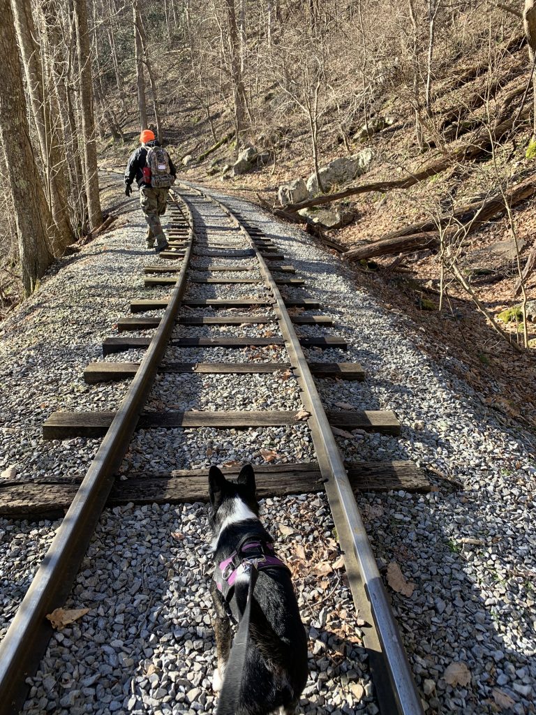
Our journey would take us along an old rail bed which once carried the East Tennessee and Western North Carolina (Tweetsie) Railroad. It follows the Doe River for a total of about 2.5 miles until it dead ends at an abandoned trestle. We would not be hiking the full length of the trail today, but would be concentrating on new caches hidden a short distance into the gorge.
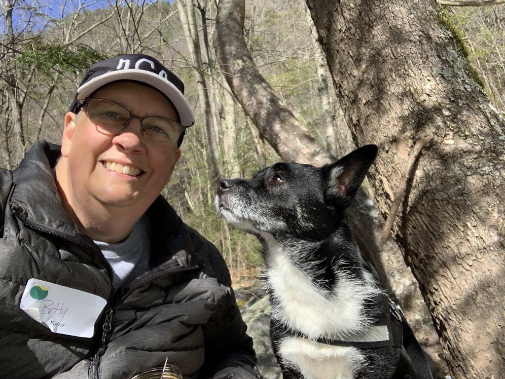
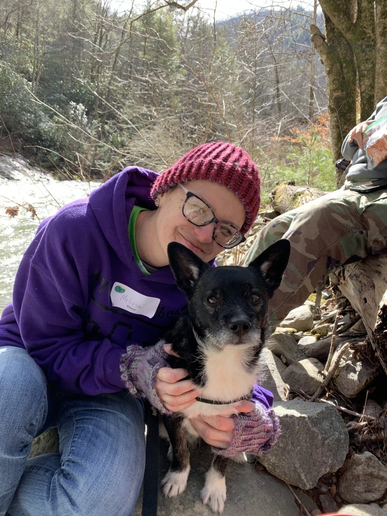
Melissa chose to join us on this adventure. She arrived at my house a little before 8:00 am and enjoyed playing with the pups while we waited for Rob to arrive.

Once he had come, we loaded into my truck and headed for Hampton. We had only made it less than a quarter mile from my house when I realized I had left my Garmin Forerunner watch on the charger back home. I needed it to map our hike, as well as to keep count of my steps for the day. I’m on a streak of getting at least 10,000 steps a day every day so far in 2020, and I didn’t want to break that streak by not wearing my watch.
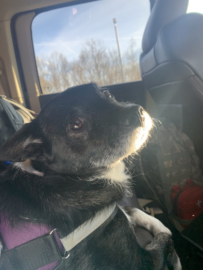
Melissa was riding in the back seat with Andy the geopup. He was not at all amused that we turned to go back home so soon after leaving. He whimpered until we were on our way again. He was ready to hike!
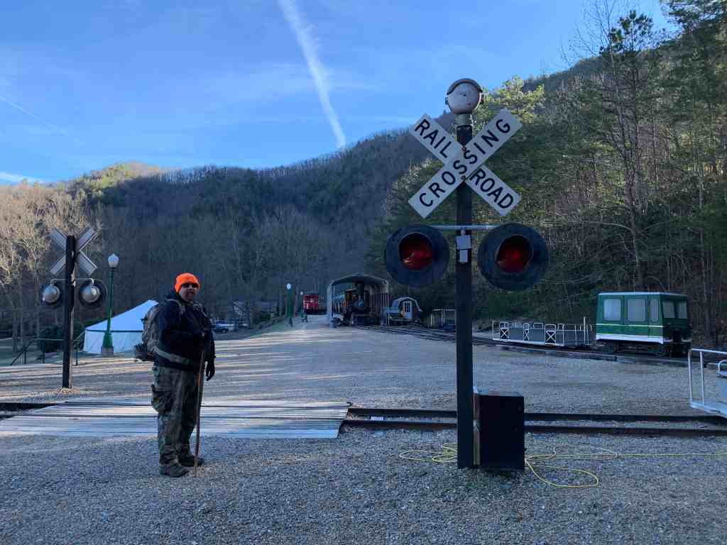
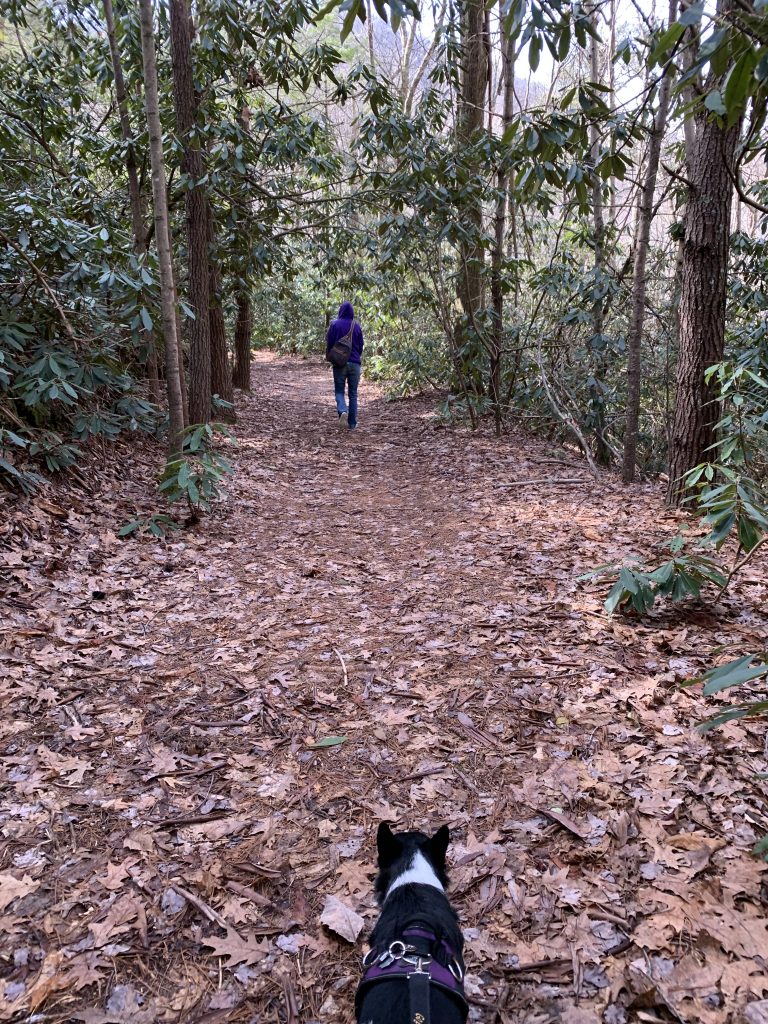
We arrived at the camp at 9:00 am. One of the new caches is hidden at the camp entrance, but we decided to leave that one for later in the day when we were leaving. We signed in at the kiosk outside the office, as required by visitors, Then we geared up, and started our hike at 9:09.
It was a cold 28° when we began hiking, but the skies were clear and the wind calm. I had dressed for the hike in a long sleeve t-shirt and my down jacket. I was glad that I had put my thin gloves in the pockets.
We climbed the steps from parking to walk past the camp lake. It was filled with water today unlike our last visit here. The water was calm and still, reflecting its surroundings like a mirror.

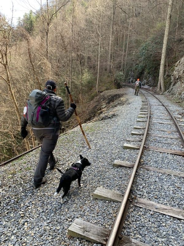
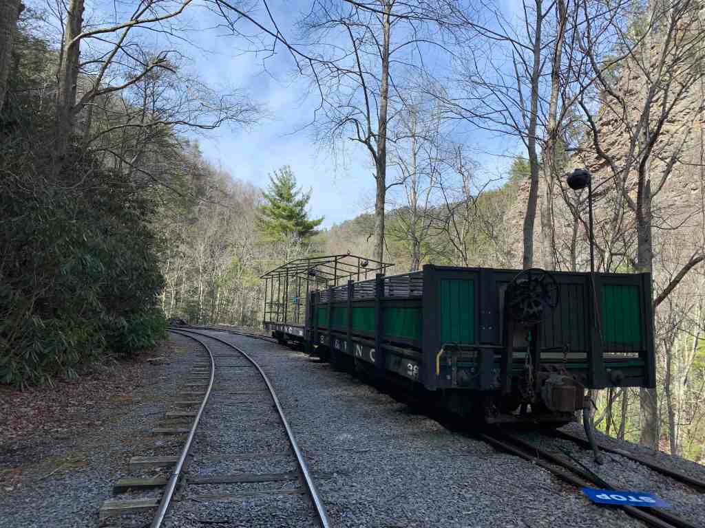
The camp has taken advantage of the narrow gauge rails left by the Tweetsie Railroad, using them for positioning rail cars that they use during summer camp, and for moving people in and out of the gorge. A friend of Rob’s has been instrumental in restoring some of the old engines and cars to working order.

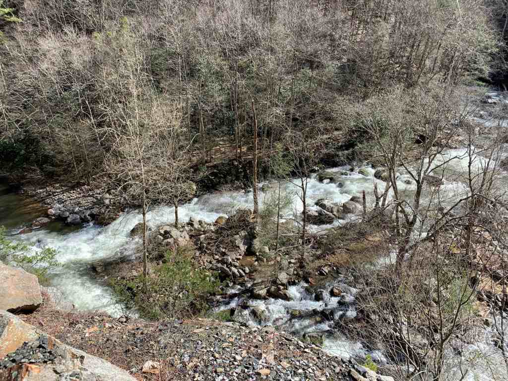
We followed the rails through the first tunnel and into the gorge. The Doe River roared below us, fed by recent rains that have flooded our region.
My ears were cold so I stopped to trade my ball cap for a beanie that was in my pack. I felt better immediately, and we resumed our hike.
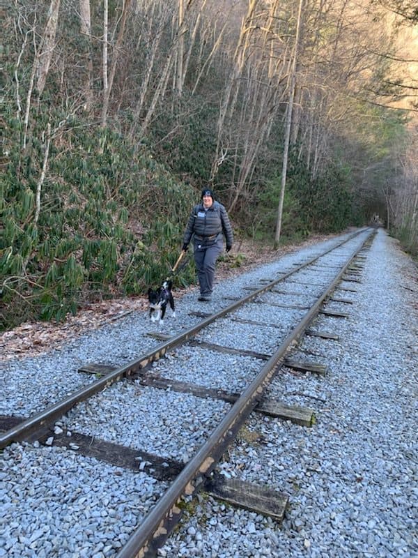
Hiking along railroad tracks has both advantages and disadvantages. It is a fairly level grade, without steep hills to climb. However, walking between the tracks is difficult because the ties are not spaced for the normal person’s gait. That leaves the walker alternating between shortening or lengthening their stride to step on or between the ties. Walking next to the tracks is a little better, but the loose gravel of the rail bed can be difficult to walk on as well.

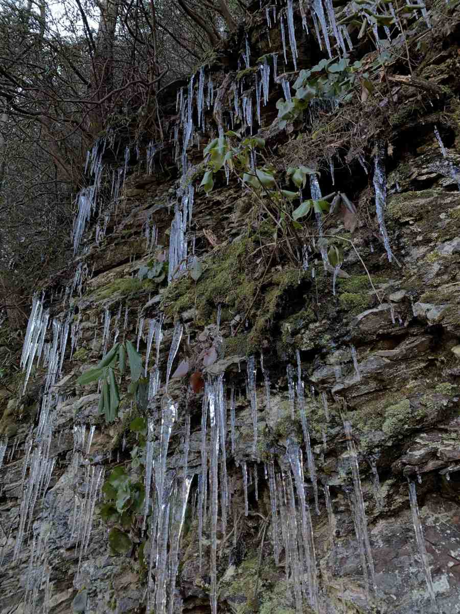
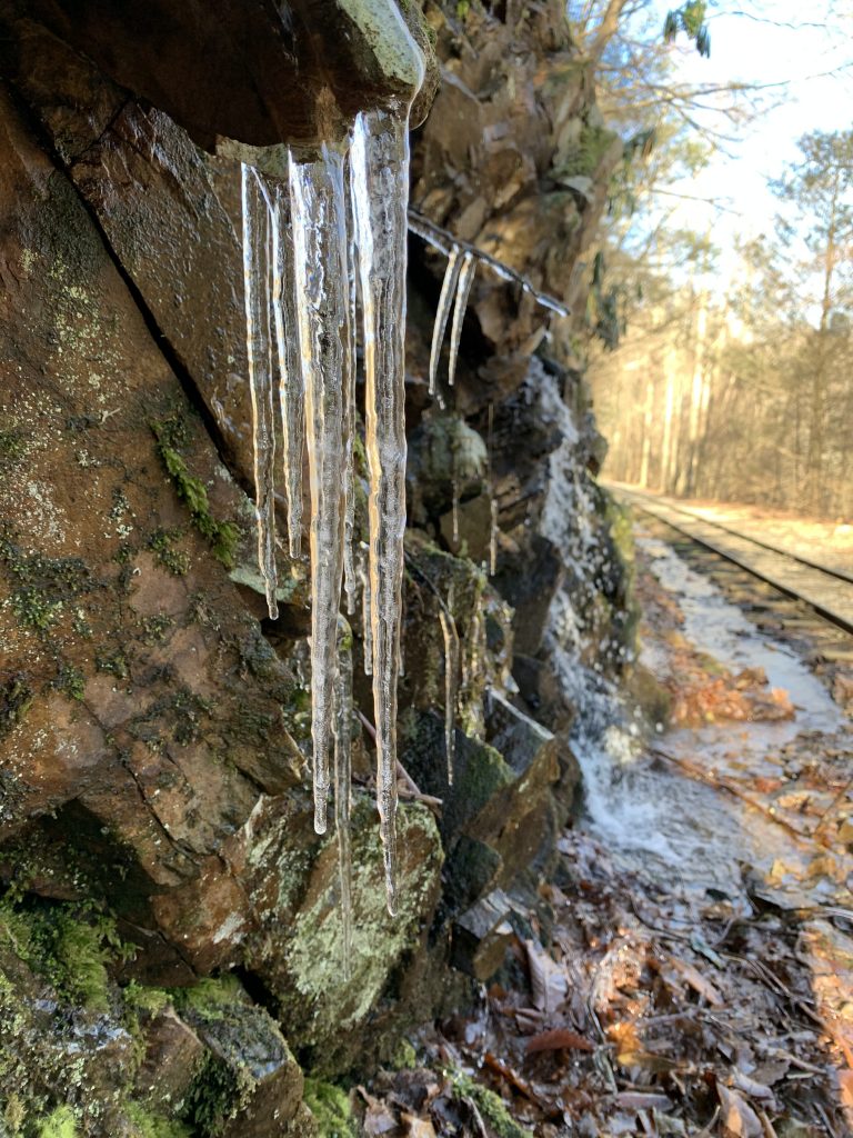
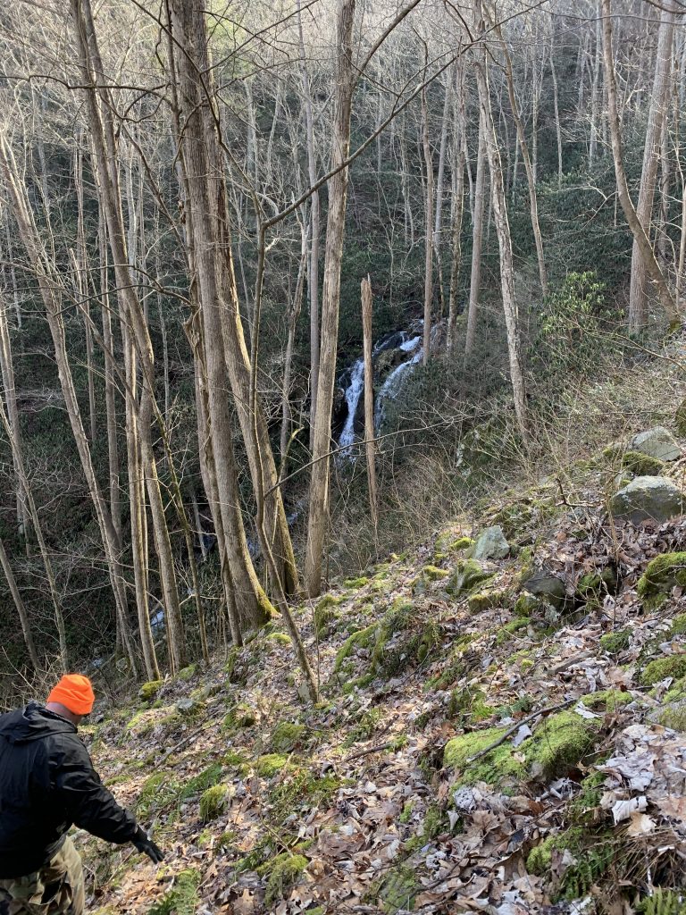
The scenery along the tracks was beautiful. We passed a wet weather waterfall and thousands of icicles hanging from the rocks. We stopped often to take photos.
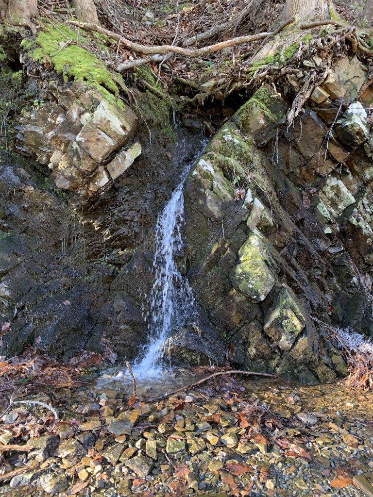
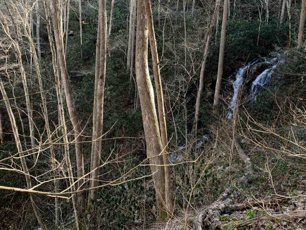
About an eighth of a mile into the hike we reached a waterfall. It had taken us 30 minutes to get here, with all of the stops to take photos. The waterfall is at the bottom of a valley descending toward the tracks, and is a picturesque spot. The pool that it empties into is far below the level of the tracks. I remember scrambling down to the bottom on our last visit to take some photos.
Today, Rob and I were more interested in finding the nearby geocache. It was just over a tenth of a mile as the crow flies from where we stood on the tracks, but it was not going to be an easy stroll. It was high above us in the forest. Ang had described the climb to it as “insane” and it had a terrain rating of 4.5 out of 5.
As we gazed uphill, we saw tangles of rhododendron bushes that would make the climb even harder. We would also have to deal with a steep descent from the tracks before we could even start climbing.
We backtracked a few hundred feet to see if we could find a better route. We came to a place where we could walk straight across instead of down and then up, and I tried it out. Rob stayed put, because he could see that the rhodos were too thick for us to climb the hill here. I finally agreed with him and retreated to the tracks.
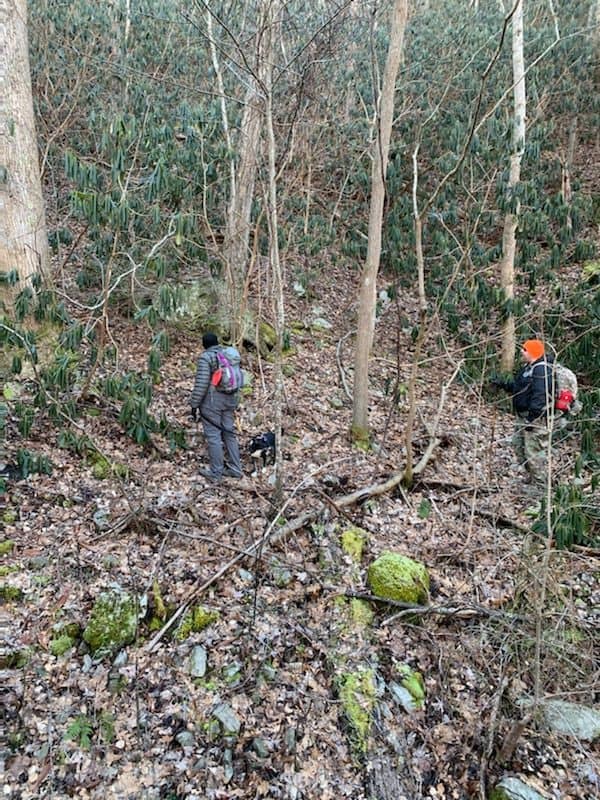
We walked to the spot above the waterfall again and contemplated our options. Rob finally suggested that we head uphill on the opposite side of the waterfall and creek from the cache, and then find a place upstream to cross over.
Melissa wisely decided to stay near the tracks. She said she wanted to go down to take some closer pictures of the waterfall, and then would just wait for us by the tracks.
Rob, Andy and I headed into the woods and began climbing, weaving our way between patches of rhododendron. We saw a spot in the creek that looked narrow enough for us to easily cross, and made our way down a steep slope to it.
Rob reached the creek first, and crossed easily. We were both concerned about letting Andy cross on his own for a couple of reasons. First, it was much too cold for him to get wet, and second the spot we were crossing was right above a cascade with a significant drop and I was worried he might get swept over it.
The harness he wears when hiking has a handle, so I was able to pick him up with it and pass him over to Rob. Team work! The creek was beautiful, just one cascade after another.

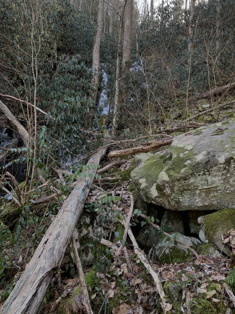
It had taken us about 20 minutes to get this far, and we were still several hundred feet from the cache. Once we were all safely across the creek, we began the brutal climb upward. There was no rhododendron at this point – just a mossy boulder field. It is also steeper than hello. Several times my hiking stick sunk much deeper into a hole in the rocks than I expected, and I worried that I would accidentally snap it in half. Or, snap a leg that got trapped in one of those holes.
We were moving diagonally up the hill, and at one point Rob pointed back down to a spot along the creek that he felt would be easier to cross on the way back. We identified a tall skinny tree to use as a landmark later.
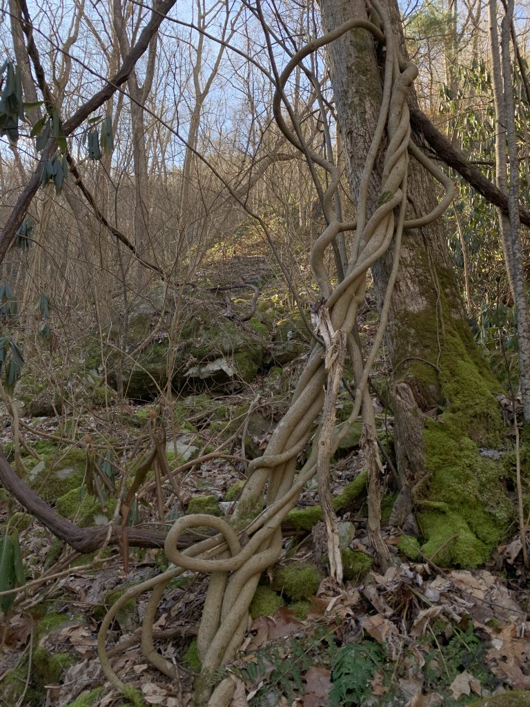
As we neared the top of the boulder field, we noticed a cool looking twisted vine hanging from a tree. I stopped to take a picture of Andy next to it.
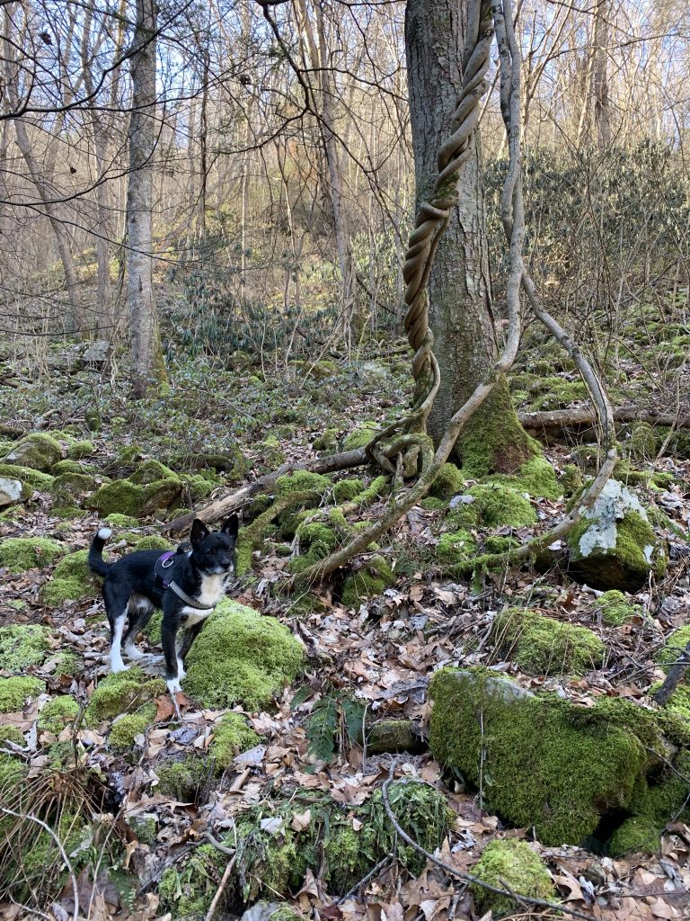
Just a couple minutes later we spotted another one, and wondered what kind of vine it is.
We skirted some rhododendron and then continued climbing upward. At one point I had to stop and backtrack because the terrain was too steep. When your dog is sliding past you downhill, you know it is too steep to continue!
I made my way down and across several yards to where Rob was, and we started climbing again. Although the temperature was hovering around 30° by now, I was sweating profusely. Still, we climbed. It had been 35 minutes since we left Melissa, so I texted to let her know we were still not to the cache. I did not get a reply, so could only hope she had received it and was not worried about us.
Rob and I branched out taking different routes. He moved further to the left searching for an easier place to ascend while I just bulled my way up. We were searching for a rock shelf as described in the cache hint. Finally, I saw a spot that looked likely, and called out that we might be nearly there. As I climbed the last few feet toward it, I spotted an unnatural looking pile of rocks under the overhang. I began crying out, “Please be it! Please be it! PLEASE BE IT!”
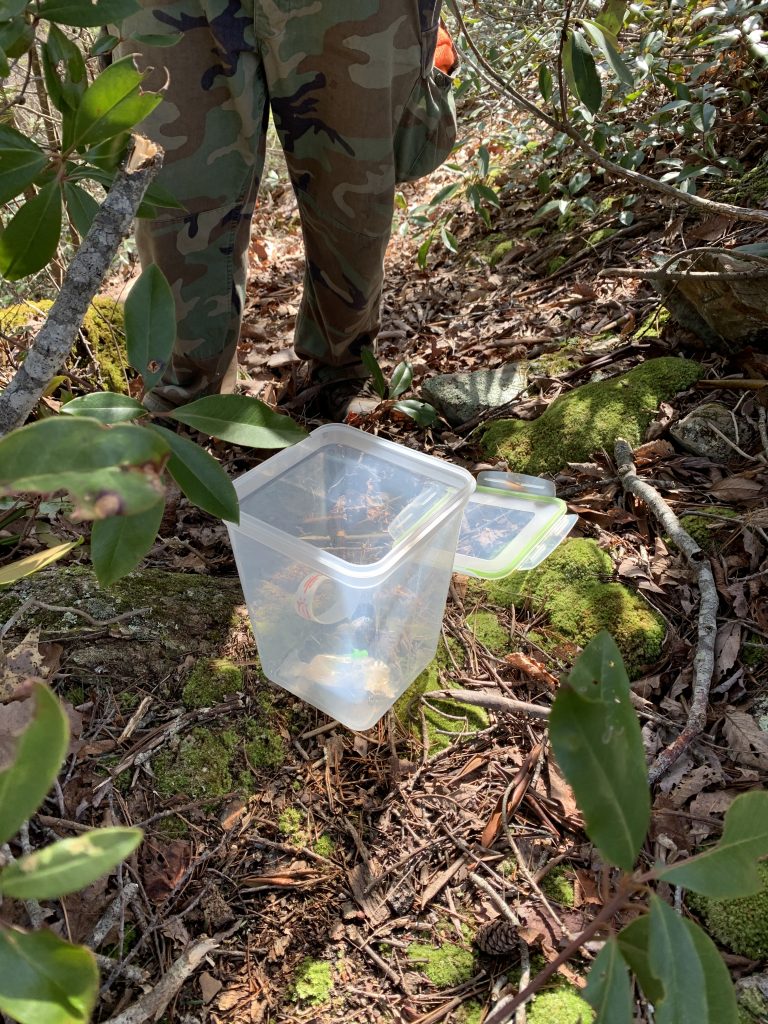
When I finally reached the rocks, I moved one and did not see the cache. My heart fell, but I reached in and shifted another rock aside. Behind it I caught a glimpse of metal and the sight of a beautiful, old ammo can. I had found o|_3 rUsTy! I yelled, “SQUIRREL!” at the top of my lungs to let Rob know I had found it. I then sent a second text to Melissa to let her know we had found it. Still no reply.
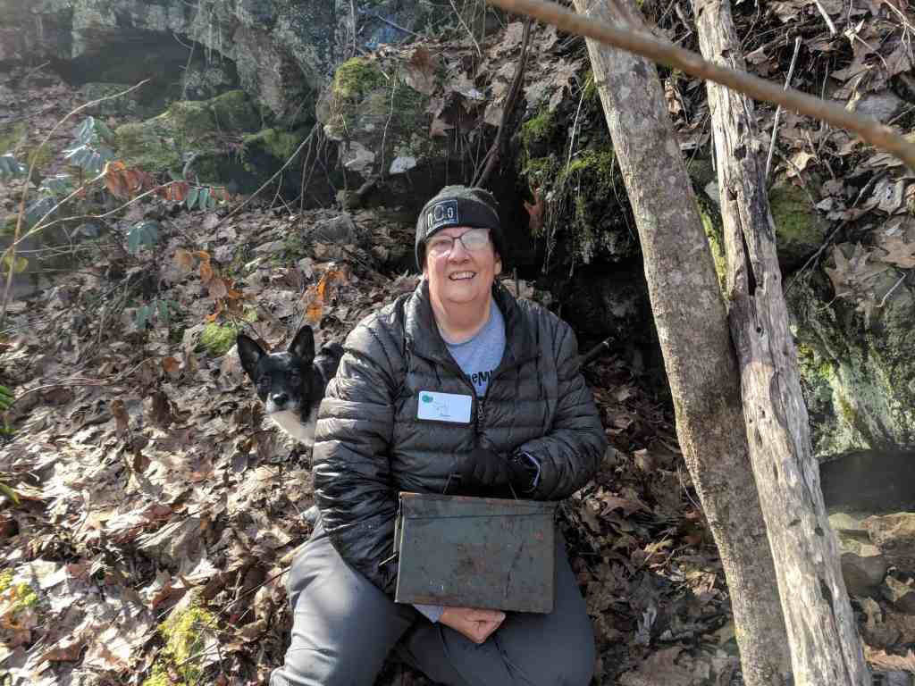
This ammo can was originally hidden in 2004 by DMFlyer (Dennis) to replace a plastic container hidden by another cacher. Dennis adopted the cache from that player and it provided great adventures to those who sought it for the next eight years. In 2012 the new owner of property you had to cross to find it contacted Groundspeak to ask that it be archived.
It took Ang and Johnny three attempts in 2018 to find a legal way to reach the cache without dying. They hiked in from Doe River Camp and had to cross an extremely high, dilapidated train trestle to get there, and finally located it buried deep beneath six years worth of leaves, dirt and pine needles.
With Dennis’s blessing, they hid this old ammo can here for us to find, and I must say they found the perfect location for it. This was quite the adventure!
It had taken us 45 minutes from the time we left Melissa by the tracks to reach this spot; 45 minutes of grueling, slow progress over some of the most intense terrain I’ve encountered while geocaching.
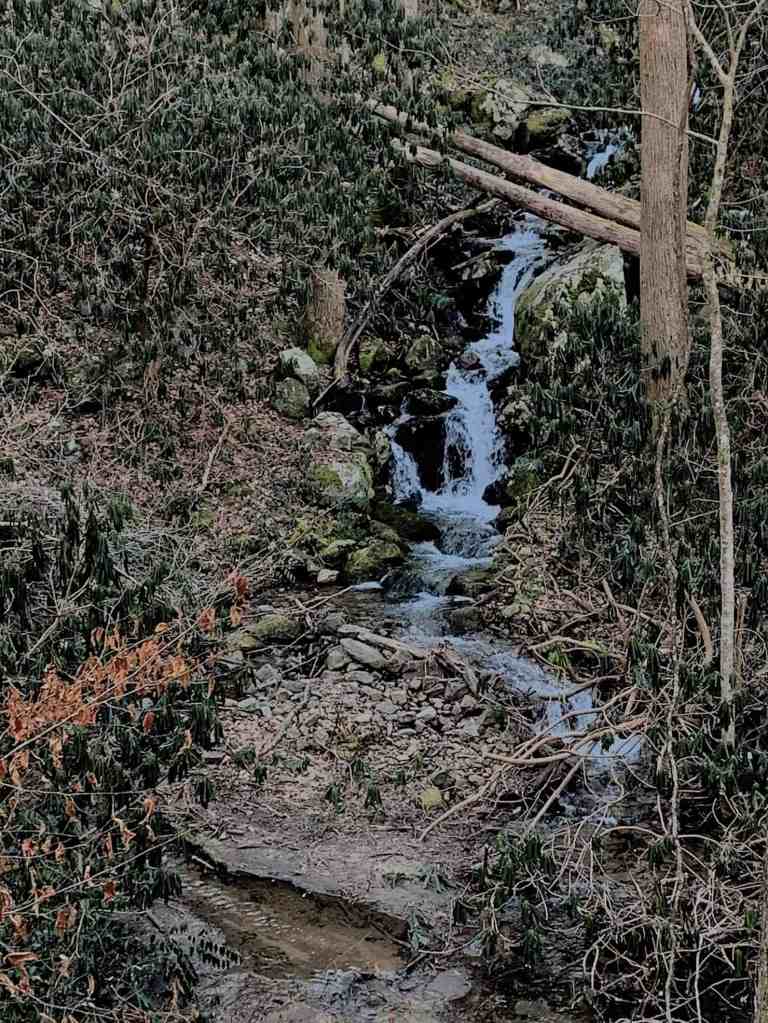
Once we had signed the log book and replaced the cache in its hiding spot, we began the trip back. Rob suggested that we angle our way across the closest boulder field away from the tracks, and then follow the creek downhill. This would be a little less steep terrain than we had climbed, and would also give the opportunity to get a closer look at a waterfall we could see near the top of the valley. This was along the same creek as the lower falls, but appeared to be triple the height.
Descending the boulder field, even at a less steep angle, was slow going. We stopped a couple of times along the way to take photos of the waterfall. I was hoping for a clear view of it when we reached its base, but that was not to be. There were far too many trees in the way to get a good photo of the entire falls.
We turned to follow the creek back down toward the tracks. Far below us we could see the purple of Melissa’s sweatshirt on the railroad tracks. We hoped that she could see us as well, and know we were on our way back.
We kept an eye out for the tall tree we had noticed on our way up, so that we would know where to cross the creek. Finally, we spotted it and I made my way toward it. I had to climb over some downed trees to get to the creek. I found a good place to cross, planted one foot on a rock in the middle, reached down to grab the handle on Andy’s harness, and started to swing him across. I didn’t get him quite high enough, and skimmed his feet through the water, short of the opposite side.
Repositioning my feet, I gave it another try, and soon had us both across. I turned to see where Rob was, and saw that he had not yet made it to the creek. He gestured as if to ask how I got there, and I signaled back that he should try going around the upstream side of the downed tree rather than climb over it as I had. He shook his head, and turned to go a little further downstream.
Andy and I set off to climb the opposite bank and skirt around a thick mass of rhododendrons. We had to step carefully along a narrow game path on the steep slope so that we didn’t start sliding downhill.
Once past the rhodies, I turned to look for Rob. I couldn’t see him anywhere. I continued on a short distance, and looked again. Still no sign of him. He was wearing a bright orange cap, so I should have been able to spot him, despite the thick rhododendrons. I called out to him, but instead heard a reply from Melissa down by the tracks.
I was beginning to worry about Rob when I finally spotted his orange hat rising up from the ground as he climbed the bank from the creek. Relieved, I continued toward the tracks where I spotted Melissa. It had taken us an hour and a half from the time we left her to reach the cache and return. The difference in elevation from the tracks to the cache site was an astounding 347 feet.
Melissa told me she had received my texts, but did not have a strong enough signal to text back. She had taken photos of the waterfall, and then explored the tracks a little further past where we had stopped, going through a second tunnel. It was sunnier and warmer on that side, but she did not linger because she was afraid we would come back and think she had left. I was not cold at all after the exertion of our climb and descent, but I could see why standing around waiting for us would be a cold business. We got moving quickly so that she could warm up.
The next cache on our agenda was above the nearby tunnel. We followed a path from the tracks that led us up and over the tunnel. There was a great view of the gorge from here.

Once we were near the posted coordinates, we began looking for a tree with a hollow base big enough to hide a large-sized geocache.
We searched for about 20 – 25 minutes, checking what seemed like every tree in the vicinity. I bushwhacked down to a couple of trees and then got myself thoroughly stuck in a thicket of mountain laurel and thorns when I tried to climb back up. Fortunately, I had left Andy’s leash safely in the hands of Rob, so I didn’t have to worry about him being stuck as well.
Finally, Rob found the cache on the backside of a tree right next to the trail. We couldn’t believe it had taken us so long to locate it.
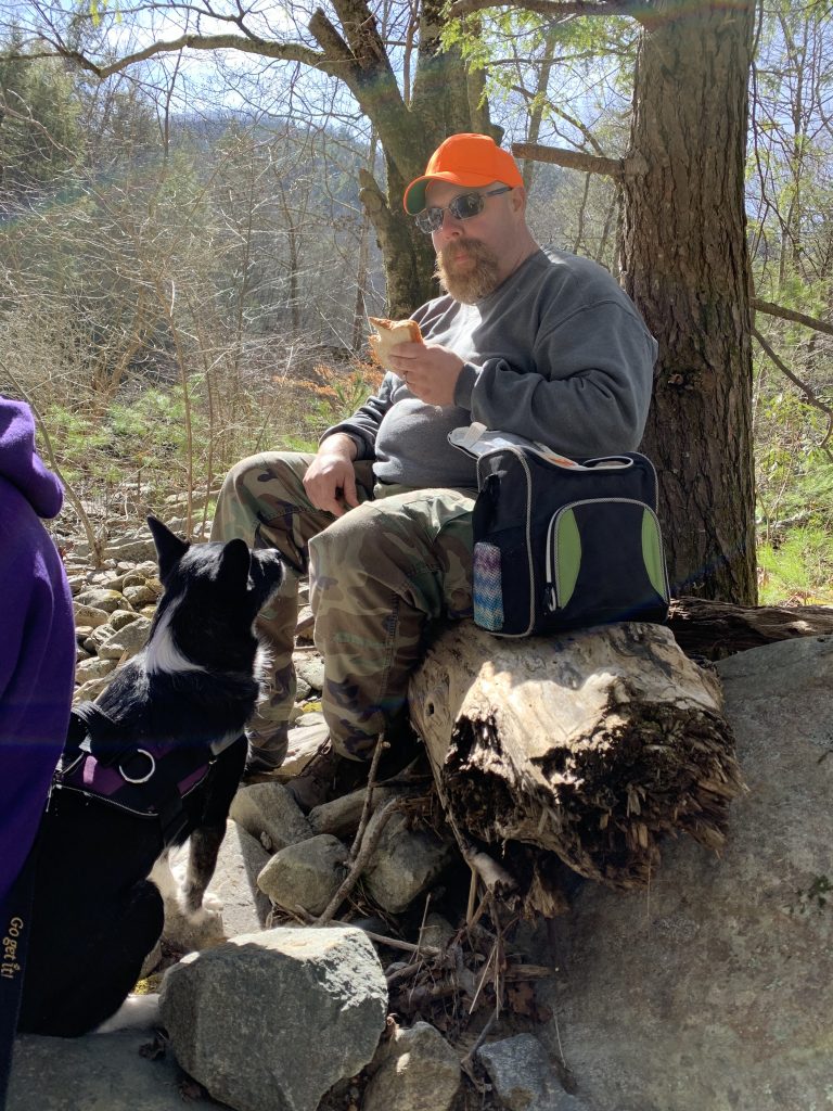
It was close to noon by now, but we decided to find the third cache before eating our lunch. It was hidden down by the river so we hiked back down off the tunnel, and then followed a wide trail down to the river side. Rob and I had explored this trail on our last visit.
Once we had reached the river, we spread out to look for the cache. Finally, I heard Melissa call out to me that Rob had found it. After he signed the log, we found some rocks by the river to sit on for lunch. I took off my beanie, and it was soaking wet from all the sweating I had done.
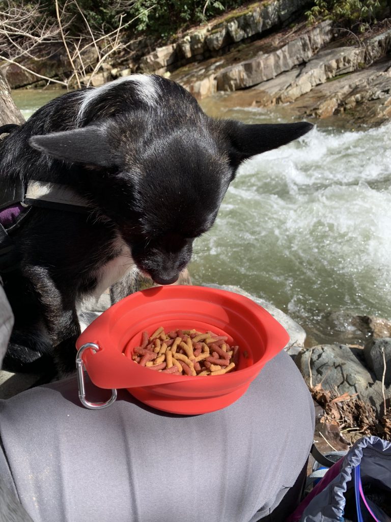
The water thundering by was beautiful to watch, but made conversation difficult. I ate my warm chili and tried to entice Andy into eating his bowl of dog food.
Instead, he went to see Rob and beg for tiny bites of his cheese, which Rob gladly shared. Not satisfied, he continued to stare at Rob with woeful eyes as he pulled out a sandwich and began eating it. Rob offered him a taste, but it was peanut butter and Andy isn’t a fan.
I had some cheese as well, so broke some small pieces off to mix in his food. He dug those out of the bowl but left the rest.
When we had all finished eating, we packed up and made the climb back up to the tracks. Along the way I pulled my gloves back out and put them on. It had been warm sitting in the sun, but under the shade of thick trees it was still chilly.
Once we were back at the tracks, we decided to hike a little further into the gorge so that Melissa could see more of its beauty. As Rob told her, it just keeps getting better.
We hiked through the tunnel, which was beautifully rimmed by icicles. On the other side, we were treated to more beautiful views of the river.

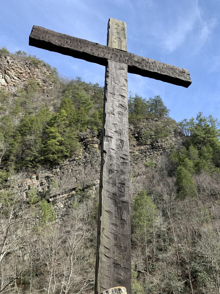
We followed the tracks to Pardee Point. There is a large, wooden cross here overlooking the river. We talked about the fact that Rob had thought this would be a good place for his and Kara’s wedding. I told him I was glad he didn’t have it here, because it would have made it much harder for Berta and I to splash the wedding. (See blog post from October 7, 2018)
A couple of train cars were sitting on the tracks near the cross. I suggested that Melissa, Andy and I climb aboard and let Rob pull us back but he wasn’t interested.
Because Rob needed to be home early to prepare for a family dinner, we turned around at this point to hike back. The return trip took us 32 minutes and was a distance of 1.25 miles.
As we walked at a steady pace, my feet were growing more and more sore. I worried about Andy’s feet since he was walking on the sharp gravel, but it didn’t seem to bother him. His feet must be pretty tough from all the hiking we do.
My watch had logged a total of 5.37 miles but it is obvious when looking at the route on the map that it lost GPS signal numerous times when deep in the valley looking for the first cache, as well as whenever we passed through the tunnels. I would estimate our actual distance was closer to 4 miles.
As we drove out of the park, we stopped to find the cache at the entrance. This time it was me who made the find, making the tally for today Rob 2, Betty 2.
Once I had arrived home, and said goodbye to my hiking companions, I made a discovery. As I was removing my hiking boots, I realized that I had forgotten to put the insoles in them that morning. I always take them out when removing my boots because my feet sweat so much. Letting the insoles air dry outside of the boots helps delay the inevitable stink that sets in after I’ve worn a pair of boots for a year or so.
I realized now why walking on the gravel rail bed had seemed more uncomfortable than usual, and also why my boots had felt a tiny bit looser than normal. I guess it is a testament to the quality and fit of the boots that I could hike in them for over four hours with no insoles, and not notice that they were missing or end up with painful blisters.
This hike will be the stuff of legends for years to come, as the climb to find the first cache grows longer, steeper and more dangerous. But, if you have read this accounting, you will know the truth of the tale. It is an adventure that I will not soon forget.
