Geocaching in Southwest Virginia
- 14 geocaches found
- 2 geocaches replaced
- 2 EarthCaches found
- 1 geocache visited (previously found)
- 1 geocache not found (DNF)
- 2 cache resurrections (finding a cache that has not been found in over a year)
- 4 sets of waterfalls photographed
I set out on a cold, snowy Sunday morning with a goal of finding a specific geocache in Lebanon, VA that I needed to fill in the difficulty and terrain rating on my D/T grid. I decided to make the drive worth while by visiting some of the geocaches and EarthCaches at waterfalls in that area of southwest Virginia. The weather called for partly cloudy skies most of the morning, which is optimal conditions for waterfall photography.
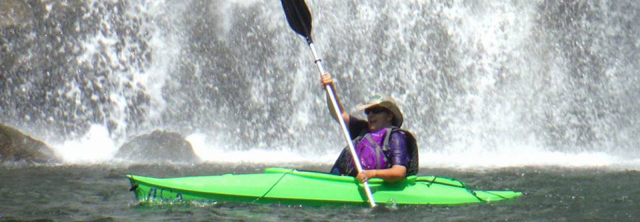
One of the legendary geocaching couples in our area, Konnarock Kid & Marge hid a series of geocaches at area waterfalls in 2005 and 2006. The Fallin’ For Virginia series includes 18 geocaches, and is a great way to find these out of the way waterfalls that are not very well known.
I got an early start, leaving at about 7:30 am. My first stop was at Garrett Creek Falls where there is both a traditional geocache and an EarthCache. Like most of the waterfalls I was to visit today, this one is hidden away along a gravel road in the middle of nowhere. While it is on private property, the land owner has given for the geocache and EarthCache to be here and for geocachers to visit the falls.
I have seen photos of this waterfall showing more flow, but on this day the water was only flowing down the left side of the falls. It was still a beautiful sight, and after taking several photos I made my way back up to the road, and then down the bank near the top of the falls to find the geocache.
It was laying out in the open, most likely left there by the last person who found it, back in March of 2016. This was their first and only find according to the geocaching website, so they probably did not understand that they should have replaced it as found. The baggie containing the log sheet was also left open, so the log sheet was very damp and hard to sign. But, I did the best I could and then hid the geocache in the location indicated by the hint on the cache page. Since the last find was one year and nine months ago, this qualified as a cache resurrection. Before that find in 2016, it was last found in April of 2014, so obviously this is a lonely cache.
I then made my way east to Cabin Creek Falls, the sight of another EarthCache and traditional cache. The hillside down to these falls is steep, but there is a trail to follow. Unfortunately, I had gotten lazy at my last stop and did not retract the legs of my tripod before loading it into the back seat of the car. As I was carrying it down the hill at Cabin Creek, one of the legs caught between two rocks and the foot snapped off. Fortunately, I was able to find it buried in the leaves and snow and the tripod was still usable. I super glued the foot back on once I was home, so hopefully the repair will hold up to the rigors of hiking.
Like the previous waterfall, this one did not have a lot of flow, but it was a very interesting falls. The rock formations here are like a series of giant steps, with the water flowing down them in sections. The sun had just started to peek over the top of the hills surrounding this creek, presenting a bit of a challenge.
After gathering the photos I wanted, I began searching for the geocache. There was only one tree matching the description on the cache page, and the cache was nowhere to be found there. In digging around for it, I did uncover a piece of wood with some very interesting lichen growing on it – white cup-shaped it orange interiors.
Checking the cache page, I saw that this cache was last found May 1, 2015 and that several experienced geocachers had logged DNFs on it since then. After a thorough search of the area, I decided to see what I could do about replacing it.
I found a pill bottle full of acetaminophen in the car, and emptied them into the ziplock bag holding my lunch. In my bag of travel bugs, I had a some replacement log sheets and ziplock pill bags. I used these to create a replacement and hid it following the description and hint on the cache page. When I returned home, I contacted the cache owner who gave his blessing for this replacement. I was happy to do so, because eventually caches that have been logged as DNFs several times will be archived by Groundspeak, which would have left a hole in this great series.
From Cabin Creek Falls, I continued along the loop road that it was on to the Falls Hill Creek waterfall. There are actually two separate waterfalls here, one about 35 feet high and the other about 20 feet. Although I knew I was parking right next to the geocache, I rushed down to take photos of the lower set of falls before the sun could get in my way. After capturing that set of falls, I climbed back to the road and sat on the guardrail to sign the geocache. I was happy for a quick and easy find after spending so much time on the previous cache. I then walked up the road a little bit to photograph the upper falls.
I found a nice perch above the creek from which I had a clear view of the upper falls. Unfortunately, by this time the sun was out in full force, making it difficult to get a good photograph. I decided to set up my tripod, adjust the settings on the camera, and then wait in hopes that one of the few clouds floating overhead would block the sun long enough for me to get some good pictures.
I pulled up the Kindle app on my phone, and sat reading a book while I waited, glancing occasionally at the sky to see the status of the clouds. After 15 or 20 minutes, a group of clouds looked like it was floating in the right direction to cover the sun. I began to cheer them on and direct them as the floated closer and closer. Sadly, they passed by without blocking the bright sunlight. Eventually, I settled for snapping a few shots despite the glare, and returned to the car to continue my journey.
Next on the list was a geocache at nearby White’s Mill. The original mill at this site was first built in the early 1790s. The current mill was built sometime in the 1820s and underwent extensive renovation about four years ago. It is listed on the Virginia and National Registries of Historic Places, and is a beautiful structure. Visitors can tour the mill and the mercantile store across the street, but I had many more caches to find, so didn’t take the time.
From the mill parking lot, it is a short walk to the geocache. Once there, I spent far too long digging around in the snowy leaves looking for the cache, before realizing I was in the wrong spot. I moved over about 10 feet, and found it quickly. Signal the Frog® was happy that I found him a friend in the cache. I happened to have a little rubber ducky in my pocket that I traded for the little green frog in the cache. He and Signal spent some time chatting on a nearby bench while I took pictures of the cascade nearby. I then walked back to the mill, and took some photos of it.
I then climbed back in my car and drove to the banks of the North Fork of the Holston River. There, I found a geocache that was last found two years and eight months ago, making it my second cache resurrection of the day. From there, I drove to Toole Creek Falls.
I had visited Toole Creek Falls last October with a group of folks after we attended an event at The Channels. On that day we logged the EarthCache here and found the traditional cache, a well-stocked ammo can. However, on that visit I did not have my good camera with me, so I wanted to stop today to take photos of these falls.
There are actually three falls in this group. I parked at the bottom of the hill and walked up the road to the first set of falls, the smallest of the three. It was a bit of a challenge finding a good spot to photograph them, but I got lucky. I then made my way up stream to the middle falls. This is a small, but beautiful fan type waterfall, surrounded by some magical terrain full of moss covered rocks. It is near this area that the traditional cache is hidden, and I pulled it out of its hidey hole to check on it. All was just as we left it over a year ago, and the last names in the log book are ours. Had I been logging this as a find, it would have been my third cache resurrection of the day. I then walked on up to take photos of the upper falls.
As I was making my way out of the woods back onto the road, I looked back and noted the No Trespassing signs posted in the area I had just come from. However, the cache pages for the two caches here state that permission was granted by the property owners, and confirmed in 2015, that geocachers may visit.
It was only after I had returned home and was logging geocaches found that I realized I had driven past one that I was planning to search for. In looking back at the cache page I see that it was last found in 2013! This would have been a four year resurrection had I stopped. It would have also included the adventure of crossing the river on a swinging bridge. Oh well, it will be there for the next time I’m in the area.
Once I had emerged back on the Porterfield Highway to drive to Lebanon, I stopped off for one more cache in Holston. I actually drove past it a couple of times, trying to determine if I was in the right place. After the second pass, I pulled over at the end of the road and checked the cache page. Yep, I was in the right spot alright. The cache is in someone’s back yard, but they have given permission for the hide, and even invite folks to sit on the back porch for a picnic.
I found the cache pretty quickly, but had a struggle getting the baggy with the log sheet out of the container. Once I did, had signed the log and replaced the cache, I was ready to go to Lebanon to find the cache that had brought me to this area to begin with.
The cache has a difficulty rating of 4.5 (out of 5) and terrain rating of 1 meaning it is wheel chair accessible. This is a rare combination, which is why I was willing to drive so far in search of it. The coordinates took me to the parking lot of a popular restaurant, and even at 3:00 in the afternoon the Sunday lunch crowd was still in full force.
I waited in the car a few minutes as some of the vehicles parked near ground zero left. I then got out and made my way in that direction, making a wide sweep through the grass so that I didn’t arouse suspicion by walking too close to other people’s cars. Unfortunately, this changed the terrain rating for this cache from a 1 to a 5 as I tripped over an extension cord powering the restaurants Christmas lights. I stopped to plug it back in, and looked up to see an older couple going to their truck, eyeing me suspiciously.
I continued to wander about nonchalantly, pretending to talk on my cell phone while they watched me intently. They finally decided to leave, and I began to look for the cache in earnest. Since this was a difficulty 4.5, I knew that it wouldn’t be easy, but I had an idea of what to look for. Finding nothing, I decided to text biblemanrick (Rick), a geocaching friend who along with his wife Seawatt (Sally) was first to find this cache years ago. He replied that he thought it was missing, and told me exactly what to look for, confirming my hunch. I gave one more good search, and then gave up.
As I was driving home, I stopped off to do search for a series of 10 geocaches in a new industrial park near Bristol. These were quick park and grabs along a lonely road. Not many businesses have moved in yet. One of these caches gave a fair bit of trouble. I actually went back to it three times after my initial stop because I hate to give up. On the third trip, I found the tiny magnets that probably held the cache container. On the fourth trip, I had remembered that I had spare log sheets and baggies in my car, so I used those to replace the missing cache.
I arrived back home 10 hours after I had left, tired, but happy. My hands were chapped from being cold and wet much of the day. I had some new bruises on my legs. I had not found the primary cache I went in search of. But it was a fun day full of beauty and adventure. And, I have some new waterfall photos to add to my collection.


