Appalachian Trail to White Rock, Coon Den Falls
- 7.84 miles
- 6:02 duration
- 1679 feet elevation gain
- 3 traditional caches
- 1 Earth Cache
- 1 cache replaced
LakeBum (Rob) and I met up to tackle this trail on a mild winter day. Mrs. Jack (Dori) was going to join us but she was feeling a little under the weather. While we missed her, it is probably good that she didn’t join us since this journey kicked our butts!
On the way in to Hampton, we stopped off to grab a quick cache near the trail head of the Watershed Trails. This is a network of 4.4 miles of mountain bike trails. We only followed the trail in about 40 feet to find the cache, but what we saw was pretty. I took a photo of a tree that was ringed by vines in an unusual way.
We then spent a few minutes looking for another nearby cache that I had found before, but that Rob had not. The area was so overgrown and there were so many places matching the hint (up and under rock) that we decided not to waste our time and head on into the mountains for our hike. This stop was not a total waste of time, however. As we headed back to the truck I spotted something on the ground. It turned out to be a little Santa hat that is just the right size for Signal the Frog®. He will be sporting it throughout the holiday season.
From Hampton we followed the winding and steep Dennis Cove Road into the cove, and then parked just across the creek from the campground. This put us near the end of the Coon Den Falls trail, so that we wouldn’t have far to walk along the road at the end of our hike. We then walked from parking one mile back up the road to point where the Appalachian Trail crosses.
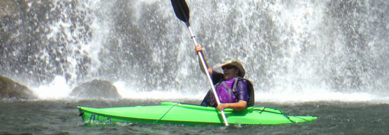
We turned right on the AT toward Laurel Fork Falls so that we could replace a geocache that was missing. We had looked for it together on a hike in April, and I had also looked for it with a larger group of folks last summer. Another cacher had recently DNF’d it so we felt sure it was missing. Because it was less than a tenth of a mile down the trail, we thought this would be a good chance to replace it, so I had brought along a container.
We then retraced our steps to the road, and headed up the AT in the other direction. Our goal was White Rock. Our maps marked this spot as White Rock Lookout Tower, so we were looking forward to seeing an old fire tower there.
One of DMFlyer’s high terrain caches is hidden at White Rock and we are trying to hit as many of those as possible. Rob needs to earn his “frequent flyer miles” to qualify for a challenge cache at Bay’s Mountain. To log it, one must have found at least 20 DMFlyer caches with a terrain rating of four or higher (on a scale of 1-5). I have found 24, but Rob still has a few to go before we can log that cache together.
A short distance up the AT we came upon an old log building, and took some time to check it out. As we started up the trail again, we checked the distance (as the crow flies) to the cache at White Rock and saw that it was “only” 1.7 miles. However, with an elevation difference of a little over 1400 feet from that point to the top, we were in for a long, slow hike.
At 2.85 miles into our hike, we passed the intersection of the AT and the top of Coon Den Falls trail. We knew we would be coming back to this point later to make the hike down to the falls and beyond to the truck. But, for now, we had to keep climbing. And climbing. And climbing. Right on cue at about five minutes to noon Rob’s stomach sent up the first signal that it was lunch time. My stomach joined in at 11:59. But, we kept trudging upward, wanting to reach White Rock before we stopped to eat.
We saw some beautiful views at various spots along the trail. The first was looking down into Dennis Cove. A later viewpoint had us looking in the opposite direction toward Roan Mountain. And still we climbed. Each ridge top we climbed, we hoped would be the ONE. But instead the trail kept going; up and over, down and around.
Finally, at 4.25 miles into the hike, we could see something through the trees on the knob in front of us. It looked like some type of platform with a railing around it. We were nearly there! Or, so we thought. At one point, Rob’s phone told us that we were within about 300 feet of the cache. But the trail kept on around the side of the knob and took us further and further from the cache.
Puzzled, we stop to take stock of the situation. We decided to cut through the woods off trail, and discovered a forest road leading back up toward White Rock. We happily began following it, but then it became steeper and steeper. Would we ever reach the cache site? Our legs screamed. Our feet complained. Our stomachs rumbled. Finally, after three hours and 4.75 miles of hiking we reached the top. We now had a clearer view of what we had caught a glimpse of through the trees.
Perched atop the knob was a communications tower. Next to it was a small building(which was what we had seen and thought was a platform. This was surrounded by a fence, which is what Rob had thought was a railing. Apparently, the fire tower that was once here is long gone. All that is left are some concrete blocks that were likely the base of its legs.
We found the cache fairly quickly. It was an ammo box stocked with lots of swag, including a pearl necklace that I tried on but left behind. After we had signed the log we made our way back over to the concrete blocks and sat down to (FINALLY!) have lunch.
We had both stashed our jackets in our backpacks before starting the hike, and were glad to have them atop the mountain. The temperature was mild, but we had both worked up a good sweat during the hike. Sitting still during lunch, with a bit of a breeze blowing, it felt good to don my jacket and ski cap.
While we were eating, we decided that this was an area where the AT had been diverted. The map showed it going straight up and over this ridge top, while in reality it skirts around the side. Rob told me this was because they had rerouted the trail in places to eliminate PUDS; pointless ups and downs. You learn something every day! Rather than backtrack down the road to hit the trail again, we decided to follow a faded track down the hillside in the direction we needed to travel in hopes of meeting up with the trail.
This plan worked well, cutting off nearly a half mile of hiking on our way back down the mountain. Eventually, we arrived back at the intersection with the Coon Den Trail and our real adventure began.
Up to this point we had been hiking on the nicely maintained Appalachian Trail, but no such care has been given to the Coon Den Trail. The upper part of the trail wound through rhododendron thickets that were threatening to choke out the path. In other spots, we had to carefully navigate over steep, rocky terrain. At times there was nothing to do other than sit and scoot.
Within about five minutes on this trail, we heard water and soon Coon Den Branch came into view. However, the trail then swung west away from the water before doubling back and then upstream toward the falls. We learned the reason for this once we caught our first view of the falls.
We had read in various places that these falls were 60 to 80 feet tall. But that is just the lower, more visible section. Obscured by trees and rhododendron bushes above that section is another, equally high falls. Combined, I would estimate that the total height of these falls is around 150 feet. However, there appears to be no safe way to navigate to the midpoint to view the upper section. The hillsides on both sides of the falls are at least a 70 degree slope.
I shed my backpack and took out the camera and tripod that I had been lugging around for the last five hours. After taking several photos of the falls from a distance and framed by trees, I moved closer and found a clearer view. When I photograph waterfalls, I typically take a large number of photos using different shutter speeds and aperture settings. That way I can look through the photos at home and choose the most appealing ones. As I played with the camera, Rob went in search of the geocache nearby. He gave a shout and a thumbs up when he found it, and I shouted back to “sign my name!” I then returned my attention to the falls and my camera.
Once I was satisfied that I had captured the beauty of the falls, I gathered the information needed to log the Earth Cache that was here. I then packed everything up and we began to make our way down the trail.
This section of trail was steep in places, but in much better condition than that above the falls. Much of the way we were following Coon Den Branch, and we saw many small cascades and falls along the way. Many of them were hidden by foliage, and nearly impossible to photograph.
Just half a mile from the falls we reached Dennis Cove Road, and then walked three tenths of a mile back to the truck. There is a second trail head almost directly across the road from where we had parked, but somehow we had missed the turn that would take us to it. That was okay with us, because it was probably quicker to walk along the flat road than


encountering more PUDS along the trail.
We stopped off in Hampton at McDonald’s to get some hot chocolate, a tasty treat after the long hike. I caught a driver sitting in the drive-thru lane chuckling at the sight of us hobbling across the parking lot on our tired, stiff legs and sore feet. We were beat, but happy to have experienced another beautiful area of our world. Where shall we go next?

What a trek! A very enjoyable read. Glad you managed to get an Earthcache. Great photos.
Loved your trail report and the captions on your photos.