
Bays Mountain Park
- 4.5 miles
- 4:05 duration
- 738 foot elevation gain
- 5 geocaches found
- 1 souvenir earned
If you are a regular reader of my blog, you may remember that last month I wrote that I had been successful in finding all of the geocaches hidden in the Bays Mountain and Laurel Run Parks. I should have known better than to make such a boast, as my friend BackWoodsAng saw that as a challenge.
He had been contemplating a scheme to identify some of the more remote knobs in Bays, and populate them with geocaches. He then set out on a weekday adventure, a mere three days after I had completed my quest, intent on hiding five new geocaches.
I lived that adventure with Ang remotely, as I watched his progress on Google Maps (in case he was injured or lost) and communicating with him via text. In fact, when it became clear that he would not complete his hike before the park’s scheduled closing time, he asked me to call the Nature Center and let them know that he would be late leaving. They were thankful for the notification and left the gate open a little longer so he could exit.
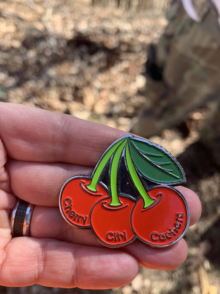
Fast forward a little over a week, and the geocaches finally published. He had named the series “Cherry Knobs” after a nearby trail and because they were on a series of knobs extending through the west end of the park.
My usual hiking buddy LakeBum (Rob) had been laid low by a respiratory illness, and wasn’t feeling up to making the hike that weekend. I needed to pack in preparation for vacation, so we decided to leave the First to Find opportunity for someone else.
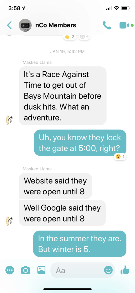
That someone turned out to be fellow New Cache Order members Penguinsushi (Jared) and Masked Llama (Tony). They shared entertaining tales of their adventure in real time through Facebook Messenger and later in their online logs for the caches. Jared is nearly as verbose as I, and I always enjoy reading his logs.
Their adventure included not starting their hike until about 2:00 pm and being unaware of the park’s 5:00 pm closing time, despite numerous signs announcing such. This resulted in them being locked in and having to wait at the gate for someone to come let them out.
After I had returned from vacation, Rob was feeling much better, and we decided to make this our first hike after a several week hiatus. The weather for our target weekend was forecast to be nasty on Saturday, but very nice on Sunday.
Because we did not want to repeat the mistakes of our friends, we decided that we wanted to get a much earlier start on the day. Knowing that the park does not open until 11:00 on Sunday, we decided to come in the “back door.” This is an un-gated entrance at the southwestern tip of the park. It would not only allow us to start earlier, but it would shorten our hike.
It is not easy to arrive at this entrance. It requires driving a roundabout route on back country roads. The last mile or so of the journey is along a road that becomes narrower and rougher, before dead-ending at the park boundary.
As I drove past the next to last house before the park, I muttered, “We are just coming to hike.” This is because on each of our other visits via this entrance, the resident of that house came to see who we were and what we were doing.
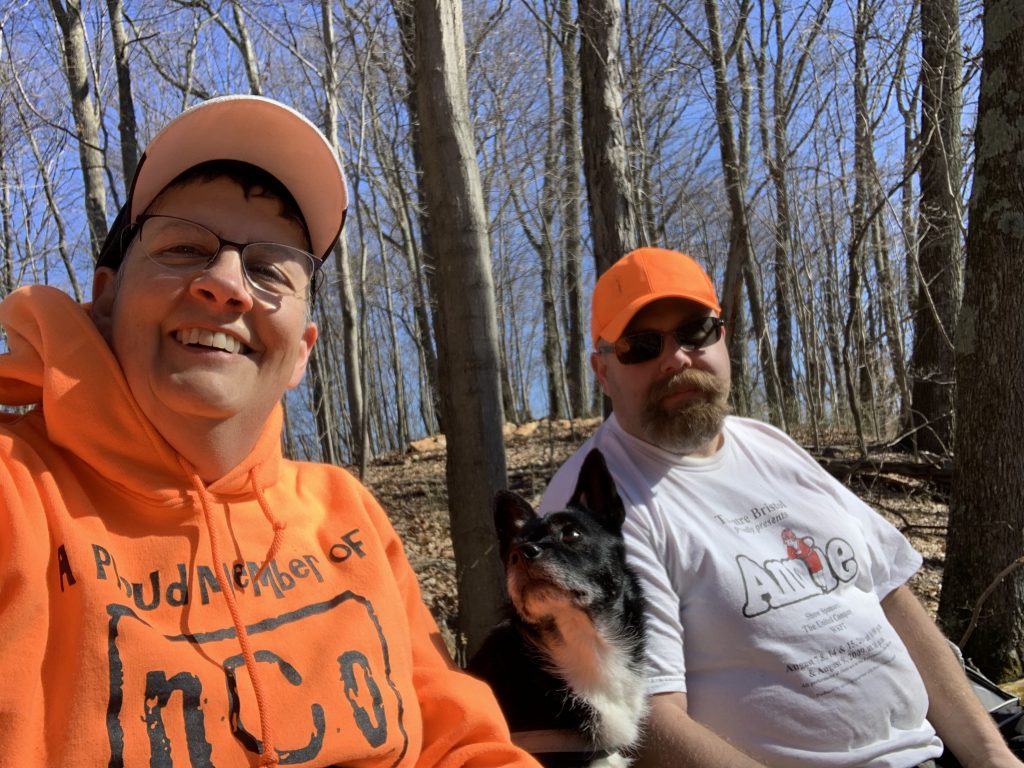
Today was no exception. By the time I had gotten the truck turned around and parked, he showed up with his usual, “I didn’t know who it was so thought I’d better check.” We chatted a few minutes as we prepared for the hike. I had brought Andy along, and he was eager to get to hiking.
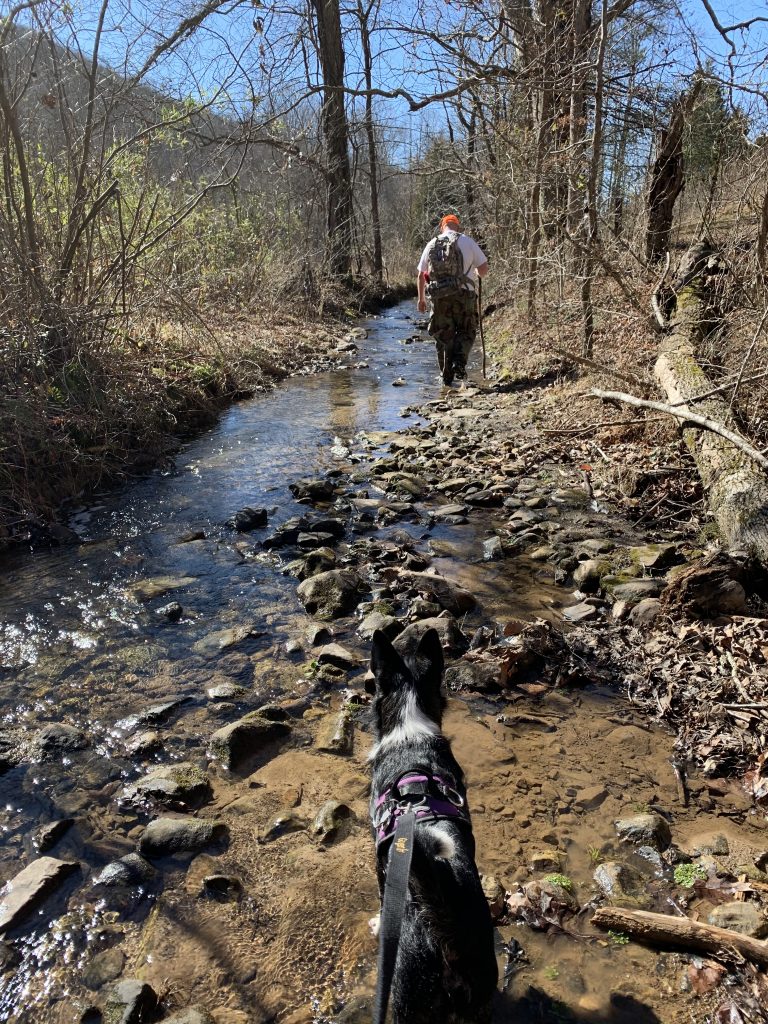
It was 9:15 am when we started, and despite bright, sunny skies the temperature was a brisk 37°. Light winds blew, but down in the valley we were hiking along, they did not bother us. I was well dressed for the weather in a long sleeve t-shirt and hooded sweatshirt.
Our route was along Front Hollow Road. It runs from this entrance all the way to Ledbetter Gap, a distance of 1.8 miles. We would only follow it for 1.3 miles before turning onto the Cross Ridges Trail.
The first .1 mile is downhill, and then the road meets the creek. In fact, the road BECOMES the creek. Knowing that the next .1 to .2 mile would involve rock hopping or wading, we decided to skirt around it through a nearby field.
We had taken this route on our last trip on this end of the park, while carrying an extension ladder so that Rob could log a cache called “Up a Tree.” As the name implies, it was hidden high up in a tall, skinny tree with no branches for climbing.
What we had forgotten about that trip was that on the far side of the field, the ground becomes very muddy and wet, and that we would have to crawl over a barbed wire fence at one point. Somehow, we made the journey without too much trouble and were finally back on the road.
We soon passed a stile over a fence, and Rob stopped check on the cache he has hidden there. We could have used a stile like this a little earlier!

Once past the water, the road begins to slowly climb. This is not like the climb at the far end into Ledbetter Gap that I dread, but it is enough to give you a good workout. We kept up a pretty good pace, and reached the turn off for Cross Ridges a little less than an hour into our hike.

We now began to climb in earnest, as the Cross Ridges Trail is somewhat steeper than Front Hollow. Since we had not hiked for several weeks, my legs soon felt like rubber. We paused a few times during the climb to catch our breath before pressing on. We both remarked that this was the first time we had hiked in this direction along this trail. We have always been coming down on this section, having come up from Back Hollow or down from Cherry Knobs.
At last, we reached the crest of Cross Ridges. Continuing forward on the trail would take us down into Back Hollow. Turning right would be a brutal climb up a little used section of the Cherry Knobs Trail.
We turned left, going off-trail and climbing to the top of the nearest knob. We had made this climb back in December when hiking to another BackWoodsAng hide. The steep slope was no easier to navigate today than the first time.
As we struggled uphill, Rob grunted out that he believes during that last trip he said he was glad he would never have to climb this again. I told him that was a stupid thing to say, almost as stupid as me saying I had found all of the caches in the park.
By this time, I had warmed up quite a bit, and was even sweating a bit. I decided to keep my sweatshirt on though, because we could feel the wind more intensely up on the ridge.
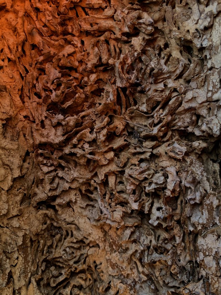
Once we had reached the top, we turned to the right whereas we had turned left the last time when seeking Ang’s other cache in this area. We continued to climb a bit. Nearing the highest point of this knob, Rob spotted the cache from several feet away. It was hidden in a hollow tree. As he signed the log, I studied the intricate patterns on the inside of the tree, left behind by woodworms – the wood-eating larvae of beetles.
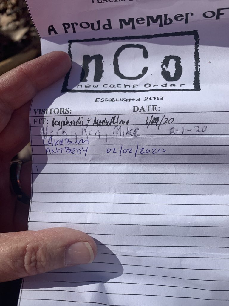
I should pause here to mention that logging this first cache of the day earned us a virtual souvenir (a badge of honor on our geocaching profile). This was palindrome day – a day whose numerical date reads the same backward and forward: 02/02/2020. Groundspeak awarded a souvenir to all cachers who found a cache or logged an event today. A screen shot of my souvenir is at the top of this page.
The name of the next cache was “SHEWWW BOY” and Ang had described the route to it as being the worst of the day. Jared and Tony had also mentioned some steep terrain between this cache and the one before. We must have taken a different route from the all of them, because it seemed a fairly easy trek to us. We just followed the lay of the land, which may have taken us a little out of our way, but made the journey much easier than what our predecessors had described.

We did not find the cache in the first place we looked, but once we got our bearings and followed our phones toward the posted coordinates, Rob spotted it easily. We quickly signed the log, and then backtracked a little way before setting off toward the next cache. We had noticed a likely route earlier when heading from the first to the second cache. This worked well for us, allowing us to get to the next knob without too much difficulty.
I have seen so much beautiful moss this winter, and here was no exception. It is so green and soft!

As we neared the top of the knob, we paused to check our phones. I looked at the hint as Rob pulled up the compass to see how far away we were. He headed off in the direction his phone pointed, but I had noticed that he was standing right next to a crazy looking stump as described in the hint. I decided to check it, and there was the cache.
After I signed the log, we contemplated our next move. Should we go to heaven or hell? No, we weren’t being philosophical. We were deciding whether to visit cache #3 in the series, ”Stairway to Heaven” or #4, “Highway to Hell.”
We could see that there was a land bridge in the distance that looked as if it would take us to “Highway to Hell.” To reach it, we needed to hike to a spot that looked as if it might be equidistant between the two caches. We decided to head there, and then make our decision on which to visit next.
We had a bit of a climb to get up to that spot, but it was nothing like what we had done earlier to make our way to the first cache. Rob mentioned that this would actually make a good route for a new trail. It was a bit rugged and hilly, but nowhere near as bad as the Cherry Knobs Trail we had done a few months ago.
Once we reached the spot we had pinpointed, we checked our phones. As expected, we were almost exactly halfway in between. We decided to go to hell first, and then finish up with heaven. We descended a bit to the land bridge we had seen that links the knobs, and made our way over to the one holding the next cache.
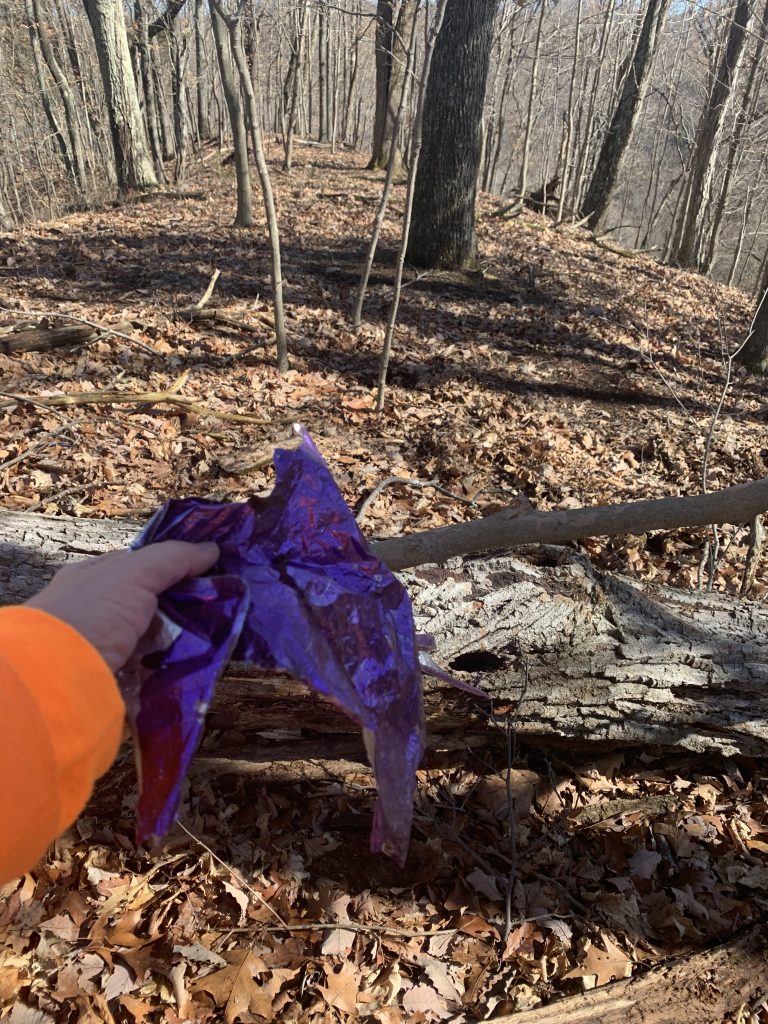
Along the way I saw something purple glinting in the sun and veered off to check it out. It was pieces of a mylar balloon. I stuffed it in a pocket and found it days later after my pants had been washed.
As we neared the peak of that knob, we spied a tell-tale rock stack on top of a fallen log, and knew we had found the cache location. We sat on the log and Rob pulled the cache out from under it.

When he opened the container he got a surprise. The log sheet had names on it other than those of Penguinsushi and Masked Llama. Vern, Ron and Mike had signed the log a day ago! Apparently these three muggles had just randomly visited this knob yesterday, a cold, rainy day, and had stumbled across the geocache.
This knob is truly in the middle of nowhere. There are no trails nearby, hunting is not allowed in the park, and there is no view from here because of the forest. I would love to know what Vern, Ron and Mike were doing in such an isolated spot. Rob and I have decided that from now on, all muggles will be known as “Vern ‘n ‘em.”
After we had signed the log, we made our way back across the land bridge and climbed up to the top of the knob to find the last cache. This was our highest elevation of the day, and while it may not have been the steepest climb, it was getting harder and harder to climb because I was growing tired. I found myself wishing for an escalator here instead of the “Stairway to Heaven.”
When we reached the top of the knob, we spotted the cache location easily. This was the largest and nicest cache of the day, a 30 caliber ammo can. We checked the log sheet, and found only the names of Penguinsushi and Masked Llama, proving that Vern ‘n ‘em’s discovery of the previous cache was indeed accidental.
There were a couple of travel bugs inside the cache – one of which was very appropriate for this cache. It was a geocoin in the shape of cherries. As you may remember, this series of caches was named “Cherry Knobs.”
It was quite windy on the ridge, and I pulled up my hood to protect my ears from the biting cold. As Rob signed the log, I glanced at my watch. It was a couple of minutes before noon, so we decided it was time for a lunch break.
There were no good places to sit on the top of the knob, so I suggested going down into the valley a little. This would also protect us from the cold wind. On the way, I noticed a smiley face in a log.

A short distance away we found a nice log and sat down to eat our lunch. It was in the sun, and I felt much warmer than I had on the ridge. I poured some dog food into Andy’s bowl, and he scarfed it down. I dug into the warm chili in my thermos, once again thankful for a great mother-in-law who makes delicious chili for me to carry on my hikes.
Andy stared at me expectantly, but I told him that he couldn’t share my chili. It has onions in it, which are not good for doggy dogs. I poured him some more dog food, but he ignored it, looking at me pitifully. I then remembered that I had a couple of slices of cheese in my lunch bag, and pulled those out to share with him.
We enjoyed a leisurely 30 minute lunch, and talked about our plans for the rest of the hike. We had a couple of choices. Follow the knobs back to Cross Ridges Trail, down to Front Hollow, and out to where we had parked. Or, we could bushwhack from where we were directly down to Front Hollow, and save a great deal of time and distance.
We knew that Jared and Tony had bushwhacked down to Front Hollow from the location of the second cache. We had looked at the steep terrain there and decided they were crazy!
Our study of the topo maps and what we could see of the terrain from where we were lunching looked as if this would not be a much easier descent. Indeed, once we packed up and headed that way it was gentle slopes through forest with little undergrowth for much of the way. However, we eventually came to steeper terrain and thicker growth, which slowed us somewhat. I let Andy off-leash to avoid tangling.
We finally reached the bottom of a valley and a small stream. I started to turn right, but was puzzled that it seemed to go uphill instead of time. Rob said, “Where are you going?” Oh. I guess I was a bit turned around. That’s why I hike with him – to keep me going in the right direction.
We followed the creek downstream. I jumped across the narrow waterway a few times, when the going looked easier on the other side. At one point we spotted a washtub next to the creek, and wondered how it came to be there. Nearby we also saw some metal that looked like roofing, but no other evidence that there had been a homestead here.

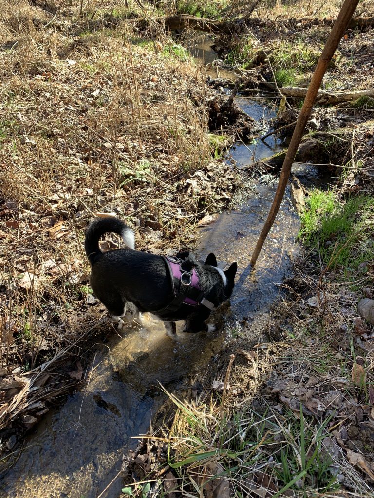
Rob was just saying, “This looks familiar,” when we came to another creek that ran perpendicular to the one we had been following. We had ended up right at the spot where a geocache was hidden that he had recently adopted from Cache Cracker Jacks. He stepped down into the creek to check the crevice where it had been hidden. I heard a splash and looked over to see that Andy had fallen the two feet or so from the bank into the creek. He jumped up, splashed through the water, and back up onto dry land.
Suddenly refreshed from the cold water, he got the zoomies and began running up and down the creek, splashing through the water at top speed. He was funny to watch, but I wasn’t able to get my camera open in time to take video.
Rob took a few steps upstream to check for the cache, but I noticed something in the water. “Isn’t that it?” I asked. Indeed it was.

This cache is pieces of PVC pipe connected in the shape of an anchor. The anchor was attached to a length of chain meant to hold it in the crevice where it was hidden. It had somehow washed out of the crevice, but thankfully the chain had kept it from washing downstream. The log sheet inside was nice and dry, despite the fact it had been underwater. Rob placed it back in its hiding spot, and we made our way over to the Front Hollow Road.
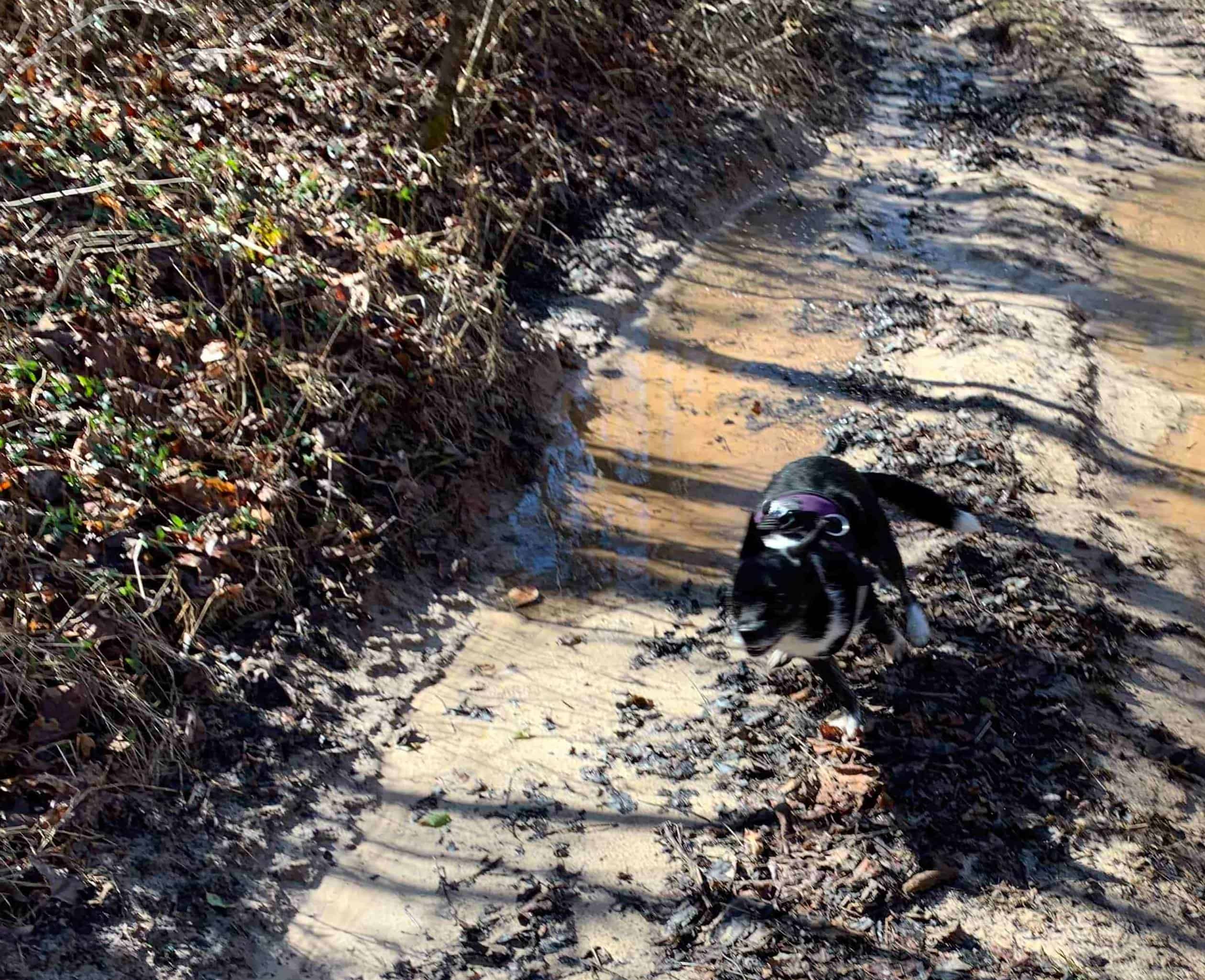
The hike back to the truck from this point went quickly. We were happy to know that there would not be any significant climbs ahead of us. I let Andy off the leash one more time so that he could play in the puddles along the road. He enjoyed splashing through them – running ahead of us about 100 feet, and then turning to fly back to my side.
Rob and I did not try to keep our boots dry on the return trip. We tramped through the water where the creek flowed along the road. It was not deep, and much easier to navigate than the muddy field and fence had been.
As we passed that field, we noticed that a horse was now grazing in it. Andy kept a close eye on it as we passed, and then kept trying to go under the fence to investigate it more closely. I was glad he was back on his leash by this time so that I could keep him from doing that. Dog’s heads are no match for flying hooves.

When we arrived back at the truck, we agreed that the hike had been much less difficult than we had expected. We decided to stop on the drive home to look for a cache that neither of us had found.
This cache is located in the Eastman Park at Horse Creek. I missed turning onto the access road that would allow us to park next to the walking path, and instead found myself pulling into the main entrance. Because the gates were closed, we could not park in the lot, so decided to leave the truck outside the gate and walk across the parking lot toward the walking path. This added to the distance we had to walk, but fortunately we still had some energy after our hike.
Andy was a little intimidated by a rather large dog that was walking its owner in the park. Fortunately, they gave us a wide berth so he did not have to worry for his safety or ours. I found it interesting that he was so brave, wanting to visit the horse, but so timid when it came to another dog.
As we walked, I recalled previous adventures here, including having to wade into Horse Creek on a February day when I dropped the custom lid of a geocache into the water. What I thought would be shin deep water ended up well above my knees soaking my shoes and pants. Reaching down in the muddy water to retrieve the lid from the bottom of the creek further soaked my sleeve and the front of my shirt. Was I fortunate, or unfortunate to have several friends there to witness this and to laugh at (or with?) me?
Today I would not have to enter the creek (here at least) which was a blessing because it was even higher than usual with recent rains. We found the cache easily, signed the log and collected the clue we will need to find a mystery cache at a later date.
Once we had returned to the truck, I took Rob home. I looked at the time, and realizing there was plenty of daylight left I decided to look for one more cache.
Hidden in 2015 it had only been visited by a handful of people, and was last found in January 2016. I had attempted to go there once before, but had not read the cache page thoroughly enough to learn the suggested parking coordinates.
This cache is located near the South Fork of the Holston River, just downstream from the Fort Patrick Henry Dam. It is due west of Fort Patrick Henry Drive, and on my previous attempt I had been driving the back roads nearby looking for a place to park. I later learned that I would need to park on the east side of Fort Patrick Henry Drive, and walk under the bridges that carry the highway across the river.
I had thought of stopping here many times in the past, but the timing and weather had never seemed right. Knowing that I would have to do some bushwhacking to get through the woods on the east side of the highway, I had decided to save this journey for winter when the vegetation would not be as thick.
I parked at the designated spot, and Andy and I made our way to the bank high above the water. Because I could see that the area directly under and between the bridges was clear of vegetation, I angled my way downhill in that direction following what looked like it could be a path.
However, part way down the steep hill I reached an impasse. A tangle of branches from fallen trees blocked my way. I released Andy from his leash, and began battling my way through. I soon found myself in the midst of the downfall, not sure if I could make my way down or even back up the way I had come. Andy was also squeezing between fallen limbs, and a couple of times his harness snagged and I had to free him.
Finally, we had made it to the cleared between the bridges. We were now along the south bank of a creek that runs parallel to the river but in the opposite direction. Fort Patrick Henry Dam was upstream from me at this point, but the water in the creek was running toward the dam, not away from it.
The walk along the creek bank was much easier than my descent, but I soon realized that I was running out of dry land and was still several hundred feet from the cache. The creek made a left hand turn and the cache location appeared to be on the other side. On the side I was on, there was a home and No Trespassing signs, so I couldn’t make my way across their yard to get nearer the cache.
I texted Rob to tell him where I was and ask if I needed to wade the creek to get to the cache. While waiting for his reply, I backtracked looking for a friendlier place to cross. I finally ended up returning to the original spot, and decided it was the most likely place. I could tell I was going to get my feet wet. The water wasn’t TOO deep, but deep enough that I would be in over my boots.
I had come too far to give up now, so I decided to go for it. I rolled my pant legs up above my knees and plunged in. The water wasn’t nearly as cold as I thought it might be. It was an easy walk across, although I was in knee deep water part of the time.
By the time Rob had replied, I was across the creek and trying to make my way closer to the cache. I had hoped that it was in the flat area to the west, but he confirmed that I would have to climb to the top of a nearby hill. Since I had walked along the flat area first, I was faced with a very steep climb to get up there, but eventually made it to the top. It was definitely not the easiest route, as I found later when going back down.
As I neared the top, I saw a stump and stopped to look around it since the hint had said it was near the base of a stump. I wasn’t finding anything, despite a close compass reading on my phone. I decided to move on and see if there was another stump nearby. I finally spotted one just over the crest of the hill from where I first looked. This was it! After digging through the debris that had collected in the base of this hollow stump for four years, I spotted the cache!
Finding a geocache that hasn’t been found in over a year is considered a cache resurrection. I was thrilled to have found this one that was last found four years ago, so I took time to share my happiness with the New Cache Order crew by posting a video in the group chat. Even more exciting was that I was able to retrieve a travel bug that has sat there for four and a half years, and get it moving again.
Our trek back to the truck was much easier. I found a better way off the knob and then back up on the other side of the bridges.
Along the way, I found a couple of large patches of some kind of leafy plant that I didn’t recognize. I’m hoping my sisters might read this and help me identify it.

This was a wonderful day filled with adventures, and it was great to get back out in the woods again. I’m hoping for many more hikes this winter and spring, but my schedule is quite busy, especially in April and May.
