
Bays Mountain Park
- 4.51 miles
- 3:03 duration
- 745 foot elevation gain
- 2 geocaches found
- 1 EarthCache found
- 1 geocache visited (previously found)
- 1 geocache hidden by LakeBum
As reported last week, I was nearing completion of finding all of the current geocaches in Bays Mountain Park. With only three left to find, and all three along the same route, I knew that I would be able to get all three in one day.
Seeing how close I was, LakeBum (Rob) suggested that we make this hike this weekend. We had hoped to do it on Saturday, but the weather was too wet and cold for comfortable hiking. We don’t mind wet, and we don’t mind cold, but those two circumstances combined make for a miserable day on the trail.
Sunday looked to be a better choice as far as weather, but the park does not open until 11:00 on Sundays. Still, we knew we would be able to accomplish this hike before the park closed at 5:00 so decided to go for it.
Andy and I arrived at the park a few minutes before 11:00. The gate was already open so we proceeded up to the parking area and waited for Rob. He arrived a few minutes later and we geared up for the hike.
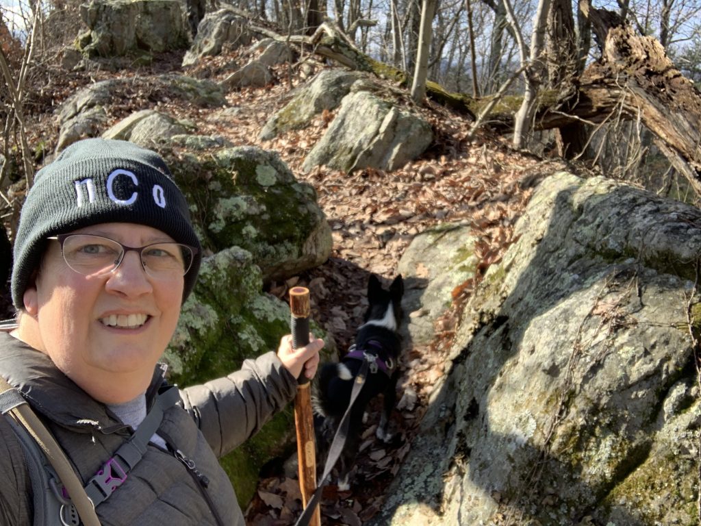
The gray skies of the day before had cleared, giving us beautiful (or as Rob said later in the day “bluetiful” blue skies with quite a few scattered clouds. The temperature was 37° which combined with 10-15 mph winds made for a chilly morning. I wore two lightweight, wicking, long-sleeve shirts and my down jacket. I had an nCo beanie to keep my head and ears warm, and lightweight gloves.
As we made our way across the dam, that cold wind blowing off the reservoir was cutting. Andy wanted to run across the dam as we had on our last trip in this direction, but I wanted to conserve my energy for the climb I knew was ahead of me.
Once we were across the dam, we headed up the Bays Ridge Road, an unpaved forest road open only to official vehicles. We climbed over 300 feet in elevation during our first 25 minutes of hiking. I will admit we made a couple of stops to breathe along the way, but for the most part, we made good time. Within minutes I was sweating under my shirts and down jacket, and had shed my gloves and hat. The gloves stayed in my pockets the rest of the day, but the hat was on and off the whole trip.
We had only been hiking for a short time when I was momentarily confused as to why I did not seem to have enough hands. Something didn’t seem right as I juggled my hiking stick, my phone that I had pulled out to take a photo, and Andy’s leash. Ah! That was it. I had forgotten to bring along the leash belt that I normally wear around my waist. I am accustomed to having Andy’s leash attached to it so that my hands are free. At our next stop I looped it through my backpack waist belt. Problem solved.
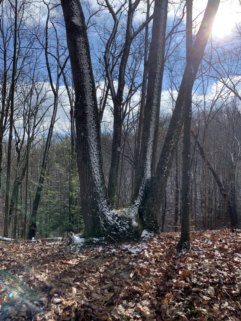
There had been a light snow the night before, and some of that still clung to the ground and to limbs in places.

It had obviously been a blowing snow, because one side of all the trees were white. I remembered looking out the night before and seeing the snow blowing nearly horizontally.
At about the .9 mile mark we left the trail and began bushwhacking over to a cache I found on Black Friday. This is a puzzle cache that has to be solved to earn the coordinates. Rob had also solved it, and was actually the one to build the phenomenal container and place it here, but he had not yet come back to log it. He wasn’t able to hike with me on Black Friday, so we decided to stop today so that he could see how his creation was faring and to sign the log.
There was more snow on the ground here, and it was not an easy climb up the ridge to the cache location. However, it was easier than my previous visit when I made the mistake of going far down into the ravine and then climbing straight up to the cache.

I believe Rob was pleased with how the cache is holding up to the weather. Animals have chewed on a few of the protruding parts, but otherwise it is in good condition. We got a chuckle out of picturing the first squirrel that came bounding through the forest and spotted it. He must have wondered what kind of creature this was before realizing it was not moving and getting brave enough to approach and even nibble at it.

I was surprised to see Rob open a part of the container that I didn’t know opened. I had obviously not spent enough time exploring all it had to offer when I was here before.

Along this hillside where the cache is located, there is a lot of very soft, green moss. I was intrigued by the colors and textures of the snow on the moss, so took a few photos before we made our way back to the road.


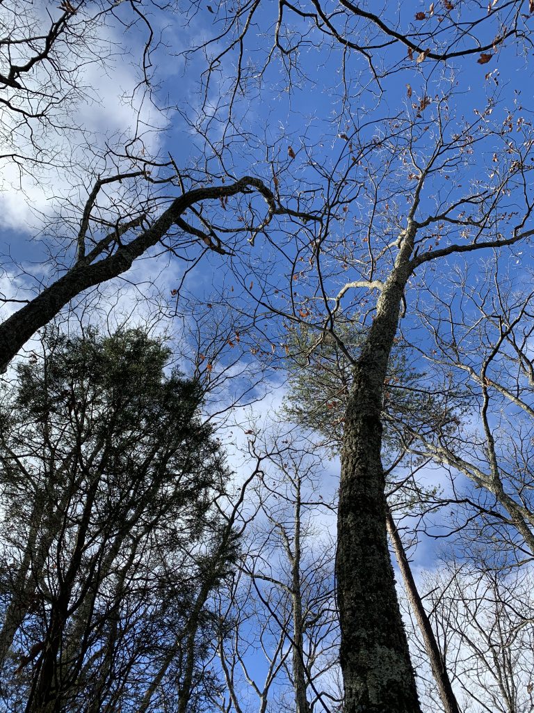
Then, I looked up and there was that bluetiful sky above the towering trees. Even in the dead of winter, the mountain was alive with color.
Back on the road, we continued hiking up the ridge. It was less steep here, but still a constant climb. Within .3 mile we reached the point where Bays Ridge Road turns right to descend to Ledbetter Gap. This is also its intersection with Bays Ridge Trail, a well maintained foot path that continues along the ridge line.
As we approached, Rob voiced his surprise to see a new bench here. We decided that it was a good place to stop and take a break. We wanted to shed his light wind jacket, and I was ready to take off my down jacket.
This was a very well built wooden and steel bench, and it faced the beautiful view of the valley below. There was even a handy dog tether next to it – a three foot high stub of a tree that I was able to loop the handle of his leash over.

I took of my jacket, but immediately put it back on. Since my shirts were damp from sweat, the wind was quite chilly without it. I decided to keep it on until we started hiking again.
I went off in search of a tree to talk to, leaving Rob to deal with a very agitated Andy. He didn’t like me leaving him behind and was very happy when I returned.
Back at the bench, I dug out my thermos and enjoyed some warm chicken tortellini soup. Andy looked interested, so I offered him some and he actually ate it! He must have really worked up a hunger coming up the trail. I know I had.

I sat on the bench and enjoyed the view while I ate. The bench was wet, but I carry a cushion in my backpack for just this reason. Rob has one as well, but he chose to stand. He ate some snacks and drank warm tea while we rested there.

After a 15 minute break, we put everything back in our packs and headed for the Bays Ridge Trail. I ended up keeping my jacket on, even after we started hiking. Over the next .10 mile we were walking a mostly level terrain. However, the name of the cache just ahead, the first that I had on my agenda for today, was Bays Ridge Huffnpuff. I knew this meant there was going to be some uphill hiking ahead.
Sure enough, we had a very steep, but thankfully short, uphill climb to reach the cache location. This was one of Rob’s hides, so he stood on the trail while I walked over to log it. His hint had read, “Look for the V.” I knew where it was as soon as I saw a big two trunk tree. There I found a cache in great condition with a nice, dry log sheet. I briefly thought about taking a piece of swag I found inside – a wristband that said “Take a walk on the wild side.” But, since I didn’t have anything to trade for it, I left it in the cache.
We then continued on to my next goal, an EarthCache by KickenChicken (Treavor). It is called “The spine of the dragon” and brings you to a 200+ foot long rock formation that stretches along the top of the ridge. I have hiked through it before, but that was before he published this EarthCache. To log it, I was required to answer some questions about what I saw there. I collected the info I needed, and we continued on our way.
Once we passed the EarthCache location, the trail began a gradual descent. Because there was space along the trail for another geocache, Rob had brought along an ammo can to hide here. As we walked along, we discussed possible hiding places. When we had reached the limit of how far he could hide it, we backtracked along the trail a bit before he found the perfect spot.

He hid the cache while I exchanged banter on the nCo members chat with Ang. He was worried we were stealing one of the locations where he plans to hide caches, but we assured him we weren’t interested in his “knobs.”

When Rob was finished, we continued our hike. We soon came to the intersection of Bays Ridge Trail and Jones Road. This is a trail I had never hiked before, and the location of the last cache that I needed to find to complete the park.
All along the road were park signs warning that motor vehicles are not allowed. It would take a special vehicle and someone who is nuts to try to drive up this road. It is steep, rocky and deeply rutted in places. I was very glad we were going down it rather than up, even though my hips and knees were protesting with every step. The elevation dropped over 300 feet on this .30 mile section of road.
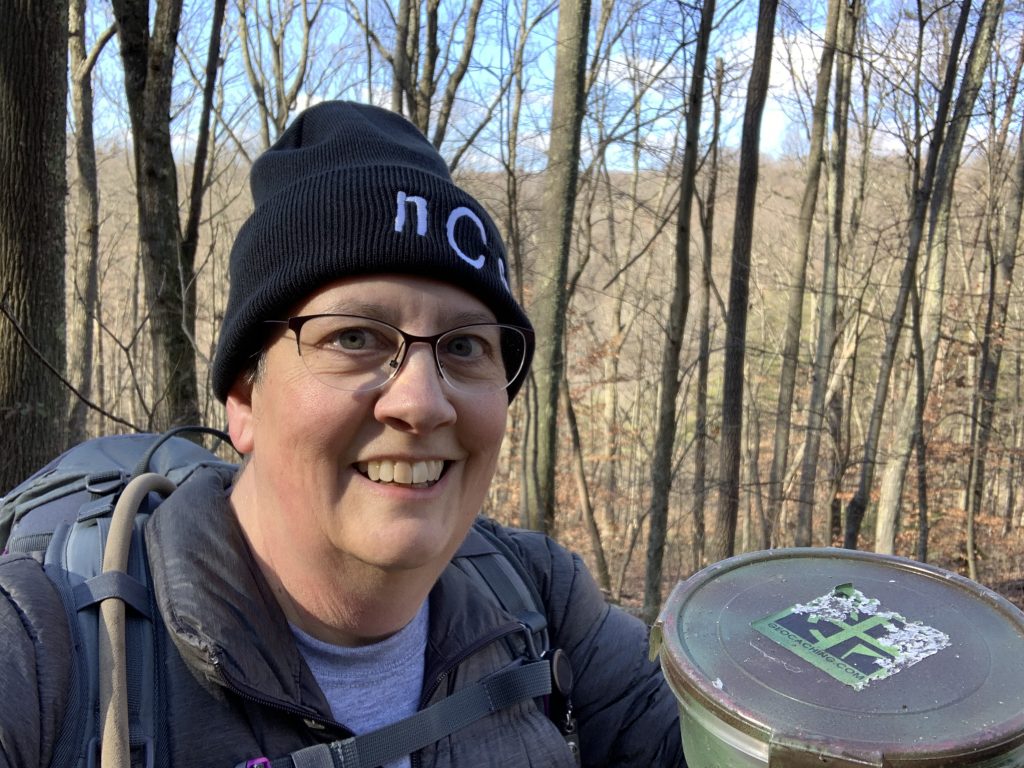
Near the bottom, we began getting close to the geocache I needed. Rob couldn’t remember exactly where he had hidden it, but after poking behind a few boulders I came up with it. He laughed as I took a selfie with the container because of the various facial contortions I went through to make sure I looked my best. But, this was a special moment for me, having logged all of the geocaches in this park. Well, other than the one he just hid.
When we were finished, we continued down Jones Road to its junction with Front Hollow. Then, it was another uphill climb along Front Hollow Road to Ledbetter Gap. I was happy to see the gate at the gap, and know that most of our trip from here would be downhill.
After the rough terrain we had been on, hiking down Lake Road from Ledbetter Gap is a relief. It is a gentle decline, and the road has only a few rocks to trip up your tired feet. We were surprised to see a wet water spring flowing down the hillside at one point. Neither of us had seen water here before.

We made the one mile trek back to the dam in record time. I was once again sweating profusely, and carrying my hat instead of wearing it. I was ready to shed my jacket, but didn’t want to have to stop and take off my backpack to do it, so I trudged on.
I paused as we crossed it to take a photo. There was a lot of water coming over the spillway. I would say that Dolan Branch Falls, which you can see just below the roadway, were beautiful with the large volume of water, but I didn’t have the energy to hike down there and see.

As always, we griped as we climbed the last hill next to the Nature Center to where we had parked three hours before. It always feels like the worst part of the hike, possibly because we know the hike is over and it is time to go home.
Before our hike, I had projected that we could be done by 3:00. Instead, we arrived at the parking lot at 2:15. A fast pace and quick, easy finds had us completing our 4.5 miles in just over three hours.
