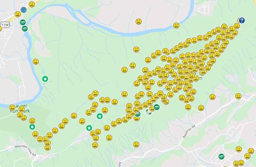
Bays Mountain Park
- 1.97 distance
- 1:02 duration
- 343 foot elevation gain
- 1 geocache found
On the next to the last day of the year, I awoke at 4:30 am to fly home from Philadelphia. We arrived home with no issues by 11:00 am, and were picked up at the airport by Deban’s mom. The three of us enjoyed lunch at the Sit ‘n Bull and then went to Kingsport to pick up my truck. I had dropped it off for a recall, routine maintenance and repairs before we left for our trip.
Once I had my truck I ran some errands, and then arrived home just as Deban was getting ready to leave to take her Aunt Sylvia to visit some animal shelters in search of a cat to adopt.
Since I had not had much sleep the night before, I could have easily napped on the couch the rest of the day. But, instead I decided to head out for a quick hike. This made Andy the geopup very happy!
Bays Mountain Park and its neighboring little sister Laurel Run Park boast 183 geocaches as of this writing. I hid three of those, leaving 180 potential finds for me in these two parks. I was down to only four caches not yet found here. Three are on the southwest end of Bays Mountain, along Bays Ridge Trail and Jones Road.
The fourth was all alone on the northeast side. This was a puzzle cache that I had solved but never had the opportunity to visit and log. I decided that Andy and I had plenty of time on this beautiful afternoon to take a quick hike out to log this cache. I emptied some of the travel detritus out of the small pack I had carried with me on our flights. I wouldn’t need all of the usual gear I carry when we hike. I didn’t even bother to change from my running shoes into boots since it was going to be a short hike and easy terrain.
Andy and I arrived at the park around 2:15 pm and parked at the highest lot above the nature center. This lot has been newly paved since I last parked here, part of the major improvements in infrastructure that the park has done in 2019. This lot gave me direct access to Lake Road.
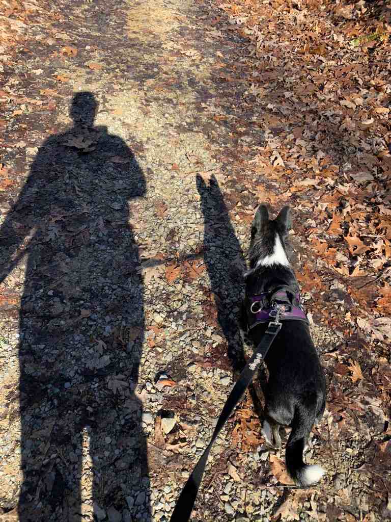
The weather was perfect: 55° and sunny. The sun was already somewhat low in the sky, as evidenced by our long shadows that marched in front of us down the trail. It was a bit breezy, but that just kept me from getting too warm. I hiked in long pants and a long sleeve t-shirt.
Because I was hiking alone, I opened the Google Maps app on my phone and sent a link to my friend Ang so that he could keep track of my location. He and I will do this for each other at times, so someone knows exactly where to find us if something goes wrong. He replied, “I got yo back.” We continued to text back and forth throughout my hike, with me mostly doing voice to text since it is hard to hike and text at the same time.
Andy and I began our hike along Lake Road at 2:19. This road is unpaved but well maintained by the park. Visitors can drive this section a short distance to reach the picnic pavilions, but beyond that the road is for official vehicles only.
We were hiking downhill at a fast clip, and even broke into a jog occasionally. Andy loves to run. I am slow, but do my best to accommodate him when he needs to expend some excess energy.
Within ten minutes we had hiked half a mile and turned left off Lake Road onto Big Oak Trail. This is a more narrow foot/bike path but also well-maintained as it is one of the more active trails in the park. Following it to its end will take you to a junction with Azalea Trail. From three you can hike to the northern most point in the park, the top of the ridge that boasts several communication towers.
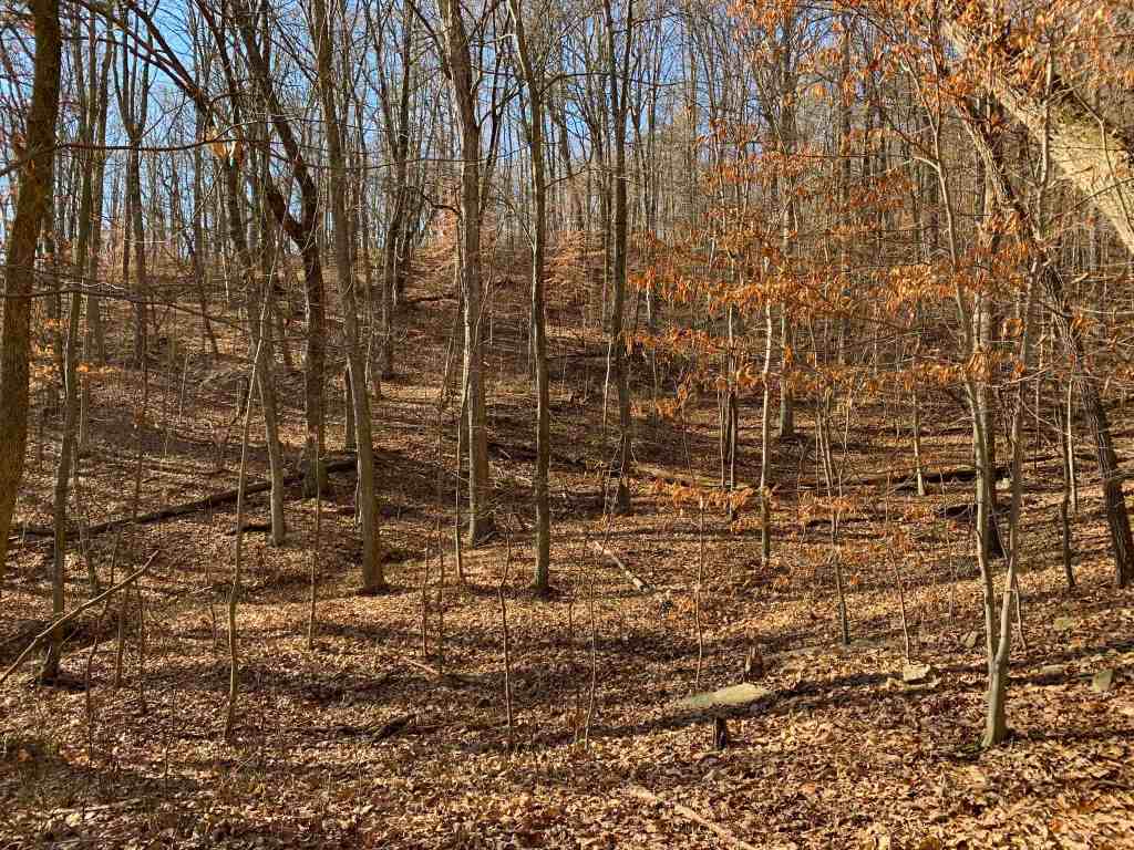
Andy and I only hiked .3 mile along this trail, steadily gaining altitude along the way. I was watching the geocaching app on my phone as we went. When it seemed the cache I was seeking was directly to my left off-trail, we began bushwhacking.
We were still nearly .2 mile from the cache, and it was all uphill. I soon had to let Andy off-leash because we were becoming tangled in thorny undergrowth and encountering downed trees that I needed to go over and Andy go under. Our pace slowed but my heart rate quickened.
Movement about one hundred yards to our left up the hillside caught my eye. I looked over to see a deer peering at us through the trees. I stopped a moment to look for him, and looked down to see if Andy had noticed him. He was oblivious. When I began moving again, the deer started to bound up the hill away from us. There were actually five deer in all, and they weren’t sticking around to see what we were up to.
I had my phone in hand, checking the distance from the cache as I went. Finally, I began growing closer and decided to stop and look at the hint and previous logs so that I would have an idea of what I was looking for. It had last been found by Reis’s Pieces (Scott) a little over a month before. He had posted, “Well that was exciting! My GPS is all over the place today.”
My GPS showed I was about 150 feet away from the cache and the compass pointed uphill. The hint had read “Log in between two trees, covered by bark.” I looked to my left and saw a log between two trees, so decided to check it before climbing further up hill. As I walked closer I saw it: the cache!

I was thrilled to have found it so quickly and easily. I took some photos, and opened the cache. Inside was a very interesting object. Rather than try to describe it, I’m simply sharing a pic.

I signed the log, and left behind a couple of travel bugs that I had been carrying around for too long. Placing the cache back in its hiding spot, I covered it with bark as it was meant to be.
We then headed back down the hill toward the trail. The trip back down seemed to take longer than the trip up. I felt certain I was going in the right direction, but began to wonder since I still hadn’t arrived at the trail. I finally spotted it and breathed a sigh of relief.
Once we were on the trail, Andy faced uphill hoping for more hiking. I clipped his leash back on his harness, and told him we needed to head back the way we had come. He reluctantly agreed.
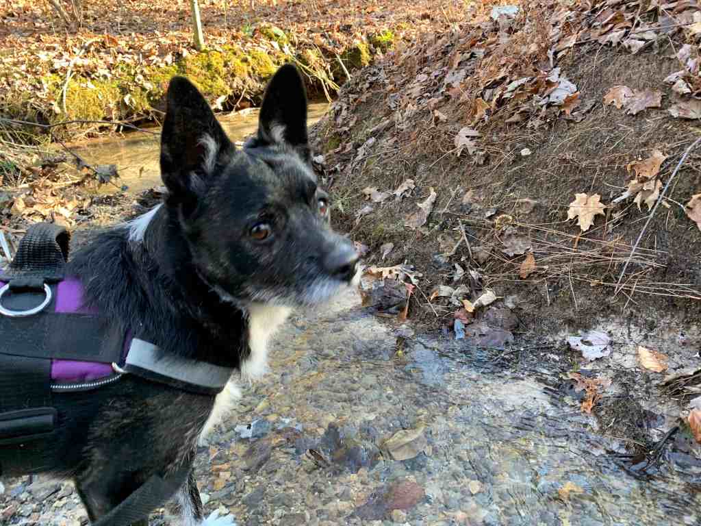
We reached Lake Road quickly and were soon passing a creek that flows into the reservoir. Andy looked up at me pleadingly, so I took him down to it thinking he wanted a drink. He just stood in the water for a few minutes looking around. Silly dog.
I led him back to the road, and we continued our hike back to the truck. We were now hiking uphill again, but it was a gentle climb. At one point we met a woman with a very energetic Labradoodle that wanted to play with Andy. As usual, he cowered behind me, shy about making friends. We parted ways with the woman and her dog and continued our hike.
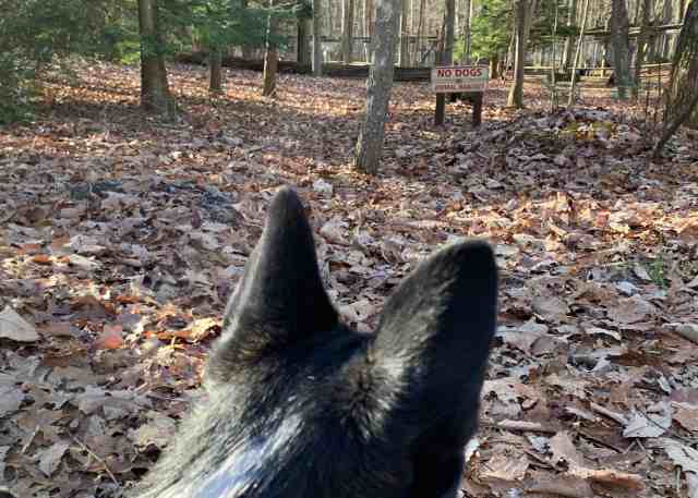
As we neared parking, we could see the signs off to our right that prohibit dogs from visiting the animal habitats. Andy looked at the sign, and I’m pretty sure he sneered at it. We continued on, not wanting to go where we aren’t wanted.
We were back at the truck just one hour after beginning our hike. It was short, but we enjoyed the opportunity to stretch our legs in our favorite park. Now, we just need to hike up Bays Ridge to get those last three caches!
