
Sugar Hollow Park
- 2.5 miles
- 2:53 duration
- 377 foot elevation gain (while above ground)
- 2 geocaches found (during hike)
LakeBum (Rob) and I had previously found all of the caches in Sugar Hollow Park except two. One was a puzzle cache that we had not solved during our previous visit, and the second was a traditional cache that was placed since we were last here. Since Rob had solved the puzzle cache since then, we decided to make that our destination for this week’s hike.
Sugar Hollow is a 400 acre park in Bristol, VA with hiking/bike trails, softball and soccer fields, disc golf and seasonal camping and picnic areas. We have hiked here twice in the past, in August and November 2017.
We had planned to meet at my house at 8:30 am but the morning didn’t quite go as planned. I woke up at 6:13, wondering why it was so dark and quiet in the house. It took me a minute to realize that we had no power. Unable to go back to sleep, I got up and while walking through the dark house noticed flashing blue lights outside. Two police cars were blocking our road in the direction Rob would need to come. Apparently a power pole was down.
I was forced to get ready for our hike without power. This meant no shower, and no warm soup to take for my lunch. I made a sandwich instead.
As our meetup time approached and we still had no power, I texted Rob to let him know he wouldn’t be able to get to my house. He replied that he was still at home and looking for his headlamp. I realized I wasn’t sure where mine was either, and we would need these for today’s adventure. I set off on a search for mine while exchanging texts with Rob to change our meeting place to Ingle’s so he wouldn’t have to try to find an alternate route to my house.
I wasn’t able to find my headlamp (which I discovered several days later was in my truck) so grabbed a small mag light instead. I then headed out by a roundabout route to meet up with Rob.
We finally arrived at Sugar Hollow at about 9:20. Since the picnic and camping areas are closed for the winter, we had to park in a lot further from the trail head than we would have liked. I pulled into a space and we prepared for our hike. I had brought along our hiking buddy Andy, and he was eager to hit the trail. As usual, Signal was riding along in the side pocket of my backpack.
It was 41° and breezy with a few clouds scattered about the blue sky. Rather than dig out the beanie from my backpack, I pulled up my hood to protect my ears from the cold breeze. It was cool enough on this day that I ended up keeping my hoodie on all day. Often I will warm up enough during the hike to shed my outer layer, but not today.
We followed a paved, and then graveled walkway toward the creek, and crossed a nice footbridge into the picnic area. Signs on the bridge warned us that it is slippery when wet and they were accurate. Each end of the bridge sloped, and we made our way carefully up and then down those areas to avoid falling on our butts.
We followed the road a short distance through the picnic area searching for access to the Ridge Trail. I was glad that we weren’t taking the first trail head that we passed because it started with several steps up a steep hillside. On top of the post for that trail head we spotted a deer skull.

Ridge Trail circles around, so we opted for the second trail head, located behind one of the picnic pavilions.
We began a steady climb up the trail, with an elevation gain of about 200 feet over the next .4 mile. At last we reached a trail intersection. We turned right on Cave trail and continued to climb a short distance.
As we neared the coordinates for the first cache we left the trail to cross the highest part of the ridge. We soon saw that we could have continued along the trail around the ridge to arrive at the same spot. As we stepped back on the trail, we found a cave opening right next to it. This was our first destination of the day.
The entrance was down a steep slope from the trail. We could see that the opening was not tall enough to walk through. Someone had rigged a cable to hold onto while entering. Rob suggested that Andy and I wait topside while he crawled down to investigate. He donned his headlamp and carefully made his way down the slope, slippery with a thick layer of fallen leaves, until he could grab the cable and enter the opening.

Among all of those leaves, he spotted a set of keys that someone had lost. He tossed them up toward me. There was a Honda key and several other door keys on the ring. I hope the person that lost them had a way home that day!
The hint for the cache had mentioned a ladder. Once he was down in the opening, Rob called out that there was indeed a ladder leading down into a deeper part of the cave but he wasn’t sure he trusted it. I told him that Andy and I would come down and check it out.
I made the slippery descent and bent over to enter the cave. I held my flashlight in one hand and Andy’s leash in the other, while using that same hand to grip the cable. The passage was only about five feet high so it wasn’t possible to stand up.
When we reached Rob, he moved aside so that I could see the ladder. It was metal, very narrow, but seemed sturdy enough to support my weight. I told him I would go down and search for the cache if he would keep Andy with him. We traded lights so that I could climb down hands-free, and I started my descent.
I had to pass through a narrow opening to get onto the ladder. I chose to turn and inch my way backward until I could put my first foot on the ladder. There were some handholds in just the right places that were very helpful. I was a bit nervous as I held on to these handholds while feeling behind me with one foot for the first rung of the ladder. Many thoughts of ways this could go wrong sped through my brain. This was the kind of cache I am not allowed to search for alone (Deban’s rules) but I knew that Rob was there to call for help should something bad happen. He shined his (my) flashlight past me and helped guide my steps.
Finally, I had one foot on the ladder, but was having trouble getting my second foot past it to reach for the next rung. The ladder was very narrow, and I had placed my first foot in the center of the rung. This left no room to put the second next to it. I was finally able to maneuver somehow and get my second foot down, and then it was a fairly easy descent. The ladder was a bit “springy” under my weight, and I felt it was a good thing I was attempting this rather than the heavier Rob.
Rob warned me that there was a missing rung near the bottom. When I had reached the rung above that one I was standing on my left foot. I carefully reached down with my right next to the ladder until I could feel the ground, and then lowered my left to the ground as well. I was basically straddling the ladder at this point, standing on a bit of a slope. Holding on to the ladder, I managed to swing my right foot around to join the left and let go.
I checked out the situation and could see that someone had wedged a large rock against the bottom of the ladder to keep it from sliding as you climbed up or down. It reminded me of the memes I’ve seen with crazy ladder configurations and the labels, “No. No OSHA here.”

Once I had both feet on solid ground, I asked Rob to read me the hint again. I was standing in a good-sized chamber. The ceiling was about 25 feet high at the highest point. On the ceiling I could see huge groups of cave crickets.
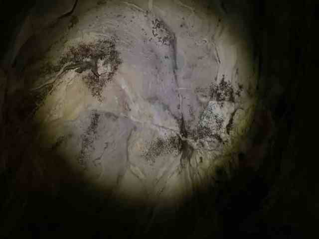
The floor sloped downward from where I was standing next to the ladder. Toward the far corner was a small opening. There were a couple of good sized stalactites hanging near it, and a steady drip of water from them to the floor.
I could see evidence of past campfires on the cave floor, and among the debris found a busted flashlight. Uphill from the ladder I spotted another opening next to a curtain wall of stalactites. This matched the hint so I made my way through that opening to look. I was now in a much smaller chamber with a ceiling of about 4 1/2 feet high. Not finding the cache there I crawled back out into the main chamber and I looked around a bit more, even going down to the very bottom to look in the opening there. I got a bit wet in the process with all the dripping, and found nothing but a used condom. YUCK!
I called up to Rob to let him know I wasn’t finding anything. He said he would go back to the cave opening where he could get a cell signal, and text a previous finder for help.
While he was doing this, I recorded some video footage of the inside of the cave. It was too dark to take decent photos, but the headlamp I was wearing was enough to illuminate the features I wanted to point out on video. I will provide a link to it later in this post.
Eventually, Rob called back down more details about the hide, and I realized my first instincts had been correct. I crawled back into the small chamber to search more thoroughly. Still no cache.
I crawled out and climbed the ladder into the upper passageway. Rob had received more info in the meantime, and told me exactly what kind of container the cache was hidden in. Knowing this, I knew that it was indeed missing as it was big enough that I would have seen it were it still there. Since we know the cache owner we knew it was okay to replace the hide.

Rob dug around in my pack to find a pill bottle and a log sheet. He had tethered Andy to the cable leading into the cave, which allowed him to run back and forth between Rob and me. He made the route look easy.
Rob signed our names to the log, put it inside the pill bottle, and tossed it down to me. I descended the ladder again, this time much more quickly than the first. I used the busted flashlight that I had found, placing the pill bottle in it and then wedging it in a crack where the original cache had been hidden. I used a perfectly shaped flat rock that I found to hide the replacement from muggles, and then crawled back out of the small chamber. I climbed the ladder and made my way back to the surface.
As noted earlier, you can watch a video of my adventure here.
With this find finally logged, we followed the Cave Loop Trail toward the other cache in the park we had not yet found. We then turned left on Salamander Trail. We recognized some of the scenery along this trail from a previous hike.
When we neared the cache location, Rob started looking for the cache. He wasn’t having any luck so I re-read the cache description and the hint. Since it mentioned a huge fallen tree, I looked around the area and spotted one some distance away. I started making my way there and when I arrived felt certain I was in the right place.

The cache name was “Black Label” and the description said we would understand that name when we were in the right place. Scattered on both sides of the fallen log were several dozen old cans – most of them for Black Label Beer. Someone must have had quite the party here back in the 1970s. The cans were from that era – evidenced by the pull tab openings rather than the more modern “stay tab.” Mixed in with the beer cans were a few Mountain Dew cans – possibly left by the designated driver? We also found a Treet can. Maple-flavored. Yummy.

It took a great deal of digging around both sides of the downed tree and a nudge from a previous finder before Rob finally found the cache. It was a waterproof pouch for a cellphone, and the earth had definitely tried to take it over. It was covered in wet dirt, a worm was living in it, and there were roots of some kind growing from it.
I scraped off the dirt and tried to figure out how to open it. Rob finally had to pull out his knife and use it to pry open the tabs that held it closed. The contents were a little damp, but the logsheet was inside a bison tube and was nice and dry. A trackable geocoin was in the cache, and I took it with me so it could travel to New York with me soon. Unfortunately, I somehow lost the coin by the time I got home. I’m hoping it turns up soon!

We started to follow the trail past the cache location when we were finished. Almost immediately it turned sharp right, and we found we were walking in the opposite direction. Looking at the map, Rob could see that the trail did that several times, so we decided to cut some distance off our hike by bushwhacking straight uphill instead. It wasn’t steep at all and pretty easy going. We crossed the trail four times before coming out on top near the intersection that we had been at earlier in the day.
From there it was a downhill trek back to the picnic area. We were surprised by how long it took us to get back to the picnic area, and that we had climbed all that way to get to the caches.
Since it was lunch time, we sat down in one of the picnic pavilions to eat. Signs warned us that we had to have reservations and pay a fee to use the pavilion, but we decided that wouldn’t be an issue on this cool day.

Once we had finished eating, we packed up and headed back to the truck. We then spent a bit of time driving around to grab a few more caches in the area. One in particular stands out. It was in an area bordered by a wooden fence on three sides and with an old barbed wire fence along the back. A huge, old oak tree grows in the center. This tree is named the Resting Tree.
This is the site of a slave cemetery with unmarked graves dating back to 1978. A five year old boy named Crippled Dan was the first to be buried under the tree which marked the spot where slaves from the Preston Plantation rested from their field work twice a day.
This was a beautiful spot, and felt like hallowed ground. We counted four unmarked stones near the tree, but history tells that around 100 slaves are buried here.

We found the geocache at the back of the cemetery, at the base of another old tree with barbed wire going through the trunk. But this tree is nowhere near the size of the oak at the center of the cemetery. The Resting Tree is estimated to be anywhere from 375 to 525 years old.
You can read more about this place here.
By the end of the day, we had logged a total of seven caches. After failing to find a couple of different puzzle caches that Rob had solved, we decided to call it a day and be happy with the ones we had found. It wasn’t a day of big numbers, but we got a little bit of hiking in and saw some amazing sights. Not a bad day at all!
