Fort Lauderdale, FL
- 3.58 miles
- 2.5 hours duration
- 43 foot elevation gain
- 75° F/64% humidity/partly cloudy/light wind
- 3 geocaches found
- 1 DNF (did not find)
Deban and I traveled to Fort Lauderdale on March 13 in order to embark on a short cruise. This was a continuing education trip for me, and vacation for her.
I know! You are thinking, “Continuing education on a cruise?” Seriously. I have been a member of PAUMCS since 2002. Formerly known as Professional Association of United Methodist Church Secretaries, we changed our name a few years ago to Professional Administrators of the United Methodist Connectional Structure. This organization’s mission is to “provide administrative professionals a supportive base for unity and fellowship and to promote individual growth, professional development, continuing education, and spiritual enrichment.”
I attended the certification institute in 2002, and was part of the first (and until 2018, the only) advanced certification class in 2003. I have attended many of the annual conferences since then, which are typically hosted by local chapters throughout the United States. This year’s annual conference was hosted by Educational Opportunities and occurred on the Royal Caribbean ship Independence of the Seas.
Deban and I arrived in Fort Lauderdale around 2:00 pm. Our first order of business after checking into our hotel was to eat a late lunch. Our first flight was delayed, giving us only enough time to travel from one gate to the other in Atlanta, so we were quite hungry.
After eating lunch in the hotel, Deban walked with me to find the nearest geocache. We stopped off at a nearby sign for a photo op. If you look closely at the photo below, Deban is pointing to a smaller sign that says, “Birthplace of Chip Yeomans.” Chip is our brother and was born in Fort Lauderdale. When he found out we were coming here, he told us to watch for such signs.

We crossed the park and I stood back while Deban located the geocache. She wasn’t able to extract it from its hidey hole, so I poked at it a bit until I could pull it out the other side. After we had signed the log we walked back across the park, remarking on the aroma of marijuana wafting about. When we reached the intersection, I spotted a penny and picked it up. It had been run over several times so it was hard to tell, but I finally determined that it had indeed been heads up. I handed it to her, hoping to provide her with some good luck in the ship’s casino.
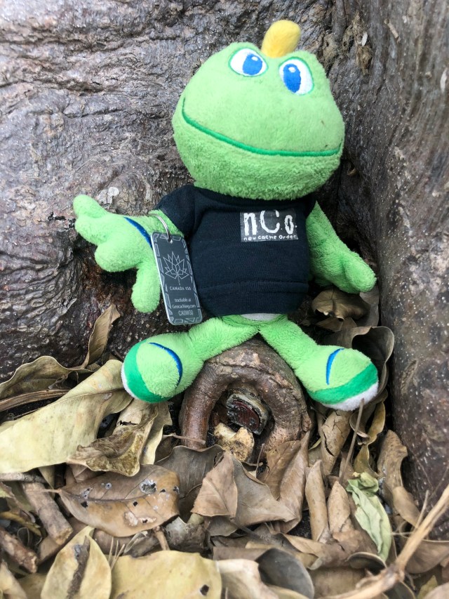
She then returned to the room while I continued on for additional caches. Most of the caches near the hotel were micros – very small geocaches that only have room for a log sheet. I had brought with me a travel bug that I recently picked up while hiking. It’s goal was to travel to Orlando, FL, so I wanted to drop it off in Fort Lauderdale, getting it close to its goal.
I had identified two caches in the general area that would be big enough to leave a travel bug. The first was a cache I had found in January 2013. Wow. It is hard to believe that those were the dark days when I was geocaching alone. I didn’t know any other geocachers back then other than the young Czech boy who had first told me about the game, but he lived thousands of miles away. Now I am part of a wonderful geocaching family called New Cache Order, and have geocaching friends at home and around the globe.
At any rate, the geocache that I had found in 2013 was 2.5 miles from the hotel we were staying in this trip, so I decided to hoof it to one a little closer. This second option was a little over one mile as the crow flies. This was to be an easy hike as far as terrain. After all, Florida is very flat!
The late afternoon weather was partly cloudy and a warm 75°. This was a welcome change from all of the rain we have had at home, and the cooler temps that we were experiencing before we left. The humidity was somewhat high so I quickly worked up a sweat despite the gentle breeze.
I began walking in the direction of the park where the cache I wanted to find was located. I had noticed there was a cache with over 20 favorite points on the way, so stopped to look for it.
This was a micro cache, so I knew I was looking for something very small. In fact, the hint said that it would be a suitable home for an inch high samurai. The coordinates took me to a tree next to the sidewalk.
I circled the tree a couple of times, looking high and low. Other cachers had mentioned a “door” in their logs, so I looked for something that looked a little out of place. The hint had also said to watch out for ants. I learned what that meant when I was digging the leaves and poking at holes in the tree. A swarm of angry ants appeared, crawling all over the trunk of the tree, its roots, and the surrounding ground. Fortunately, I saw them quickly enough to step away so none of them crawled on or bit me.
On about the third circuit around the tree I finally spotted the tiny door. It no longer closed properly, so was partially hidden by the small rock that was propped against it to secure it. Inside was a log sheet. I signed it, took several pictures, replaced everything as found, and continued on my way.
I was using the satellite view on my phone’s map to navigate toward the park that the larger cache was hidden in. My plan was to walk south a few blocks and then make my way west to the park. As I neared the point where I would need to start heading west, I started looking for side streets that would take me in that direction. I could tell from the map that I was nearing a major highway, and wanted to avoid having to walk along it.
As I walked, I could see that the side streets and parking lots were very short, and were dead ends. The map appeared to have some sort of path running parallel to the highway, so I continued walking until the elevated highway was right in front of me, and turned to follow what turned out to be a dirt road. It led me a short distance and stopped next to several sets of railroad tracks. I could see a street across the tracks that I could follow toward the park, but I heard a train whistle and stayed put for a few minutes.

A commuter train soon sped by. Once the tracks were clear, I crossed them and stepped over a guardrail separating the tracks from the street. I crossed the street, and walked along the wide shoulder in the shadow of the elevated highway. By this time I had already walked a mile and was still .6 from the cache. As I was walking along I spotted something interesting on the ground and stopped to pick it up. It was a metal Velamints tin and will make a nice cache container. I stuck it in my pocket and continued on.

I finally reached the park, turned up a side street, and walked through the entrance. To the left was a large fenced area for off-leash dog play. One of the humans inside was throwing a tennis ball and several large dogs would race after it. I thought of my pups back home and wished that they could be there with me.
I followed the park road to a picnic pavilion. The geocache I was looking for was hidden near it in a hollow tree. I found what I felt was the correct tree, and looked in and all around it with no success. I read previous online logs and looked at photos to see if I could find more hints there. I decided to check another set of trees, but still had no luck finding the cache, so I went back to the original tree. This was definitely where the coordinates indicated the cache was hidden. I looked more, and deep inside was able to see a string tied to a piece of wood. Some of the photos I had seen had a string that looked like this attached to the handle of the cache, and the owner’s maintenance logs referred to it.
After searching for several more minutes I decided the cache was missing and gave up. Deban had called to see if I had found it and when I might be back to the hotel, so I decided to start the long walk back and skip looking for the other two caches in the park. They would have taken me a long distance from the entrance, adding to my walk and time.
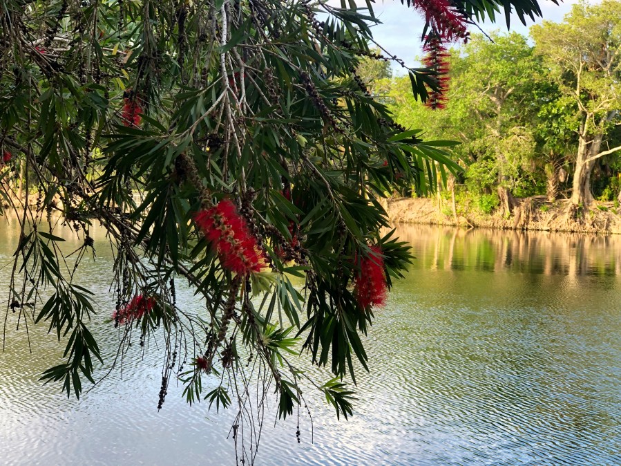
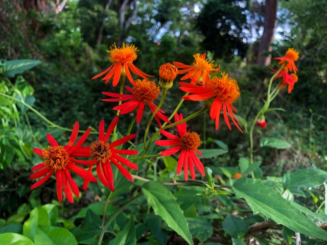
I paused to take photos of some of the interesting trees and some beautiful flowers and then started my journey back to the hotel.

As I was walking back toward the entrance, I noticed that one of the small lakes had a fenced off section that was a dog swim area. Our Andy would really love that! I went inside and was greeted by a friendly corgi. I asked his owner if he liked to swim and he said he basically just stood in the water.
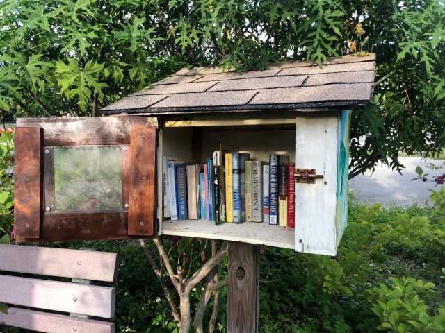
I also stopped to see a butterfly garden before leaving the park. Inside it I found a bench next to a little library. I wished I could spend more time exploring all the park had to offer. It seemed to be a very nice and popular place, even on a weekday afternoon.
I took an alternate route back toward the hotel, using Google Maps to guide me. This ensured that I was following streets with sidewalks rather than having to cross railroad tracks, jump guard rails and walk on gravel shoulders. I stopped along the way at a convenience store to buy a bottle of water and a diet dr. pepper. I finished the water in less than a block, and started on the dr. pepper, drinking it a little more slowly.
Along the way I passed a diner called Lester’s. Since that is Chip’s birth name, it seemed appropriate to find a diner named for him in his city of birth.

I also stopped to log one last geocache that was a couple of blocks from the hotel. It was a tiny bison tube attached to the bottom of a stop sign pole in a way that it was just lying on the ground in plain sight.
When I arrived back at the hotel it was nearly time for us to eat supper. After I had cooled off a bit, we went back down to the hotel restaurant to eat. Florida hikes may be easy terrain, but they sure do make you sweat!
