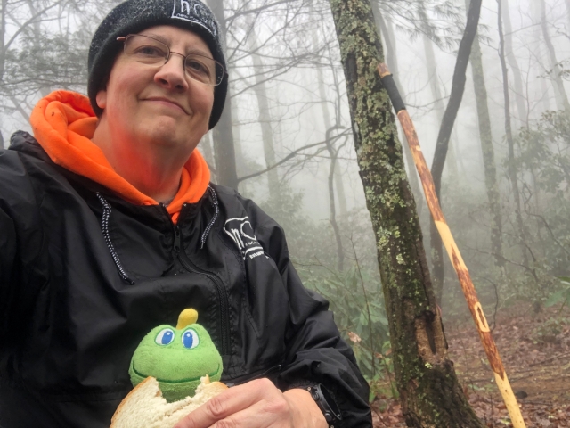
Appalachian Trail ~ Unicoi County, TN/Mitchell County, NC
- 5.69 miles
- 4:21 duration
- 1,449 elevation gain
- 34° F min/39° F max
- 5 geocaches found during hike
- 2 geocaches found after hike
- 2 geocaches visited (that I own)
The Appalachian Trail (AT) is a world-famous 2,200 mile long trail reaching from Springer Mountain, Georgia to Mount Katahdin, Maine. The trail began as an idea of forester Benton MacKaye in 1921 and was completed in 1937. Over the years it has continued to be improved and in some areas rerouted, but is still a popular destination for hikers. Thru-hikers are those who hike the entire trail from beginning to end. Section-hikers will hike segments of the trail, leaving it from time to time to jump to another section but eventually completing the entire trail. And then, there are recreational hikers like me who will just do a small section occasionally.
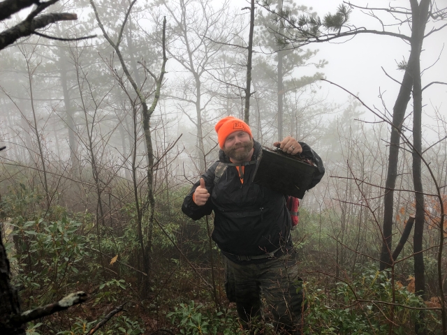
LakeBum (Rob) had identified a handful of geocaches along the AT that we could reach from Indian Grave Gap along Rock Creek Road in Unicoi County, TN. We decided to brave the elements on a morning that was forecast to have a 10% to 20% chance of rain and temps in the 30s and 40s. The forecast for Sunday was for even more rain, so this was our best opportunity to hike this weekend.
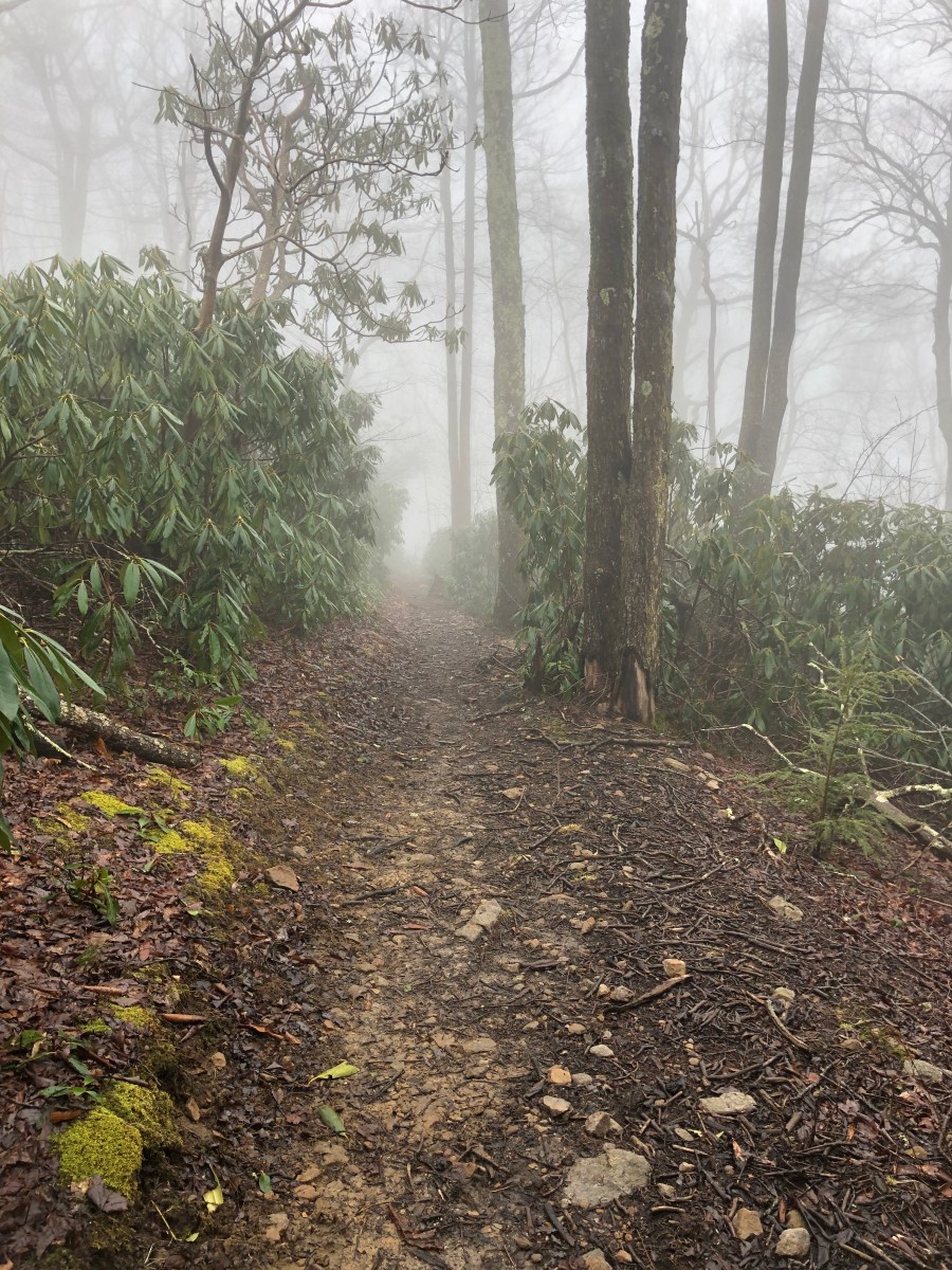
As we drove up the mountain from Erwin, TN, fog began to overtake us and the road. By the time we had reached the Indian Grave Gap parking lot at the top of the mountain, visibility was about 50 feet. Despite the thick fog, there was no rain falling, which made us very happy. I put on my rain jacket anyway, since there was so much dampness in the air. I was also wearing my Singbring pants that repel water and are fleece lined.
The Appalachian Trail crosses the road at this point, and so does the border between Tennessee and North Carolina. We began our journey by hiking south on the trail toward Beauty Spot. There was one cache .25 mile in this direction that we wanted to find.
Despite the fact that the parking area is at the highest point along the road, we had to climb about 100 feet in elevation to reach the cache. The name of the cache is Blowdown Ridge, and when we neared the cache location we could see the reason for this name. As the cache page states, “Blowdown is a slang term used by hikers, hunters, mountaineers, rangers, and other outdoors people (including geocachers) to describe a tree knocked over by the wind. The term is often used where the fallen tree (or trees) has become an obstruction to travel.” As we left the trail to search for the cache, we encountered a good bit of “blowdown” that we had to maneuver around and over.
The trail in this area closely follows the state border and this first cache was on the North Carolina side. We carefully made our way through the blowdown until we reached the point where our phones indicated the cache was hidden. We looked around for a spot that matched the hint, and made our way there to search. Not finding the cache, we spread out in different directions to look in other areas. I made my way back up the slope we had descended and spotted another place that matched the hint. As I got close, I saw the cache and gave a shout to let Rob know I had found it. We had actually walked right past it on our way to the first location we searched.
This cache was a favorite type for me – a metal ammo can. These containers hold up very well in the elements, and despite being over 10 years old this one was still in great condition – air tight and dry inside. Rob took the travel bug that was inside and both of us left travel bugs there. I had picked up the one I left during my trip to Maryland in December.
Because a fire had burned this area of forest several years ago, there are few big trees in the area. Most of the vegetation is low to the ground, with the taller trees being young and slender. I can imagine that the views looking into North Carolina from this point are beautiful. However, today we could see only a white blanket of fog. We could hear running water below us, and I surmised that it was Rock Creek. However, when looking at the map later I determined that it was Shinbone Creek.
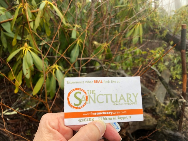
Rob had been looking through some of the items in the cache, and as he dropped them back in, a familiar looking logo caught my eye. I fished out the card that he had dropped in, and saw that I was right. It was for The Sanctuary, a congregation that uses the building I manage and where my office is located. The card was old, having a former address on it, but the logo, phone number and the web address have stayed the same. I wondered who had left it there, whether they are still members of that congregation, and if they are still geocaching.
After we had signed the log book and replaced the cache, we made our way back to the trail, and followed it back to the parking area. We then crossed the road, climbed a few steps, and followed the trail north in search of more caches.
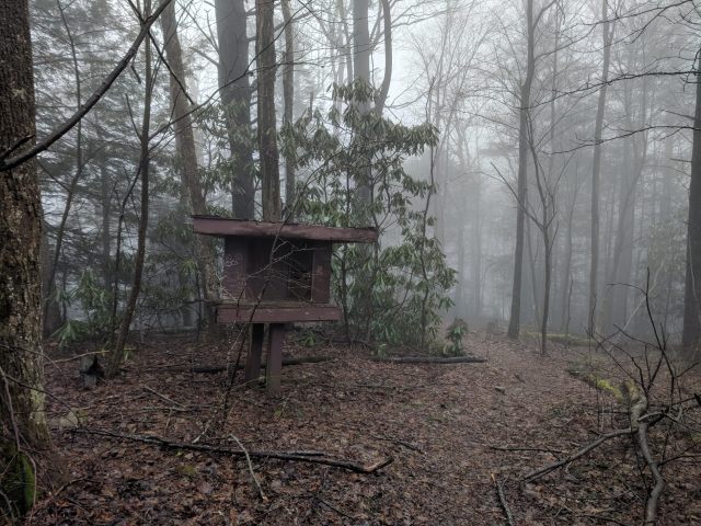
The first was at an old wooden kiosk standing beside the trail. We searched the general vicinity for the cache. Twice I picked up a rock at the base of the kiosk thinking it might be under there. Sometimes I am slow to learn the error of my ways. Finally, I reached into a place that Rob had already checked, and felt something move. Behind it was the cache. Once more we signed the log, and I left behind a travel bug that I had picked up in Delaware. We then began hiking along the trail toward the next cache.
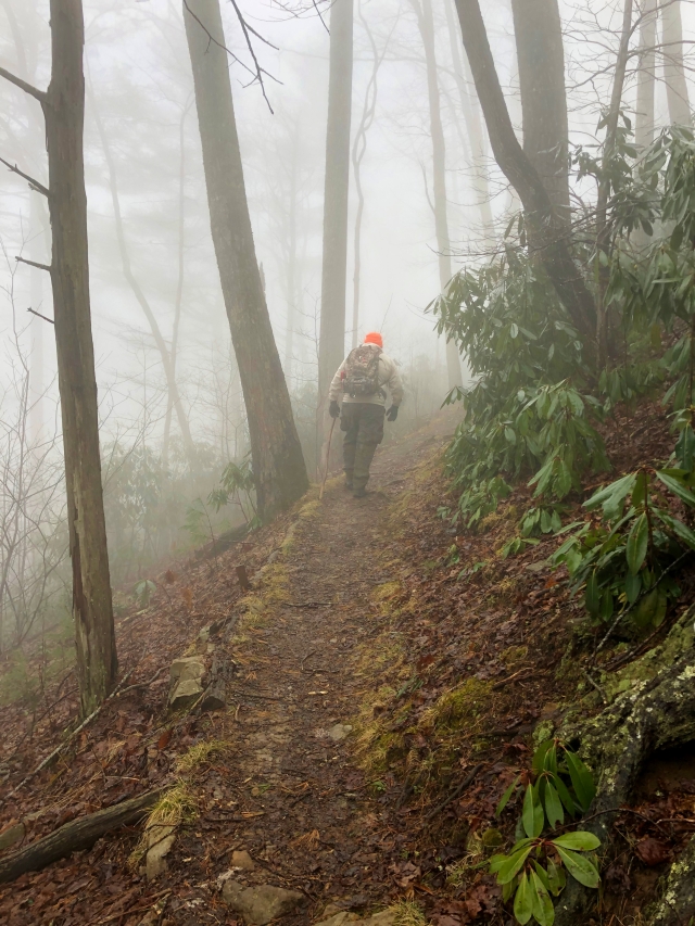
We had only gone a short distance when we met another hiker coming from the opposite direction. He was a young man with a full backpack and looked as if he were a long distance hiker. Rob was in front of me at the time, and greeted the man. The man sort of nodded to acknowledge the greeting, but said nothing and kept hiking.
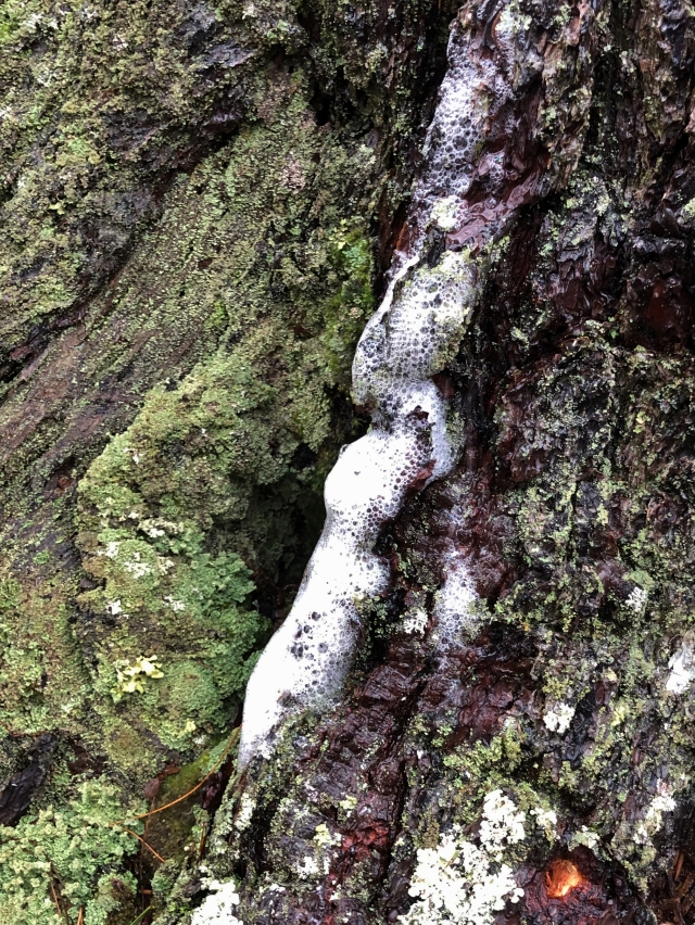
Further along the trail we noticed a tree that had foam near the base. Water was dripping along the trunk of the tree, and in the area where it landed, a white, bubbly foam had formed. We decided the tree must have rabies and that we should move away rapidly. Okay, we were just joking about the rabies part, but still curious as to what caused the foam.
Doing research later, I found the following information on the website wonderofeverydaynature.com: Foam forms on the trunks of trees in heavy rains because of chemical interactions similar to those that occur when you make soap. That is, it’s like a simple soap made in nature. On pine trees, foam forms because some of the chemicals found in pine sap are soap-like. On other trees, sometimes foam is formed from a chemical process that is created by the combination of air pollutants and plant materials. The air pollutants land on trees during dry periods and build up. During rains, they interact chemically, forming a soap and run down the trunks, foaming as it hits bumps in the bark.
This seemed like a good explanation for what we saw, and a much better than the other alternative explanation – a disease called Slime Flux. This is a bacterial disease caused by damage to the bark, in which the foam is accompanied by a foul odor. Since we didn’t notice an odor, I believe the first explanation is accurate.
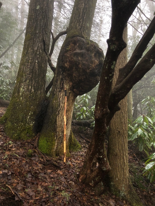
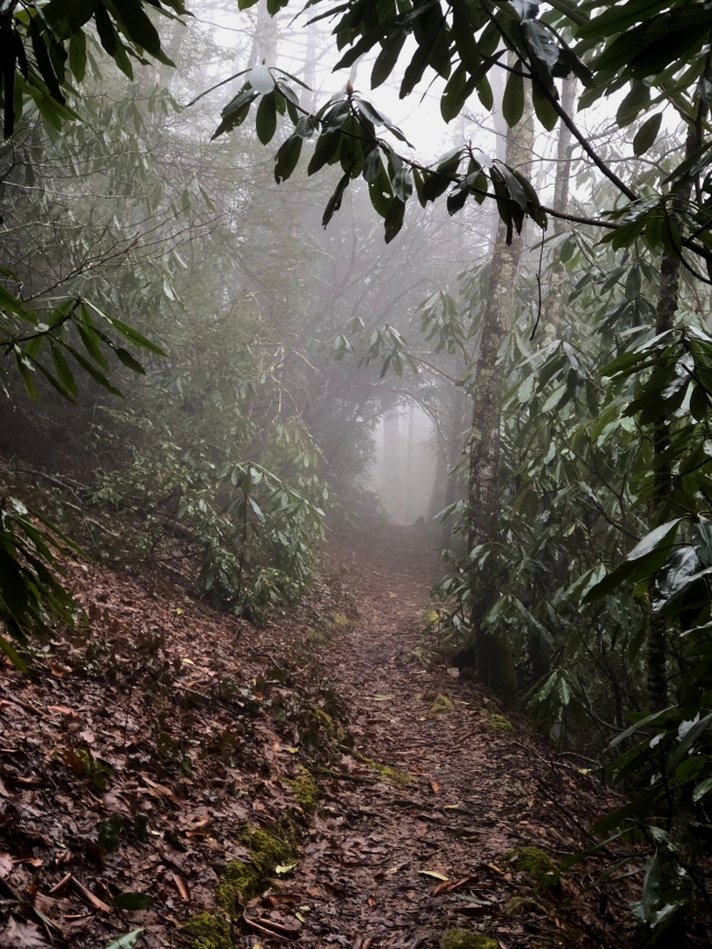
We also saw a tree that had a huge burl on it – a growth that is caused by stress to the tree such as an injury, fungus or virus. I took a photo of it, but then decided that it did not adequately show the size of the burl. I climbed up the bank to lean my hiking stick against the tree under the burl, retreated to take a photo, and then retrieved my stick. By the time I had done all of this, Rob was far ahead of me on the trail and I had to rush to catch up. I did pause first to take another photo – this time of the natural tunnel that the trail goes through, formed by the thick vegetation. It was an eerie sight with the fog.
We found our next cache at about the one mile mark of our hike. It was a short distance off trail on the downhill side, and I spotted it easily at the base of a hemlock tree. Rob and I both dropped off travel bugs here, signed the log, and then made our way back up to the trail to continue our journey.
To this point and for the next half mile we had a very gentle climb for the most part. Then, the trail turned due north and began to slope downward. Over the next .60 mile the elevation dropped 300 feet. It was very rocky in places, causing me to slow my pace and be very careful of my footing. I also encountered several slippery roots, which when stepped on can send your foot sliding out from under you. I commented as I nearly always do that hiking downhill is hard for me since I wear trifocals and because I do not feel as secure in my footing as when going uphill. As he nearly always does, Rob agreed that he didn’t like the downhill parts because it is hard on his knees. It is a good thing we don’t get tired of hearing the same thing from each other every time we hike.
We finally came to within .10 mile of the next cache, with our phone compasses pointing off to the right of the trail. There was a level, cleared area here with a fire ring that is apparently used for camping. I suggested heading across it toward the geocache, but Rob felt it would be better to continue down the trail to see if we could get closer to it. We descended the trail until we came to a switchback. There was also a trail leading in the direction of the cache from this point, so we began following it. We climbed up, up and up until we reached the top of the ridge. We were still several hundred feet from the cache at this point, but on the other side of it. We began making our way in that direction, weaving through thick blueberry bushes along what appeared to be game trails. It was like a huge maze. We would walk several feet, and have to veer off in another direction. The vegetation was wet, so our legs were soon soaked. Fortunately, since my pants are water-resistant, that wetness did not penetrate to my legs.
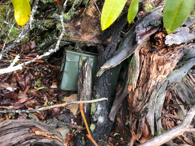
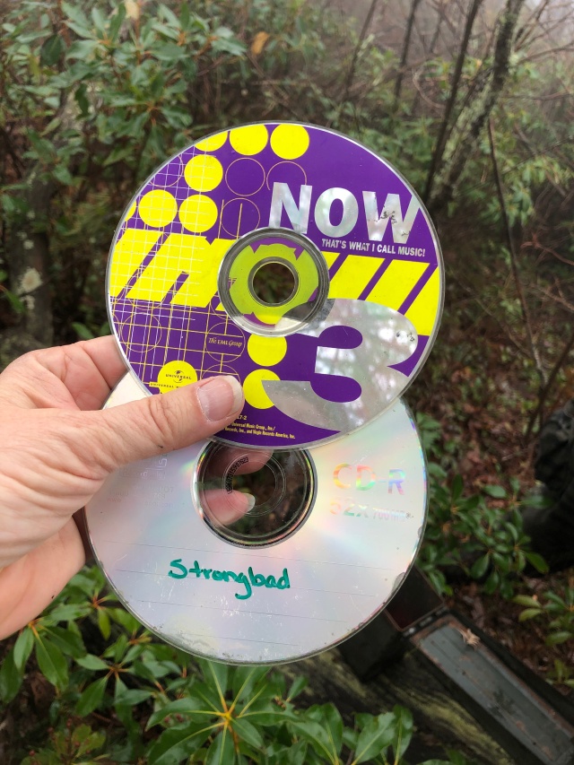
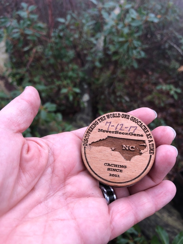
Finally, we got within 30 or so feet of the cache and started searching. I was off in one direction looking when I heard Rob call out that he had found it. I made my way over and found him holding another old ammo can.
Inside the cache was some swag popular in the early days of geocaching – music CDs. There was also a cool wooden coin left behind by a geocacher whose name I have seen on many logs, but whom I have never met – NeverSeenGene. He has indicated in logs that he is in his 70s, so the fact that he still hikes to find caches like this one gives me hope for my future.
When we had finished with the cache, we had a decision to make. What route would we take to return to the trail? We both agreed that we didn’t want to go back the way we had come. We pulled up the maps on our phones and decided to head in a southwesterly direction. This took us through more of the thick vegetation that we had battled through getting to the cache. We found ourselves going downhill again, following whatever game trails we could find through the maze of blueberry bushes. I was glad that it was blueberries, not blackberries, and that it wasn’t summer with even thicker vegetation, snakes, and mosquitos.
We finally broke through all of the vegetation to see what looked like a path leading back uphill. We checked the map again and could see that we had veered off track a bit, and decided to climb the hill on this path. It was very steep, but at least it was clear of vegetation. Eventually, we reached the top of the hill and found that we were back on the Appalachian Trail at the campsite that we had seen before going off trail to find the cache.
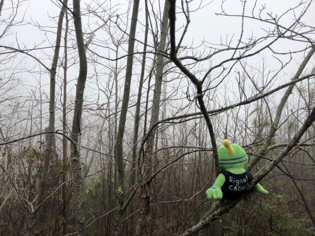
Since it was 12:02 by this time, we decided to sit here and eat our lunch. I shared my peanut butter and jelly sandwich with Signal. Fortunately, he doesn’t eat much because I was very hungry. We didn’t take too long to eat because it was a little chilly with our wet pants. We ate, packed everything back up, and hiked on toward the next cache.
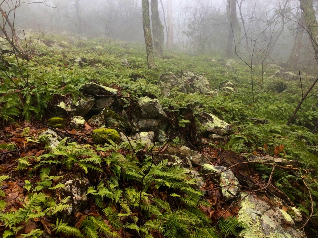
Although this cache was just about .35 mile away as the crow flies, we had to hike .7 mile to reach it by the trail. There were several places along the trail that I believe we would have had beautiful views, but the fog remained thick allowing us to see just a little way. We passed one area where the hillside above the trail was covered with beautiful ferns.
We finally reached a spot on the trail where our phones indicated we were within about 20 feet of the cache. There was a fallen tree stretching up the hillside above us, and we each climbed up on opposite sides of it. Rob reached the end of the tree first, and began digging in the leaves and dirt beneath the roots with his hiking stick. At first he said the cache wasn’t there, but then he changed his tune. As I approached, I could see him fishing out a long plastic container.
After we had signed the log and replaced the cache, we turned to hike back to the truck. It was downhill the first .40 mile, but then we began the long, slow climb to the gap. I remembered saying earlier in the day that up was easier for me. I certainly felt more secure in my footing and had an easier time seeing the trail, but it is definitely more tiring hiking up hill. I remarked that it was probably a good thing that we had hiked in the opposite direction first to find the one cache on the other side of the road, because we probably would not feel like adding that extra distance after making this long uphill climb. Rob agreed.
At one point I was growing quite warm despite the fact that it was still under 40°. I took off my warm cap and carried it for a little while. I noticed that Rob had done the same. I also tried hiking without my glasses for a short time because they were fogging up with the extreme temperature difference between my body and the air. That didn’t work very well and I soon put them back on.
As we neared the end of the trail, we passed a young man hiking toward us and said hello. He was friendlier than the other hiker we had met, and responded. After he had passed and we were a good distance from him, Rob stopped and said, “Did you…” I finished, “…notice is unusual choice in footwear?” He was wearing white socks and flip flops – not what you would expect to see on such a rugged mountain trail, especially in cold, wet weather. Rob said, “I’ve seen two people on the trail today and they were both weirdos.” I responded that I had seen three people. He realized I was referring to him, and said, “And they were ALL weirdos.”
We also talked about the possibilities of the first man we had seen who did not respond to our greeting. Rob thought that perhaps he was from another country and did not speak English. I suggested that maybe he had taken a vow of silence and was hiking the trail as part of a spiritual journey. I guess we will never know.
The 2.25 mile hike from the last cache back to the truck took us an hour and 15 minutes, which we felt was a good pace for so much uphill. After all of the climbing, it was tough to descend the steep steps back down to the road.
Arriving at the parking lot, we found another vehicle parked behind our truck with signs indicating it was a hiker shuttle. We assume it belonged to the fellow in socks and flip flops, and that perhaps he was looking for a hiker that he was supposed to pick up.
The fog continued to envelope the road until we were nearly to the bottom of the mountain. In Erwin we pulled into the parking lot of a barbecue restaurant we had noticed that morning. We wanted to investigate it for future visits. A woman was walking across the parking lot and quickly signaled to us that they were closed. I rolled down my window and asked if they had a menu we could look at. She replied that they hadn’t made one yet and that they hoped to be open in a couple of months. We took a few photos and moved on, making a mental note to check back next time we are in the area.
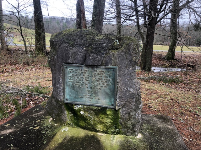
We stopped to log a couple of caches as we left Erwin. One provided me with an interesting piece of history that I didn’t know. Governor John Sevier was arrested for treason nearby in 1788 for supporting the State of Franklin. The cache is hidden near a monument that tells about this historical moment.
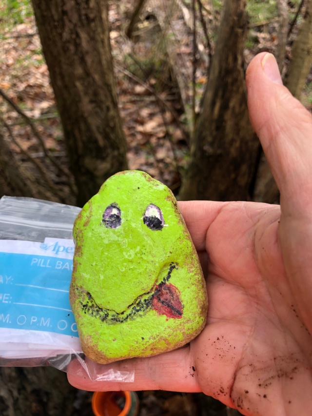
There was a cute piece of swag inside the cache. Someone had used the natural contours of a rock to paint an interesting face on it. I liked it, but left it behind for a future cacher to find.
We made a detour on the drive home to visit The Laurels, a park that I had never heard of that Rob remembered visiting as a child. There were caches there that he wanted to log. Unfortunately, when we arrived we found the gate closed, so decided to visit another day.
As we drove through Johnson City, we stopped off so that Rob could log two of the caches I had hidden in 2013. I worked nearby back then, and could keep an eye on them but had not been by to check them for quite some time. Rob found the first one quickly and said it was in good shape. I waited for him in the truck.
The second was hidden along a little used road leading up to Tannery Knob. It had not been found since 2016. We found that the road is currently closed for reconstruction, so parked at the bottom and walked up. The tree where the cache had been hidden was still there, but the cache was gone. I gave Rob the option to log it since he had walked up the hill with me to check, and have since archived it. I may hide another there after the new road is finished, or may leave the space open for someone else.
We arrived back at my house about seven hours after leaving, tired but happy for the chance to log some more smilies.

Shame about the fog on your hike but reckon it all added to the eeriness of the trail. Interesting to read about the foam. When I saw the photo, I didn’t expect to see so much. Like you, often find it more difficult going downhill but for the same reason as LakeBum – very tough on the knees. Now to get back to my blog. Happy caching to you and LakeBum.
You are amazing, antbedy! This was awesome. You could have been a writer. I sure am blessed to be who I am in relation to who you are. I look forward to reading another entry soon. As you can tell I’m always behind in getting things done, but you already know that about me!
Thanks, Brother. I love hiking, I love writing, and I love YOU!