White Creek Falls – Lee County, VA
- .6 mile hike/.5 mile walk
- 1:38 duration (hike)
- 760 ft elevation gain (hike)
- 1 traditional cache found on hike
- 2 DNFs (did not find) on walk
- 10 traditional caches found after hike
- 1 EarthCache found after hike
- 1 geocache hidden
On January 1, my friend tncorgi (Mary) visited a state park in Lee County, VA to hike and geocache. While in the area, she checked to see what other geocaches were nearby. She noticed that there was a cache hidden by DMflyer (Dennis) that had not been found in four years and eight months.
After her hike, Mary and her dog, Bane, went to the trailhead to do some reconnaissance. She followed the trail a short distance, but turned back when she came to a creek crossing. With a leashed dog and no hiking stick, she did not want to attempt the crossing. She spent some time picking up trash in the parking area because it appeared someone had rung in the new year there the night before.
She sent a message to our geocaching group, asking if anyone was interested in attempting a resurrection of the cache during the weekend. I was definitely interested! Especially when I looked at the cache page and saw that it was hidden at a waterfall.
On Sunday morning, Mary, LakeBum (Rob) and I headed to Lee County, Virginia to search for the lonely cache. Mary had contacted Dennis ahead of time and received his permission to replace the cache if it was missing. I had prepared a container to carry with us just in case.
When we arrived at the parking area at 11:00 am it was a moderate 46°. We were on a rugged, one-lane forest road. There was no signage to mark the trail head, but our route was obvious. We quickly grabbed our gear out of the truck, and headed up a wide trail that was probably a fire road in the past.
After a little more than .10 mile we came to the stream crossing that Mary had seen on her previous trip. Rob had worn his waterproof socks and water shoes, so stopped to tie up his pants legs. He then proceeded to wade through the shallow creek while Mary and I rock-hopped across.
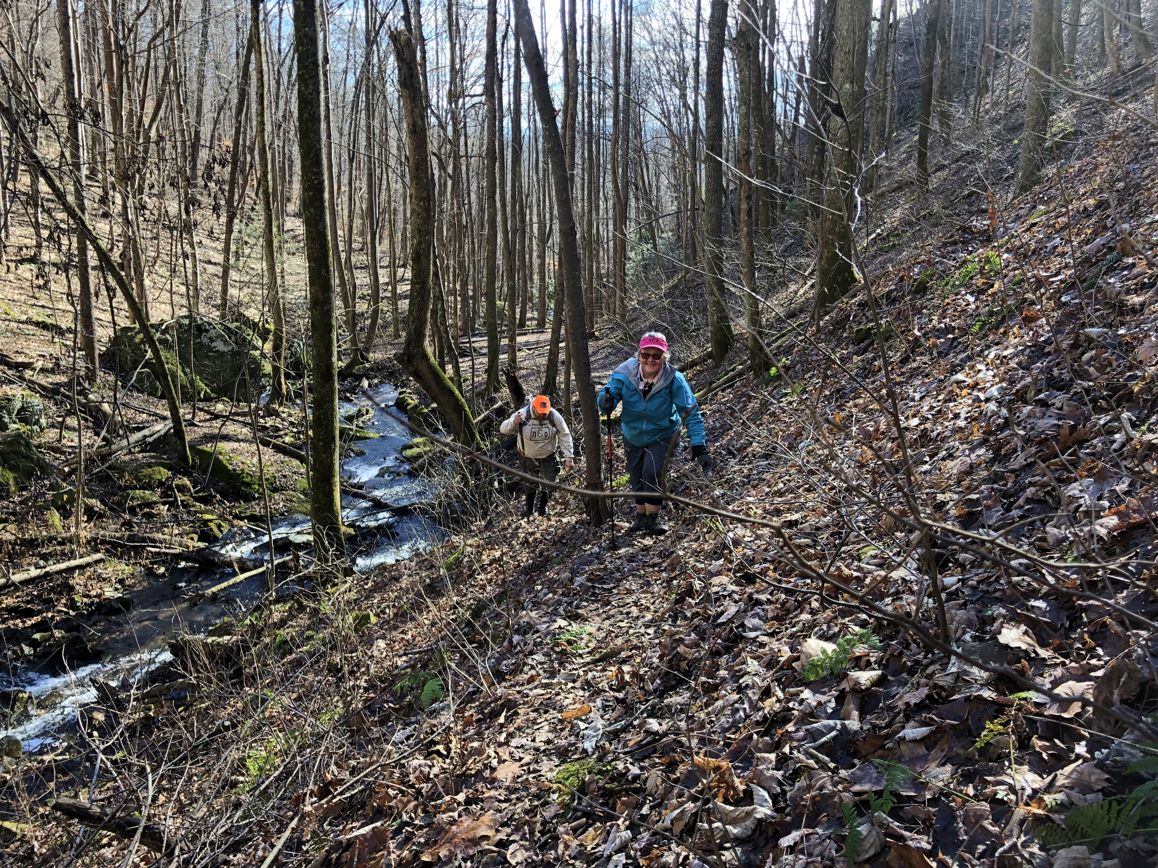
The path then became more narrow and steep as we began following the stream up the mountainside. In some places the trail was very faint. A heavy carpet of wet leaves made the path slippery.
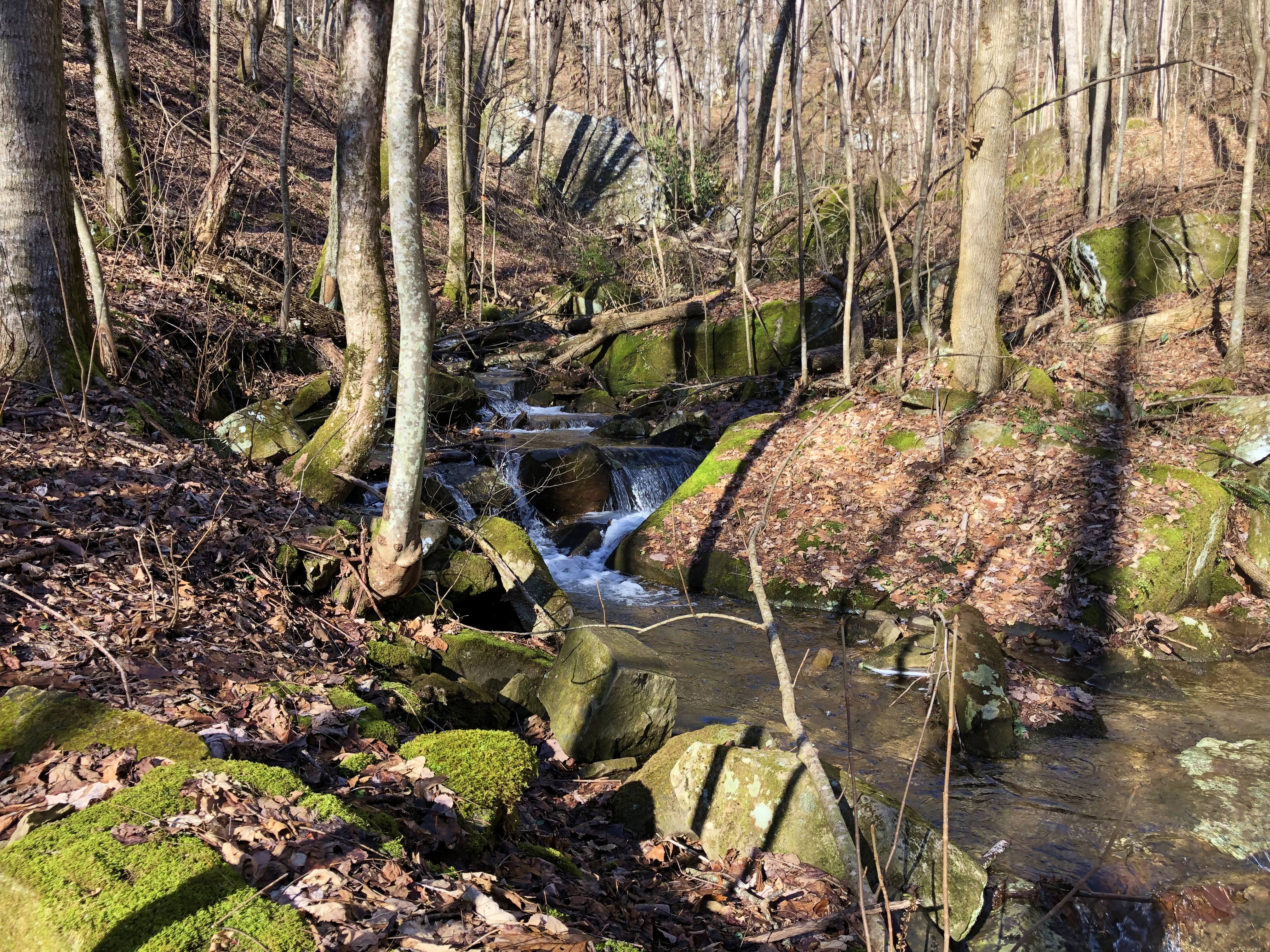
We were still several hundred feet away when we caught our first glimpse of the waterfall high above us. It became a beacon for us to follow, but the stream next to us also vied for our attention. There were numerous cascades and small waterfalls along the way, and large rocks that beckoned for us to climb up for a better view of the stream. At one point I could see three separate streams that came down the mountain from different directions.
At one point the trail seemed to disappear altogether when we reached a large boulder. Mary took a low route around it while Rob and I climbed a steep, slippery hillside to circle above it. As hard as it was going up the hill, I found myself dreading the trip back down. I decided it would likely involve some professional butt-sliding.
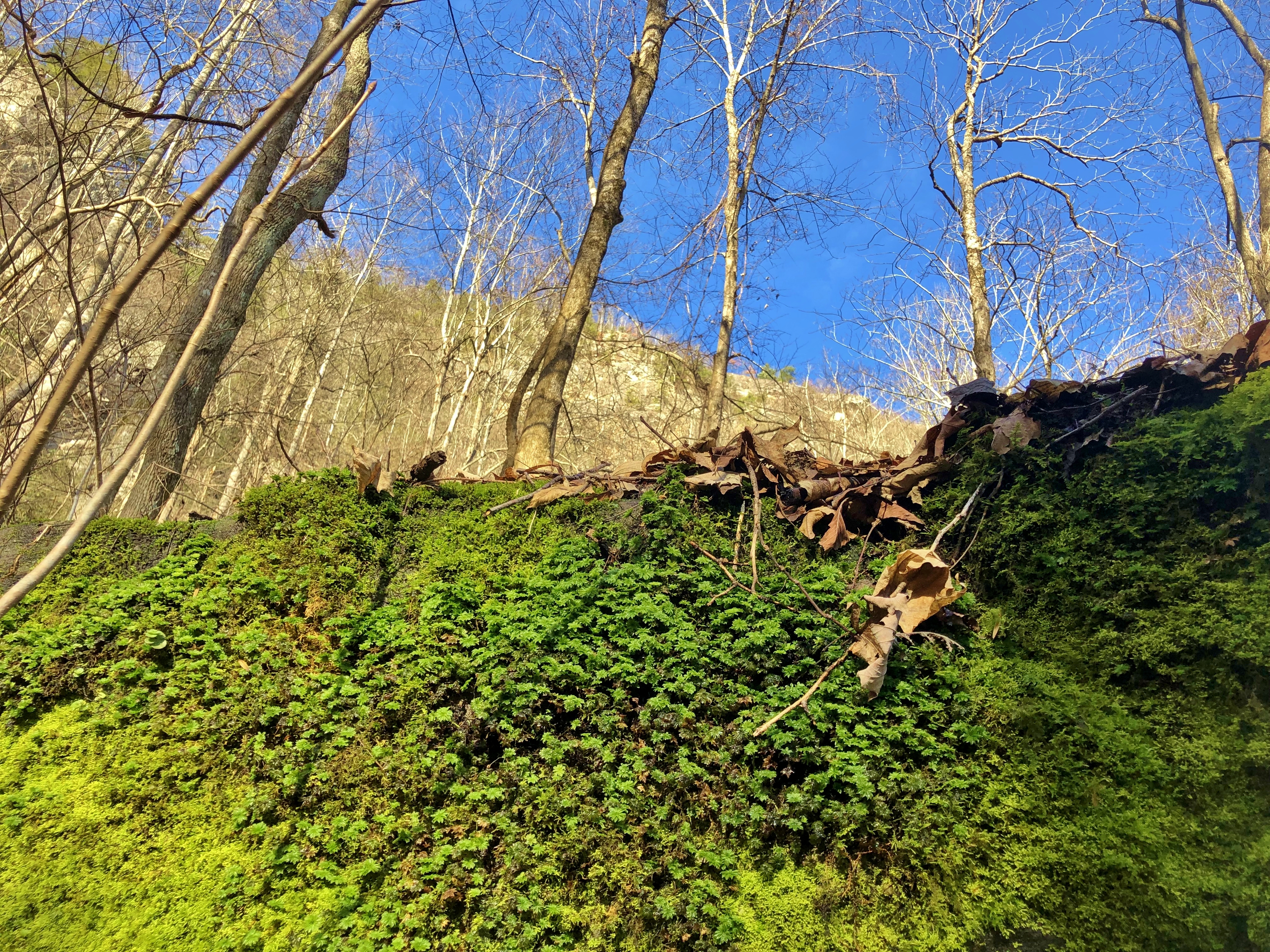
The sky above the trees was a brilliant blue. As I passed a huge rock covered in bright green moss, I couldn’t resist stopping to take a photo of the colorful scene.
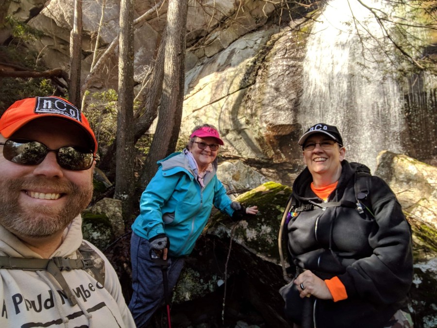
Finally, we rounded a huge boulder and the waterfall was just above us. We climbed the last several feet and paused to enjoy the beautiful view. Most of the photos that we had seen of the falls did not compare to the amount of water flowing over the cliff today. This is a free falling waterfall of at least 30 feet. With the heavy flow, there was a lot of spray to be felt near the base of the falls.
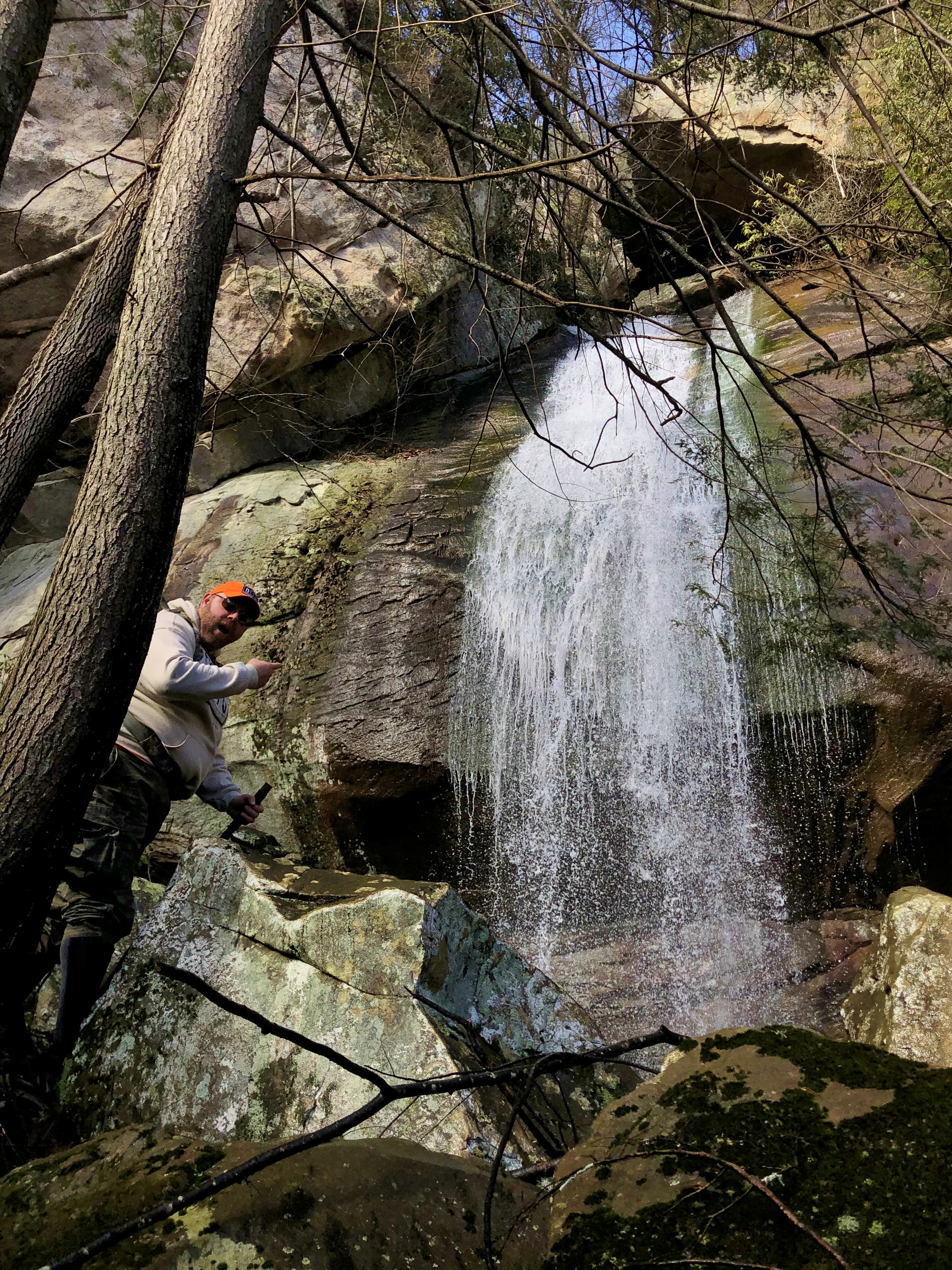
After taking a few photos, Rob and I climbed higher along a rock field to the left of the falls in search of the cache. With the towering cliffs above us, the GPS signal was weak and our phone compasses could not decide which direction we should go. The hint mentioned a crack in the rock, and we poked around in every crack we saw with no success. Eventually, we went back down to the base of the falls to talk with Mary and reevaluate the situation.

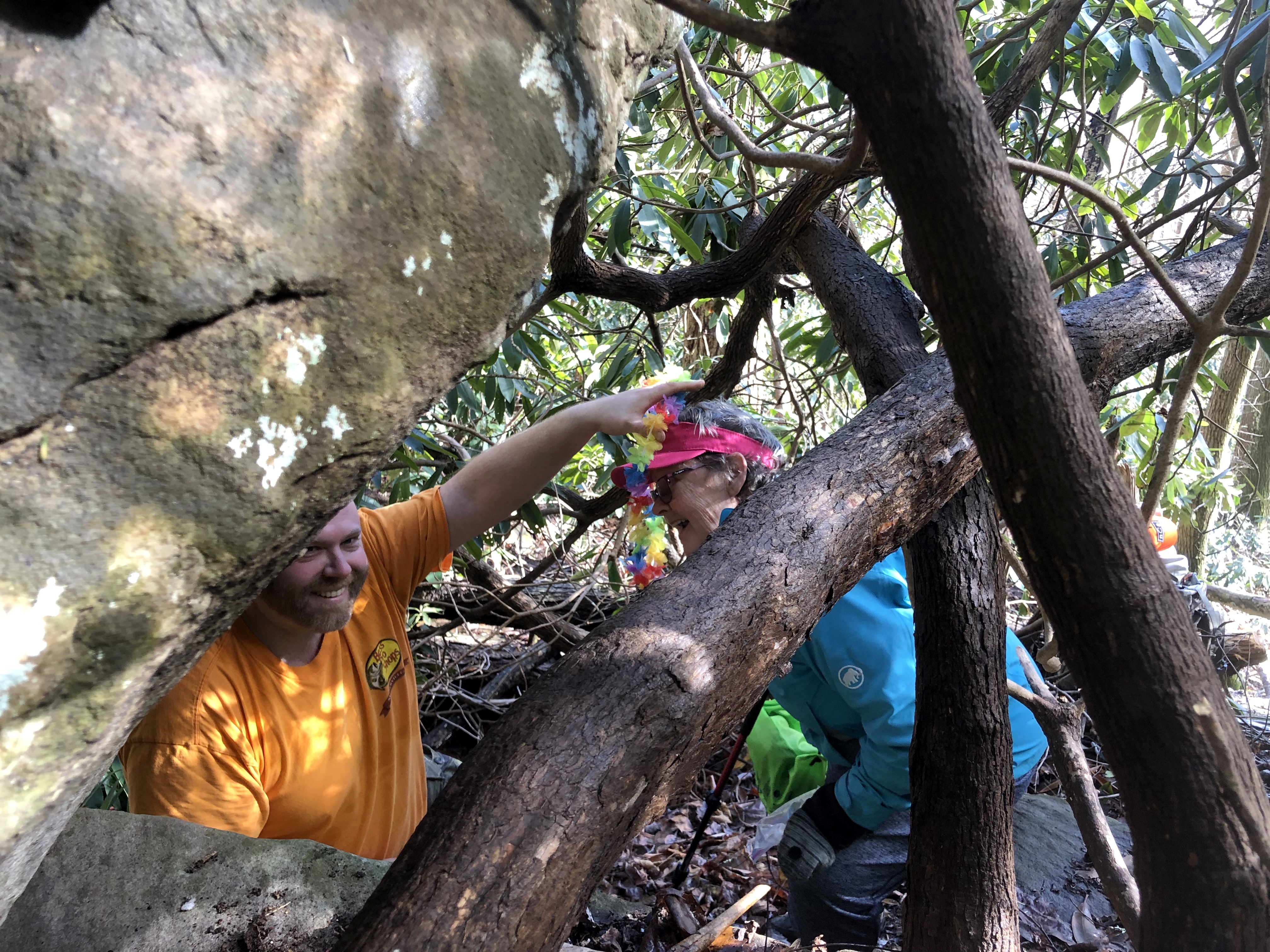
Dennis had posted a spoiler pic on the cache page, and in looking at it, Rob saw a spot that looked similar. Of course, nature can make a lot of changes over the years. Since it had been nine years since the cache was hidden, things looked a little different. We all made our way to the large rock that Rob identified, and began searching around it. I had approached from a different direction than Mary and Rob, and searched the back side of the rock as they searched the front.
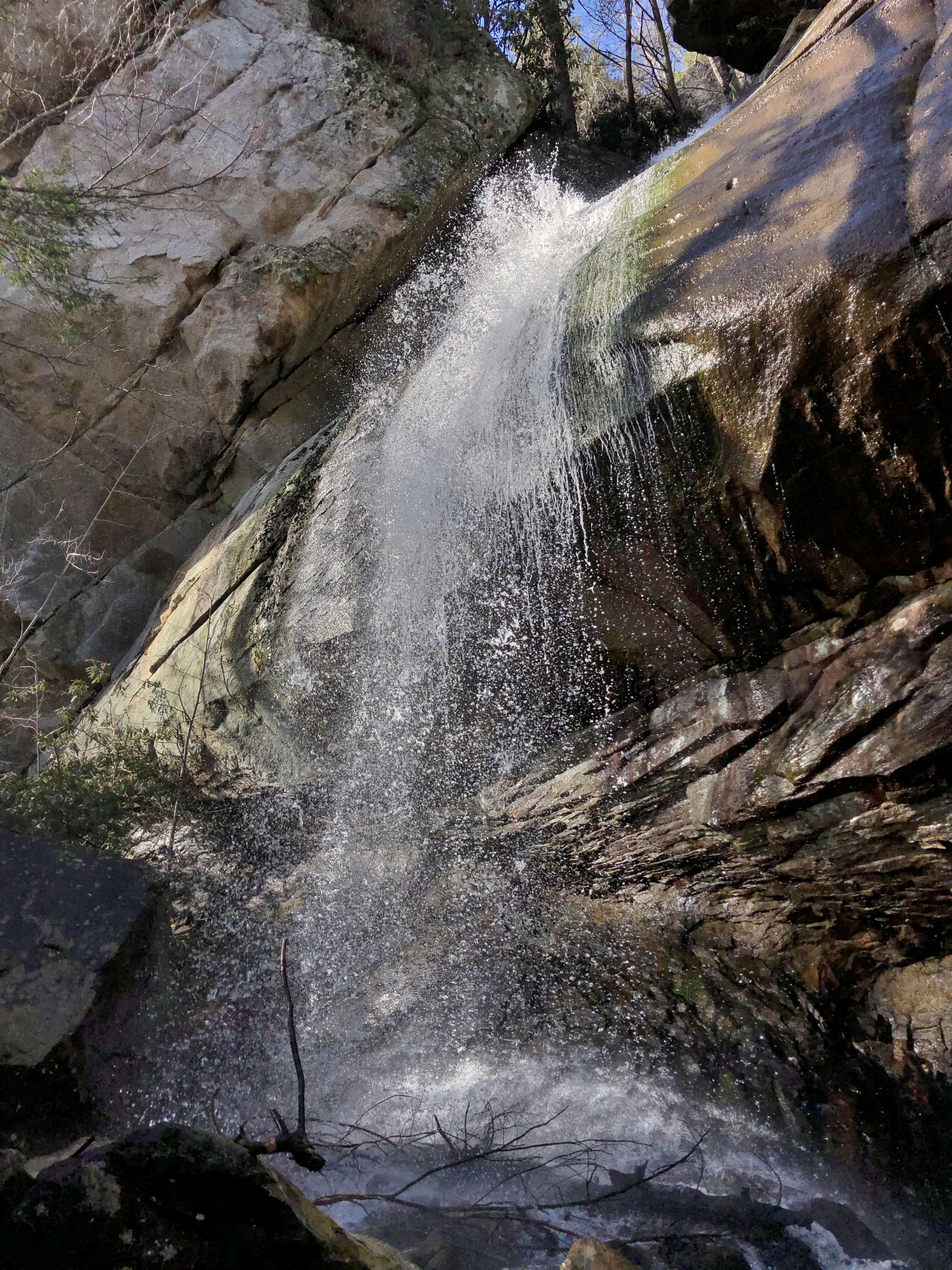
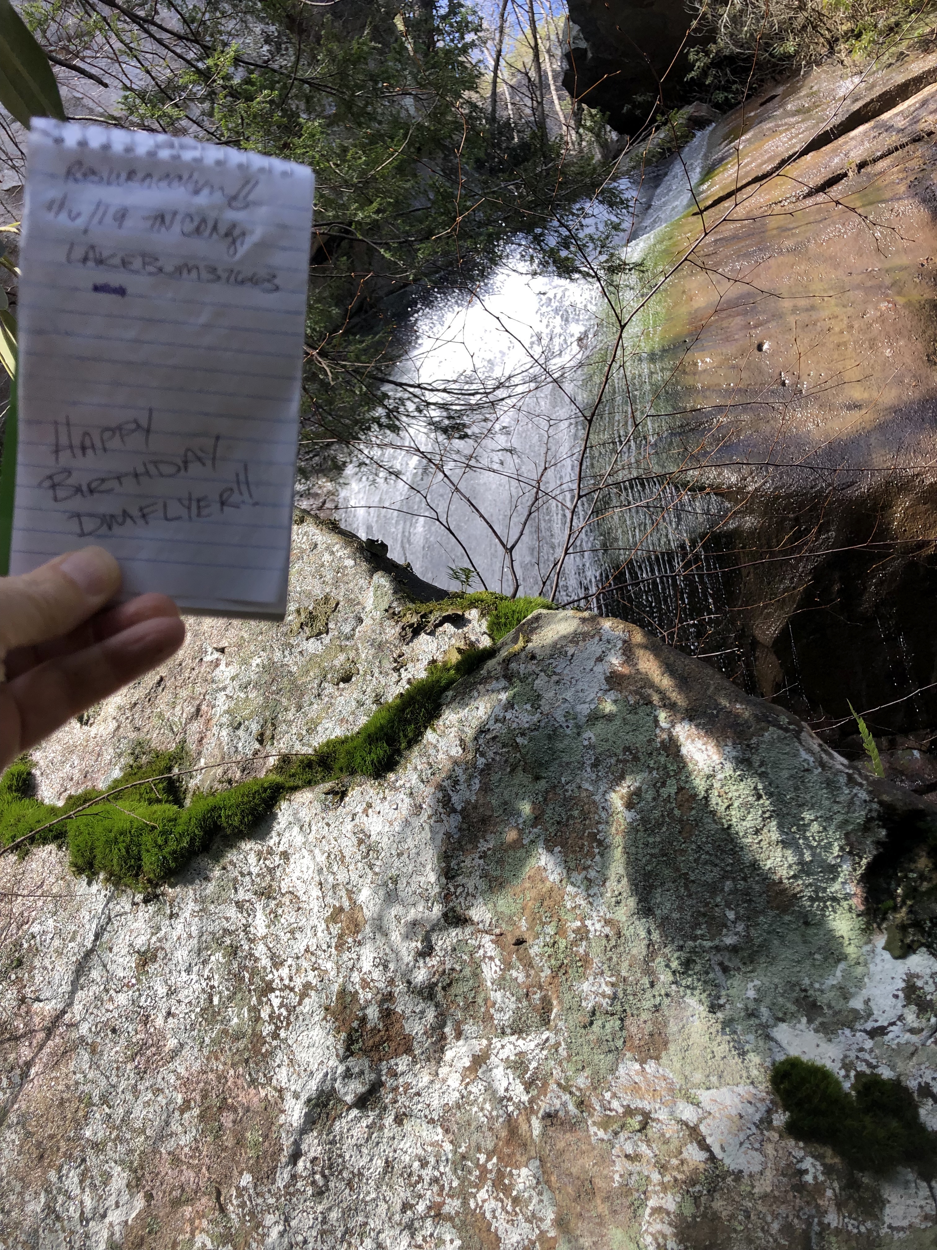
We still did not find anything, so I paused to take some photos of the falls from this new perspective and then started making my way back around the rock. Mary was poking in a crevice with her stick but could not reach all the way in from her position. I poked my stick in and heard that beautiful “clunk” of stick hitting metal ammo can. We scraped away a few leaves, moved a rock , and there it was! The can was in perfect condition despite having not been found in nearly five years. We posed for a photo with it and I recorded a video report for our friends back home.
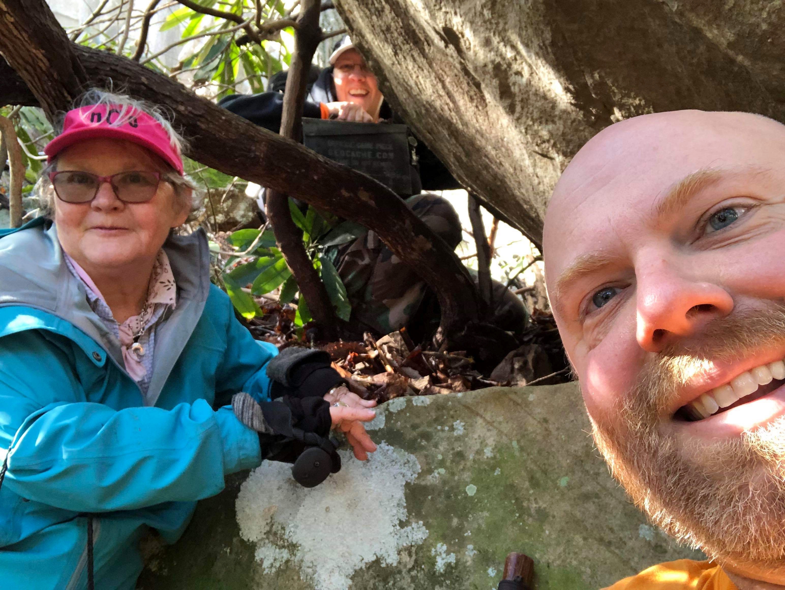
Rob opened the container and found everything nice and dry inside. He pulled out a lei and offered it to Mary, then handed Mary the log book. She signed the log first, followed by Rob who added, “Happy Birthday DMflyer!!” to the page. I stamped my name and took a photo of our logs.
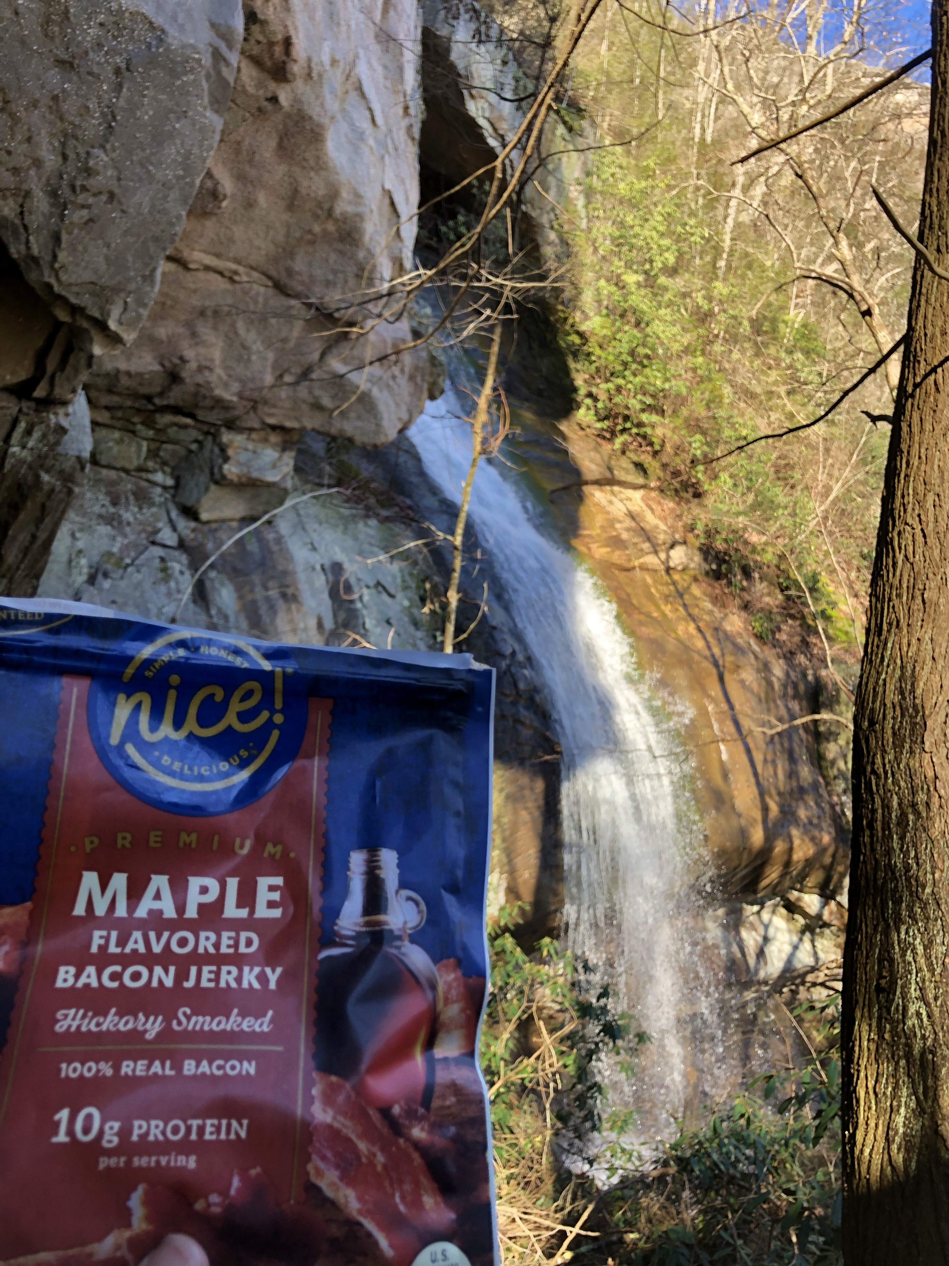
Once we had replaced the cache, we decided that it was time to eat some lunch, and that this was a beautiful place to do that. It was too damp at the base of the falls with all of the spray, so we climbed back up to the rock field to the left of the falls and found places to sit. I had brought with me one of my favorite hiking snacks, Nice! Premium Bacon Jerky. I got Rob hooked on this tasty treat during a hike last year. On this day, Mary tried it for the first time and vowed to stop and buy some on the way home. It’s that good!
While we ate, we discussed the fact that I had brought with me a replacement container in case we didn’t find the original cache. I decided to find a place to hide it as we made our way back down the trail. Mary finished her meal first, and since she was cold sitting still decided to head back down ahead of us. Rob and I finished eating, packed everything up, and followed close behind.
As I had anticipated, the way back down was slippery and we had to move slowly. I stopped along the way to take some more photos of another beautiful area of the creek. When I caught up to Mary and Rob, they were waiting at the bottom of the roughest part of the trail. Rob had already checked his phone, and saw that we were just far enough from the waterfall for me to hide the cache container I had brought. He and I took care of that, and then we all made our way back to the parking area.
Once there, we picked up to big garbage bags full of trash. I really don’t understand why people treat such beautiful settings as their own personal garbage dumps.
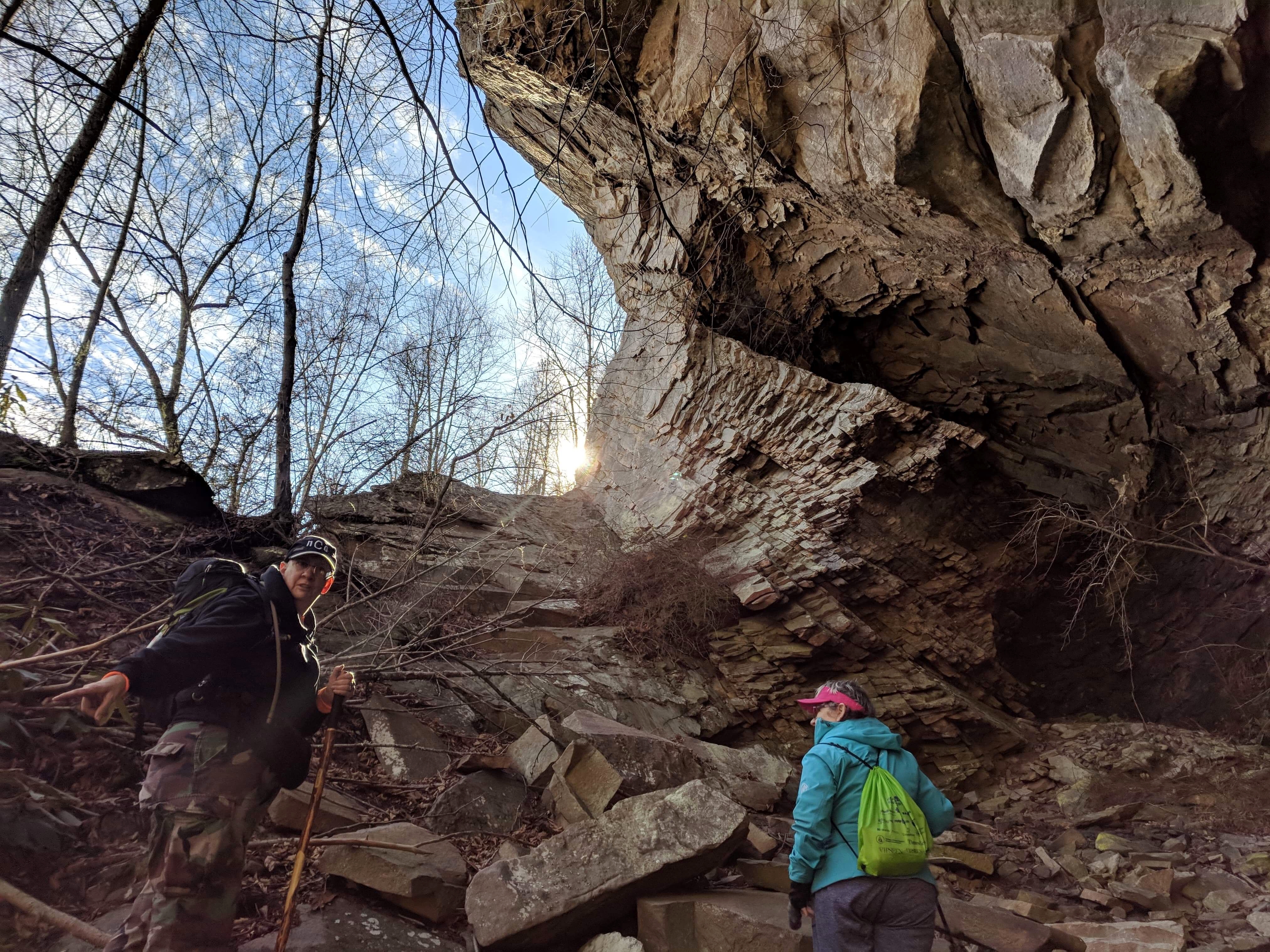
Since the day was young, we decided to hunt for additional caches in the area. We first drove to the Wilderness Road State Park where Mary had hiked on January 1. There were four geocaches there in a close proximity. Mary had found one of them during her visit, had looked for another without finding it, but had not looked for the other two.
The gates to the portion of the park she had visited were closed so I pulled into a parking area near the primitive camping site. Mary opted to stay in the truck while Rob and I went in search of the nearby caches. They were hidden along the Wilderness Road Trail which is a rails-to-trails trail roughly following the path carved by Daniel Boone in 1775. Sadly, both of the caches have gone missing, so we had to log them as “Did Not Find”.
Returning to the truck, we headed out to log some “Park and Grabs” as we made our way back toward home. There were two EarthCaches nearby that Mary and I had logged a few years ago, but we stopped so that Rob could collect the information needed for each of them. At one of them, he found a dollar on the ground! Cash at the cache.

We also stopped for a third EarthCache called “Natural Bridge of Lee County.” This EarthCache is a limestone arch over a creek. It supports the road above it, and most travelers would never know it exists, assuming it is just another man-made bridge or culvert they are crossing. It was very interesting to see, and we wished that the creek was not too deep and cold to wade into because we would have liked to have walked through the tunnel to the other side.

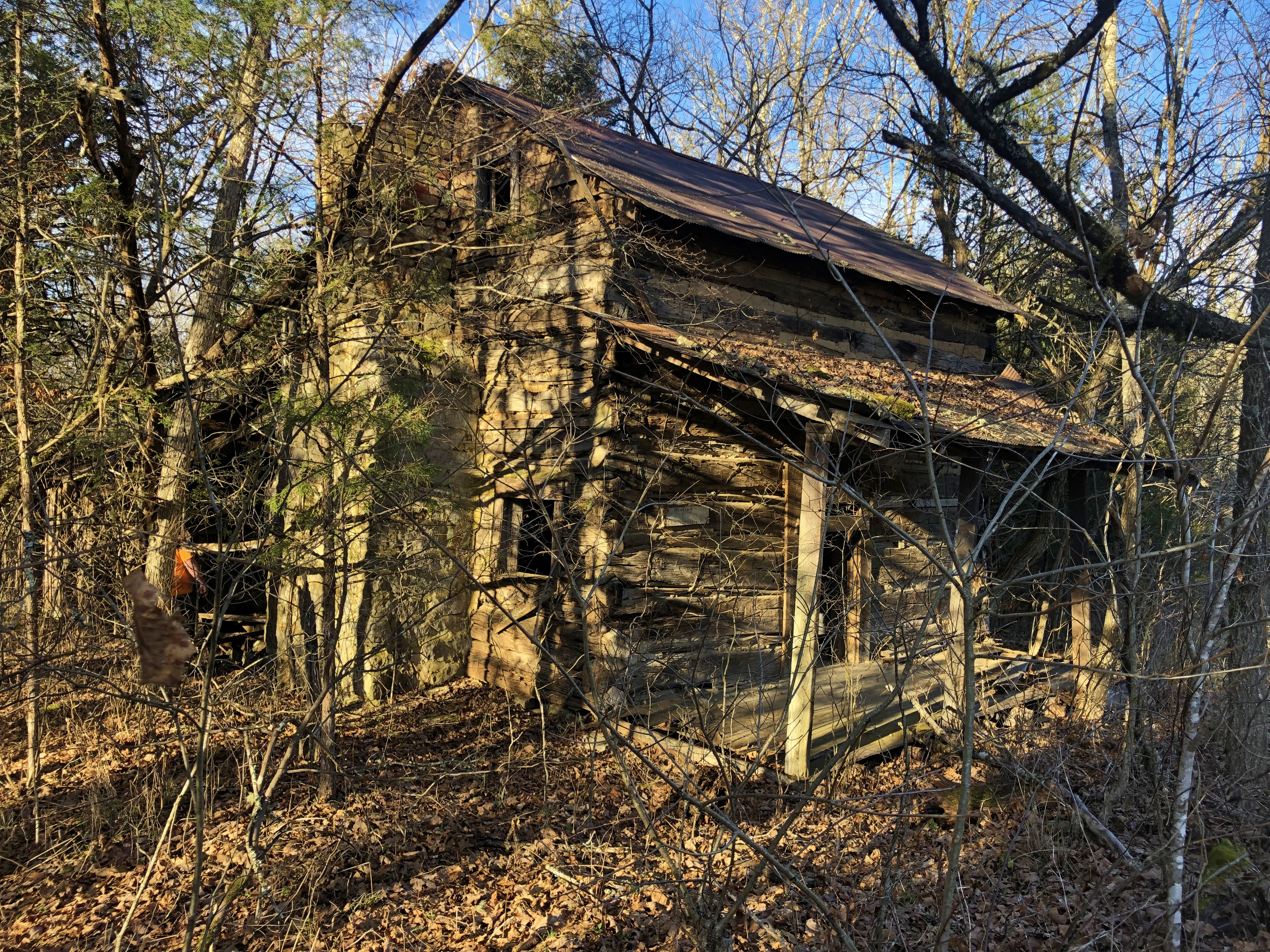
Just up the road from where we parked to see this tunnel was an old log cabin. Rob and I walked up the road to look at it and take photos. It was abandoned but still seemed to be in decent condition.
Another cache that we stopped to log was in the front yard of a cacher named Heironimous. Sadly, she died about five years ago. I never had the chance to meet her, but several of my friends knew and loved her. Her husband has been nice enough to keep the geocache in their yard active, and it was an honor to have the opportunity to log it.
We logged a total of ten traditional caches before calling it a day and driving home. This was another great adventure that I enjoyed sharing with good friends. I wonder where life will take us next?