
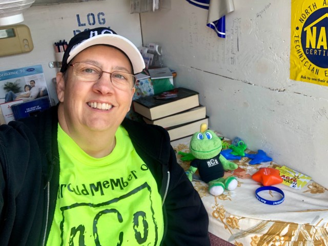
Baltimore, Maryland area
- 14 geocaches found
- 1 new state souvenir earned
- 8 different cache types logged in one day
- Day of the year hidden grid completed
- 1 cache resurrection
Deban and I decided a few weeks ago to take a last minute holiday trip so that we could use a free companion ticket with Delta before it expired. We looked at many options, and settled on Baltimore for a few different reasons. A. The seat we would be paying for was less expensive than other destinations. B. There was a casino for Deban to play in. C. It was close to Delaware, a state that I had not yet cached in. D. Deban was able to get a really good room rate for the Live! Hotel and Casino.
We left on Christmas Day for the two short flights from Tri-Cities to Atlanta and Atlanta to Baltimore. With plenty of empty seats on both flights, and with our Sky Miles status, we received free upgrades to First Class on both flights. On the shorter flights and small planes this doesn’t make a huge difference, but it still makes for a more comfortable flight.
I made sure to profusely thank people everywhere we went on Christmas Day for working on the holiday. Many seemed to be appreciative that I acknowledged their sacrifice. Especially touched by this simple gesture was the TSA agent that checked our tickets in Tri-Cities. I’m sure that she is used to encountering passengers who see the security we must go through as a pain. I am thankful for the work they do to keep us safe, and the agents in our little airport are always very friendly.
We arrived in Baltimore in the early evening, picked up our rental vehicle, a pickup truck, from Enterprise, and drove toward our hotel. It was a short trip of about 10 minutes. Before checking in, we drove around the area in search of a place to eat. The only places open on Christmas Day were McDonalds and TGIFridays. We had just eaten lunch at TGIFridays in the Atlanta airport, but we didn’t want McDonalds, so we went for a repeat performance.
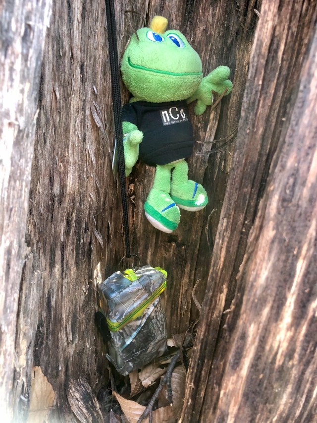
After a good meal, we checked in to the hotel. I spent the rest of the evening mapping out my plan for caching the next day, while Deban went to the casino to play. I had a good night’s rest, and headed out on Wednesday morning around 9 am. I found a store called Bagels & Grinds near the hotel and bought a couple of yummy bagels. After buying a Diet Dr. Pepper (my lifeblood) at a convenience store, Signal the Frog and I made our way toward Delaware.
My target for my first Delaware geocache was called “Your Key to Cache.” Before any trip, I typically check for highly favorited caches in the area I will be visiting. This one had 678 favorite points, so I knew it would be a special one. I was so excited when I pulled up to the cache that I decided to video my experience to share with my geocaching family back home.
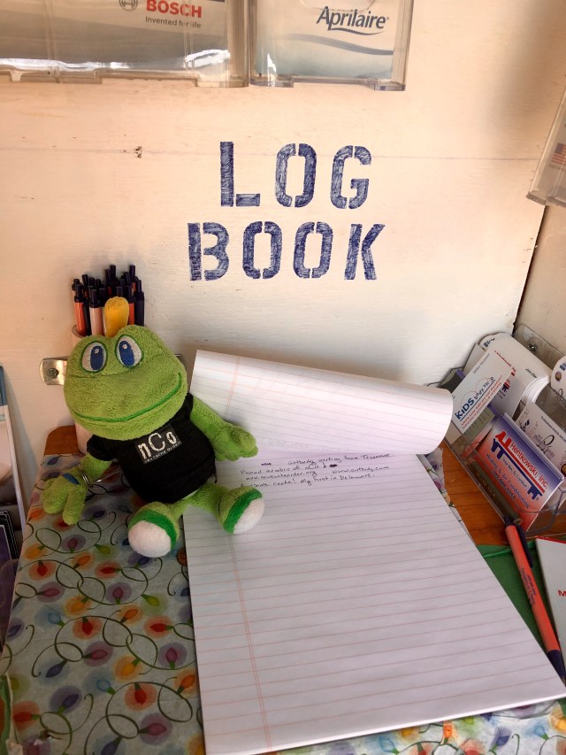
This cache did not disappoint. The cache container is the largest I’ve ever seen. It is a work van, parked on the property of a locksmith company. The “key” to opening the cache is finding… you guessed it… the key! That was easy enough, and soon I was inside the back of the van. Wow! INSIDE a geocache! This was a first for me. I spent some time checking out the inside of the van, exchanging travel bugs, signing the log book, and taking numerous photos.
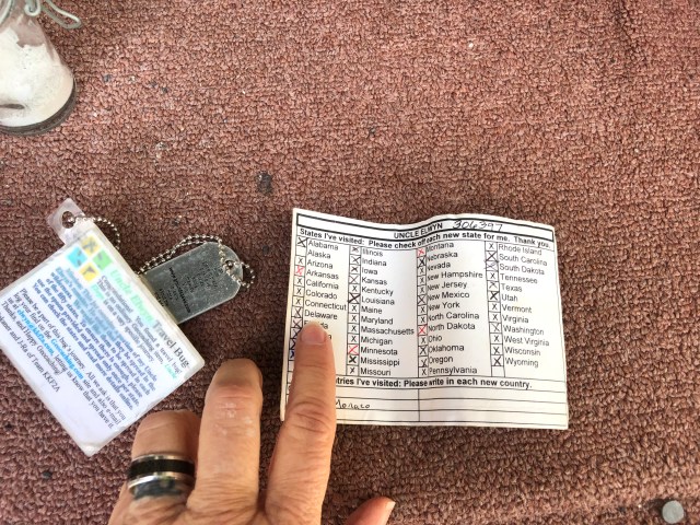
I had with me a very special travel bug that I had decided to leave here. It is named Uncle Elwyn and is a small wooden box containing a glass jar of ashes. The note on the box explains that these are the cremains of Uncle Elwyn whose dream was to visit all 50 states in the US. There is a tiny plastic spoon in the box, and cachers are encouraged to use it to spread some of his ashes in each state he visits. Also in the box is a card where the states visited can be checked off. When I received Uncle Elwyn, he lacked two states: Alaska and Delaware. I was excited to help him visit one of those and spread some of his ashes there.
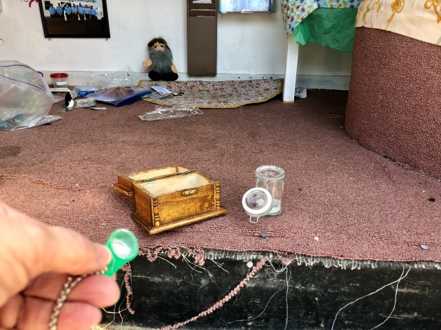
Disclaimer: If you visit the webpage for this travel bug there is a link to a page that states these are not actually human remains. However, this is still a fun trackable to have in your inventory, and it was nice to be able to help him get closer to his goal. This trackable has been traveling since August 2002 which is a pretty amazing lifespan for a travel bug. Many of the ones I have created over the years have gone missing.
While I was exploring the geocache, a man wearing a uniform shirt with the name of the locksmith company came out to talk with me. Steve is a member of the family that owns the business, and said he likes to chat with the geocachers that visit. He is not a geocacher himself, but is proud of the fact that this cache has so many favorite points.
After spending close to an hour here, I moved on to the next geocache on my list named “Not 4 the Meek”. This one was nearby and also had a lot of favorite points. It is in an electrical box, and to reach it you must stand atop a high wall next to a parking lot. Unfortunately, the box was open and no log book was inside. This had been reported by the last cacher to visit back in October but had not been rectified. I had a spare log sheet and baggie that I signed and placed in a 35 mm film canister, then placed this in the box and closed it back up. This is a nice cache and since the owner is no longer playing the game, I felt obliged to keep it active.
I then drove to a nearby state park and took a short walk down a trail to find a cache that would help me fill in a month that I needed for the Jasmar Challenge. The goal of this challenge is to find a cache hidden in every month since the inception of geocaching. I still lack some of the early months from 2000 and 2001, so had decided to target caches that will help me reach that goal.

The next cache also fit this category, and was not far from the last. As I drove toward it using Google Maps, I was shocked to hear my phone announce, “Welcome to Pennsylvania!” I had no idea that I was near the state border. I had already earned my Pennsylvania souvenir a couple of years ago, but was happy to find another cache in this state.
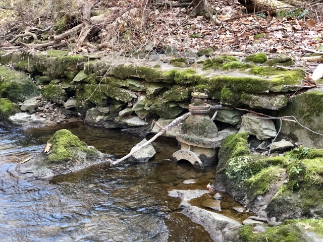
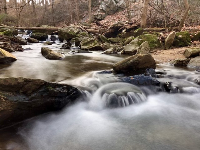
This cache required a little bit longer hike, but still less than a half mile. It was not a walk in the park, though, since I had to climb a rather steep hill and cross a creek to reach the cache site. I was happy to note that other travelers had left a collection of natural hiking sticks on each side of the creek to help steady those of us that followed. I missed having my cedar hiking stick along, but the one I grabbed served nicely to help me balance on the rocks as I hopped across. I saw the remains of a rock building along the trail, but could not tell what it was in its former life.

This was a very nice hide in a very old twelve foot high rock wall next to the creek. It was a rusty old ammo can, but nice and dry inside. This find turned out to be a cache resurrection since it was last found a year and two months ago.

I signed the log book and then explored the area along the creek a little. I spotted an old metal contraption along the creek that looked like a valve of some type to control water flow into or out of the creek. I wonder what the history of this place is?
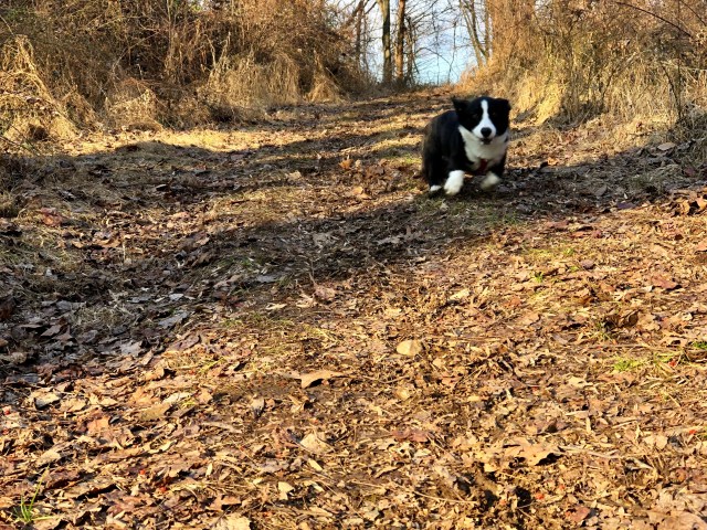
As I walked along the trail, I saw a cute black and white Corgi coming toward me. He stopped to check me out, turned to look back around the bend for his humans, and then ran toward me. I bent down to meet him and he excitedly greeted me. Soon, his humans came around the bend and called for “Amos” to stop jumping on me. I assured them that I did not mind.
I made one last stop in the area to find another geocache that I needed to fill in a month on the Jasmar challenge. This was in another state park and just a short walk from parking. At this location I found not one but TWO ammo cans. Unfortunately, they were both very wet inside and the log book was too soggy to sign. I had an extra little notebook in my pack, and placed it in a baggie after I had signed it.

I then made the drive back to our hotel, picked up Deban, and we went to Lone Star Steakhouse for supper. I spent the rest of the evening logging the caches I had found and reliving my fun day. I also made plans for the next day’s adventure. Deban returned from the casino early and told me that she would like to go geocaching with me the next day. This made me very happy. I would enjoy spending the day with her, and also having a chauffeur to drive while I navigated.
My goal for Thursday was to log as many different cache types as possible in one day. All geocaches fall into a category.
- Traditional caches have a physical container and a log book or log sheet that you sign. The coordinates that are posted on the cache page will take you right to the cache location. These are the most common type of caches.
- Puzzle or mystery caches also have a physical container and a place to sign your name. However, you must either solve some sort of puzzle to learn the coordinates, or complete a field puzzle at the cache site to access the log.
- Multi caches have more than one stage. The posted coordinates take you to a location where you must use information provided on the cache page or onsite to learn the location of the next stage.
- Virtual caches do not have a physical container or log book. The coordinates take you to some type of historic landmark or point of interest, and typically you must send answers to the cache owner to prove your visit and log the cache.
- EarthCaches also do not have a physical container or log book. These are located at some type of geological place of interest, and again you must answer questions to prove your visit.
- Letterbox hybrids are caches that are typically listed both on Geocaching.com and the website for another game called Letterboxing. A true letterbox hide gives you coordinates to a location near the cache hide, and then you must follow clues to find the actual container. Inside the container you will find a log book, but also a rubber stamp that allows players of the Letterboxing game to stamp their game books.
- Webcam caches do not have a physical container. They utilize existing web cameras around the world to give proof that you have visited the site. To claim a webcam cache you must navigate to the posted coordinates, position yourself in front of the camera, use your phone to log onto the website for the camera (or call a friend and ask them to access it via their home computer) and capture a screen shot showing your image.
- Whereigo is another type of game that has been incorporated into geocaching. To log a whereigo cache, you must download a game “cartridge” on your phone or handheld GPS device. When you arrive at the starting coordinates, the game cartridge will activate and ask you a question about what you see there. You then type in your answer, and if you are correct the cartridge will tell you where to go next. In some cases, all of the stages will be within walking distance. In other cases, you may have to drive a few miles to reach the next stage. There is no set number of stages, but eventually you will be given the location of the final stage where you will find a physical container and log book to sign.
- Events are another type of geocache, a chance for geocachers to gather either for a specific reason or just to fellowship and trade stories and trackable items. There are actually several types of events. Some are based on the number of attendees (such as a Mega or Giga event) while a Cache in Trash Out (CITO) event is a chance to help the environment by picking up trash at a designated location.
- There are a handful of additional geocache types that are much more rare. Project A.P.E. caches were created in 2001 as a publicity stunt for the movie Return of the Planet Apes. There are only two of these caches still in existence: one in Brazil and the other in Washington State. Lab caches are temporary caches set up to be found during Mega or Giga events. Visiting the Geocaching Headquarters in Seattle, WA will earn you the Geocaching HQ type.

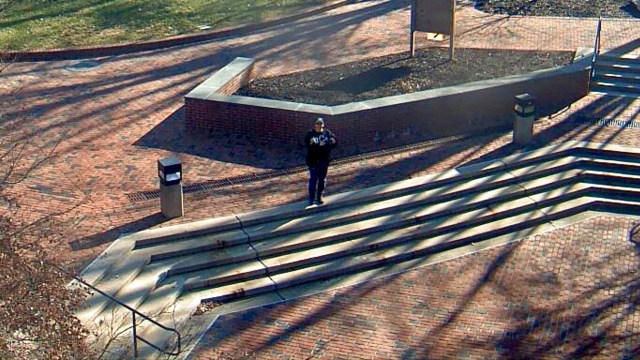
We drove to Towson University where there is a webcam cache. Finding a place to park was difficult, despite the fact the school was closed for the holidays. Our problem was finding our way around campus due to construction that blocked some of the streets. We finally spotted an empty spot not too far from the webcam and I hopped out and made my way there. I was able to pull up the steaming video from the camera on my phone, and snapped a few screenshots.
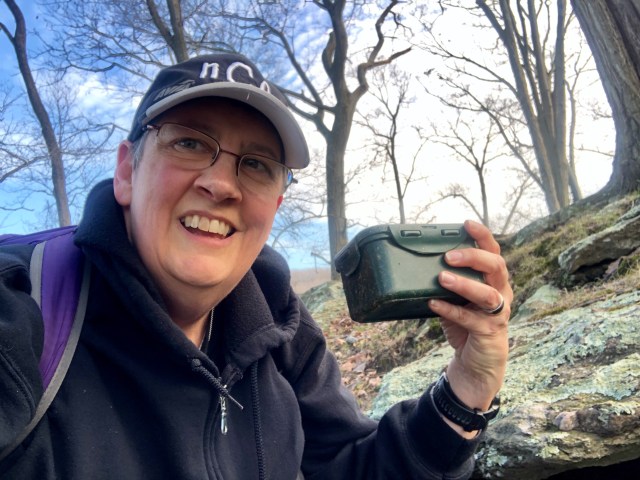
Once I got back to the truck, I directed Deban further north toward the Loch Raven area. We stopped at Cromwell Valley Park where we walked a short distance from parking to the site of an EarthCache. Here we found three large rock structures that were kilns once used to “cook” marble and produce lime. There were several questions that I needed to collect the answers for. I must have done a pretty good job studying the signs and the cache page. After I had sent in my answers that evening, I got a reply from the cache owner saying, “Great job! You are the first person to give 100% correct answers.” Since at least 30 geocachers had logged this EarthCache before me, I am amazed that no one else was 100%. If only I had done that well in school!

The next cache on my agenda was a multi. It instructed hunters to go to the posted coordinates, and then use their compass to go 295 feet in a specific direction. I had used an online tool the night before to determine where that would be. This cache was in the woods between the road and the lake. What I couldn’t see from looking at the map was how steep the terrain was from the road up to the cache site. Since there was no parking nearby, Deban dropped me off on the side of the road nearest the cache. I looked at the hillside and decided to find a better way up. I walked back down the road until I found a trail, and then followed it to the top of the ridge line. I made my way toward the coordinates I had projected. This sent me down the steep hillside on the opposite side of the trail toward the lake. I searched several likely looking spots with no success. I finally reloaded the original coordinates and concentrated my search on an arch 295 feet from them. I finally found the container just feet from the trail. I texted Deban to let her know she could head back to pick me up, and found a trail leading down closer to where she had dropped me off.
Next was a puzzle cache. It was one that needed to be solved ahead of time to learn the coordinates, and I had done that before leaving home. It was a simple process of watching and interacting with a game on the computer.
She drove me to the posted parking coordinates for the cache, just a couple of miles away from the one I had just found. As I prepared to hike toward the cache I looked at the map and saw it would be about a mile each way. I found a spot on the map where it looked as if I could access the trail from a neighborhood, significantly shortening the hike. We drove there, and I could see that I was now just a little over .10 mile away. I jumped out and headed along a trail which was really just a mown strip of grass between houses marking the path of a buried gas line. I soon realized that it had taken me to the top of a very steep hill leading down to a creek below. On the other side of the creek, the trail continued up an even higher steep hill.

I checked my map, thinking that if the cache was up THERE I was in big trouble. Thankfully, I could see on the map that it was next to a trail that ran along the creek. I carefully made my way down to the creek, crossed it, and started following the trail the few hundred feet toward the cache. In my way was a huge tree that had fallen across the trail. There was no room to crawl under, so I had to climb over it.

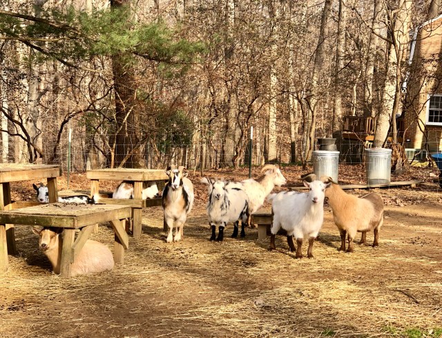
I finally reached the cache, signed the log, snapped a photo with Signal the Frog, and headed back toward where Deban had parked. Of course, what goes down must go up… or something like that. So, I had to climb that long, steep hill. I finally reached the top, and as I walked back between the homes I noticed that one had several goats in the back yard. They were all different colors and were very cute. Most of them posed nicely so that I could take a photo.
I was so hot and sweaty by the time I got back to the truck that I felt like I was in a sauna. The windows even fogged up because I was radiating so much body heat.
Since it was past lunch time by now, we decided to take a break and go into town to find a place to eat. We had a nice lunch at Applebee’s and then went back to caching.
Next on the agenda was a whereigo cache. At the posted coordinates we found a historical sign and I answered the questions that appeared on my screen. This led us to another sign about a mile away, and then another. The next stage was at an old cemetery which also happened to be the site of the traditional geocache that I had on my list for the day. I had chosen it because of the day of the year it was hidden. This was the only day of the year that I still had open on my calendar grid, so finding it filled that spot. It had a Dr. Who theme, so the log sheet was inside a two inch tall Tardis. Deban was the one who spotted it hiding in the rock wall around the cemetery. She is good for more than driving the cache mobile!
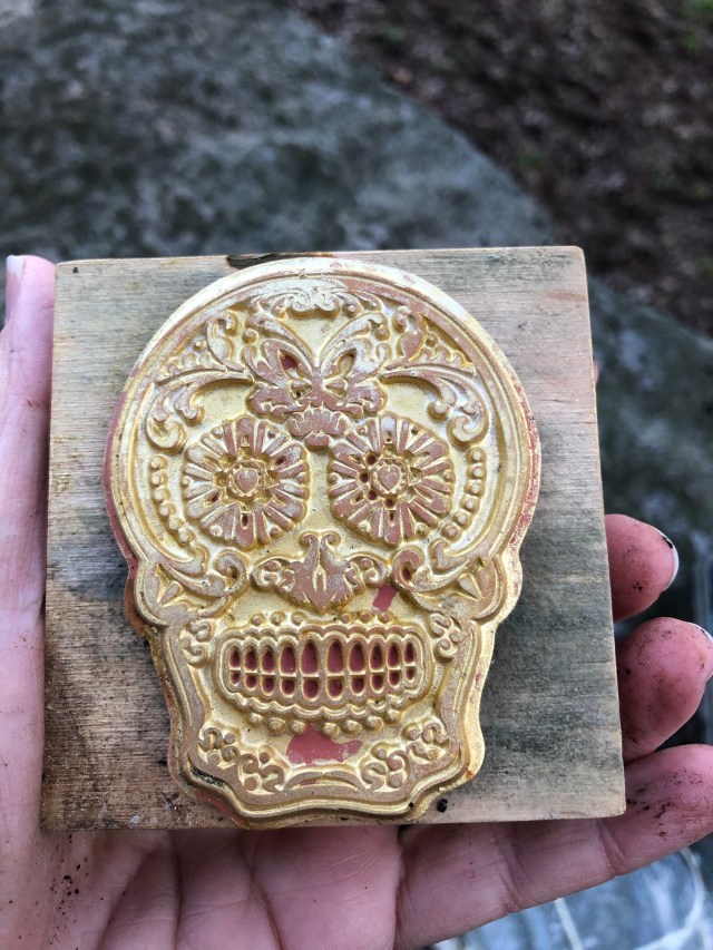
We continued through the rest of the stages of the whereigo, making a slight detour at one point so that I could find the letterbox hybrid cache on my list. It was also hidden in a cemetery. The cache description had me stand just inside the gate, and then it led me on a walk through the cemetery, looking for the names of various people buried there. Once I had reached the final name on the list, it told me where to find the cache from there. I wished that I had carried something with me that I could stamp, since the rubber stamp in this letterbox was a lovely sugar skull.

Back on the trail of the whereigo, I finally reached a stage that gave me the coordinates for the final stage of the cartridge. We drove to the parking coordinates and found that we were at a trail head about .3 mile from the cache location. Deban was desperate to find a restroom by this point, but sunset was nearly upon us. I told her it would take me about 20 minutes to get to the cache and back, and for her to go on and find somewhere to use the restroom and buy us some soft drinks. I then jogged most of the way to the cache. The coordinates led me slightly off the trail, and as I approached I could see a corner of the box sticking out from its hiding place. I quickly signed the log, took a photo, replaced the cache, and then headed back to the road. Once there I called Deban to let her know I was done, but she was still at a gas station. I entertained myself while I awaited her return by recording a “live update” video to send to my geocaching friends back home.

By the time she picked me up, it was too late to try to attend the event that was happening several miles away, so we headed back toward the hotel. I dropped her off, visited the nearby Bass Pro Shop, and then went to find one last cache for the day. This one was a traditional cache, but contained several travel bugs. I wanted to drop off one of the bugs that I had brought with me from home. Like Uncle Elwyn, it has a goal of visiting all 50 states. I was able to add three states to its list on this trip: Delaware, Pennsylvania and Maryland. I left it there so that someone else can pick it up and take it to more states.

We flew home on Friday, once again receiving seat upgrades on both flights. Our journey was longer than anticipated with a delay in Atlanta caused by weather issues, but we arrived home safely and that is all that matters. Although this was a short trip, I felt like I packed a lot of fun into my visit. Maybe I will return to Baltimore someday and actually tour some of the historic sites.

Sounds like you had a fun trip. The inner harbor area in Baltimore is really nice. You definitely need to go back
Yeah, I kept meaning to get down there, but I couldn’t find the spare time.