Bay’s Mountain Park
- 4.72 miles
- 4:27 duration
- 652 feet elevation gain
- 1 geocache found
- 1 geocache visited (previously found)
- 2 geocaches hidden by me
- 2 geocaches hidden by LakeBum
- 1 geocache found and one DNF on the way home
A few weeks ago, LakeBum (Rob) and I made a trip to the lower end of Bay’s Mountain Park to scout the “back door” entrance. He had a cache hidden “way out Back Hollow” that I had never found, and I wanted to see if it was possible to enter the park from the lower end and reach that cache. This would be a much shorter hike than coming from the usual entrance and parking area near the nature center and animal habitats.
On that trip, we learned that it was indeed possible to park near the end of Bay’s Mountain Road and walk into the park via Front Hollow Road. During our reconnaissance mission we met the resident of the last home on that road. He told us that we were welcome to park inside the gate next to the abandoned saw mill or outside the gate near his home. He also showed us how to reach Back Hollow Road from Front Hollow Road.
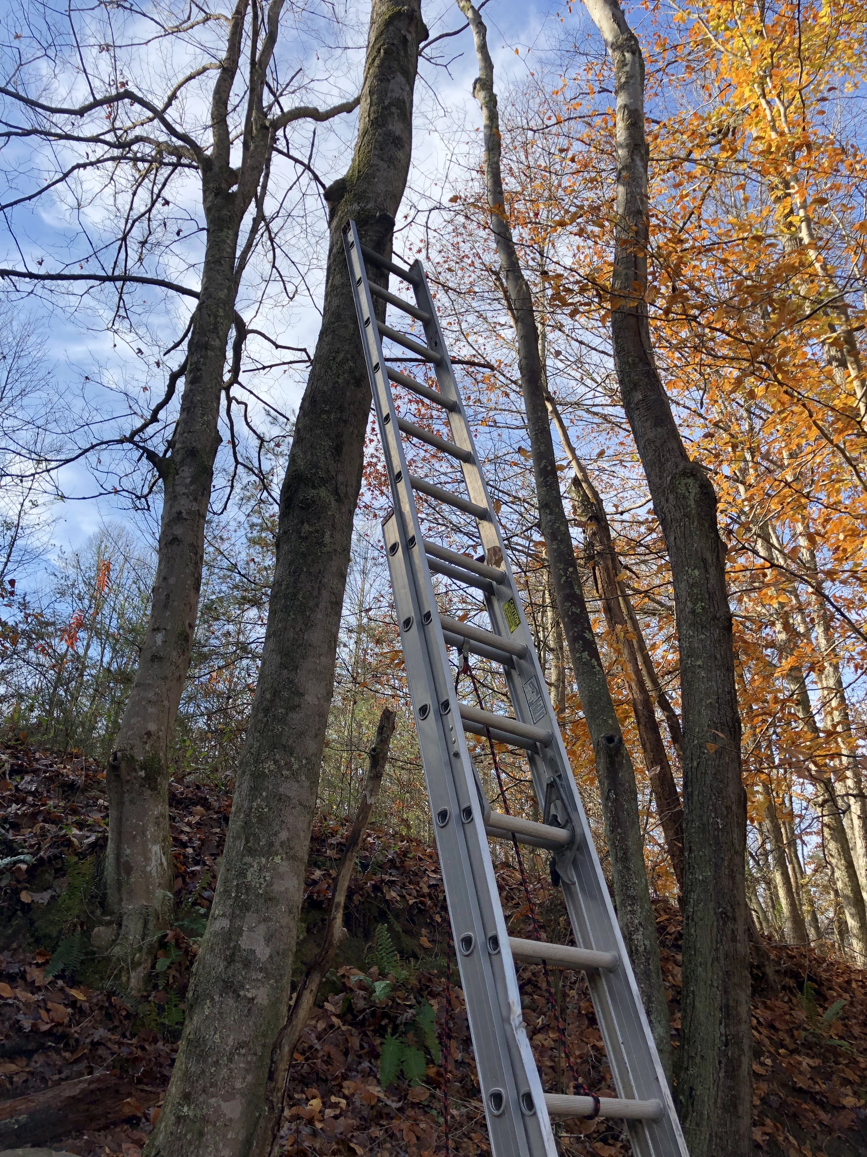
As we prepared for today’s visit, I texted Rob to ask if he wanted to attempt to find Up a Tree, a cache on Front Hollow Road and one of only two caches in the park he had not yet found. This is a difficulty 5, terrain 5 cache – the hardest to find and log. I was with the group that hid the cache four and a half years ago. GrandMasterCamp (Johnny) carried pole climbing gear to the cache location and climbed a tall, skinny tree to hide the cache. Rob and I had hiked past it on a previous trip, but he did not have the appropriate equipment to log it. In fact, the only cachers to log this cache other than the group that hid it were BackWoodsAng (Ang) and jollymon9999 (Joe) who logged it in July 2014.
Since we were entering from the lower end of the park, the trek to this cache would be only about .2 mile as opposed to the 2.5 or so miles I hiked to it the first time. We made plans to carry Rob’s extension ladder with us so that we could reach the cache in its hiding place.
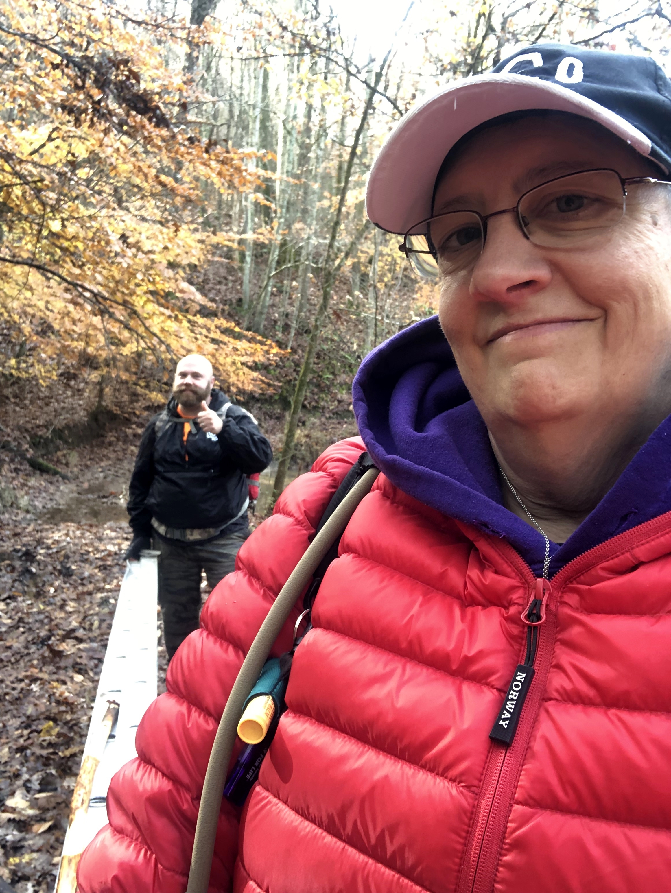
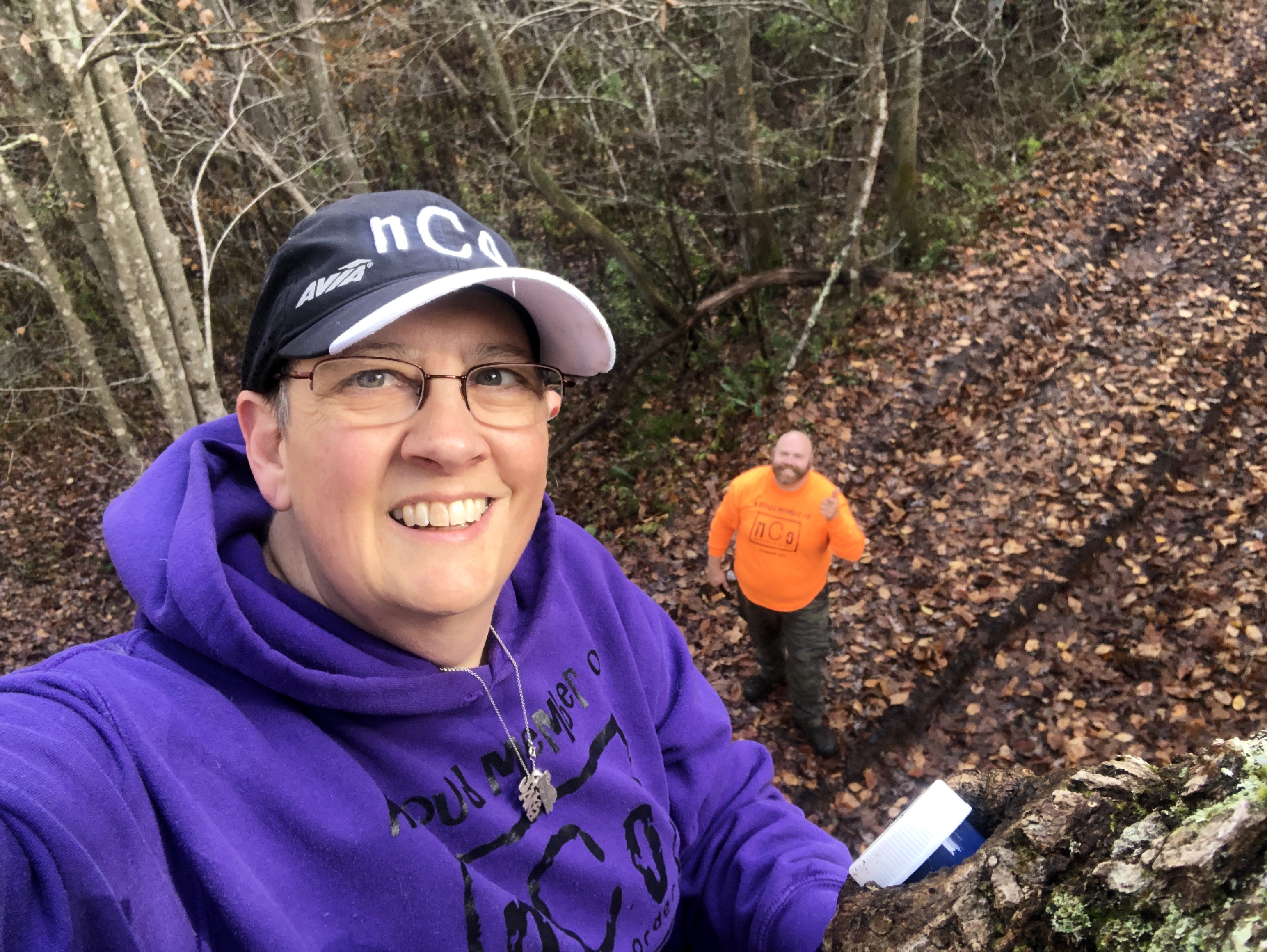
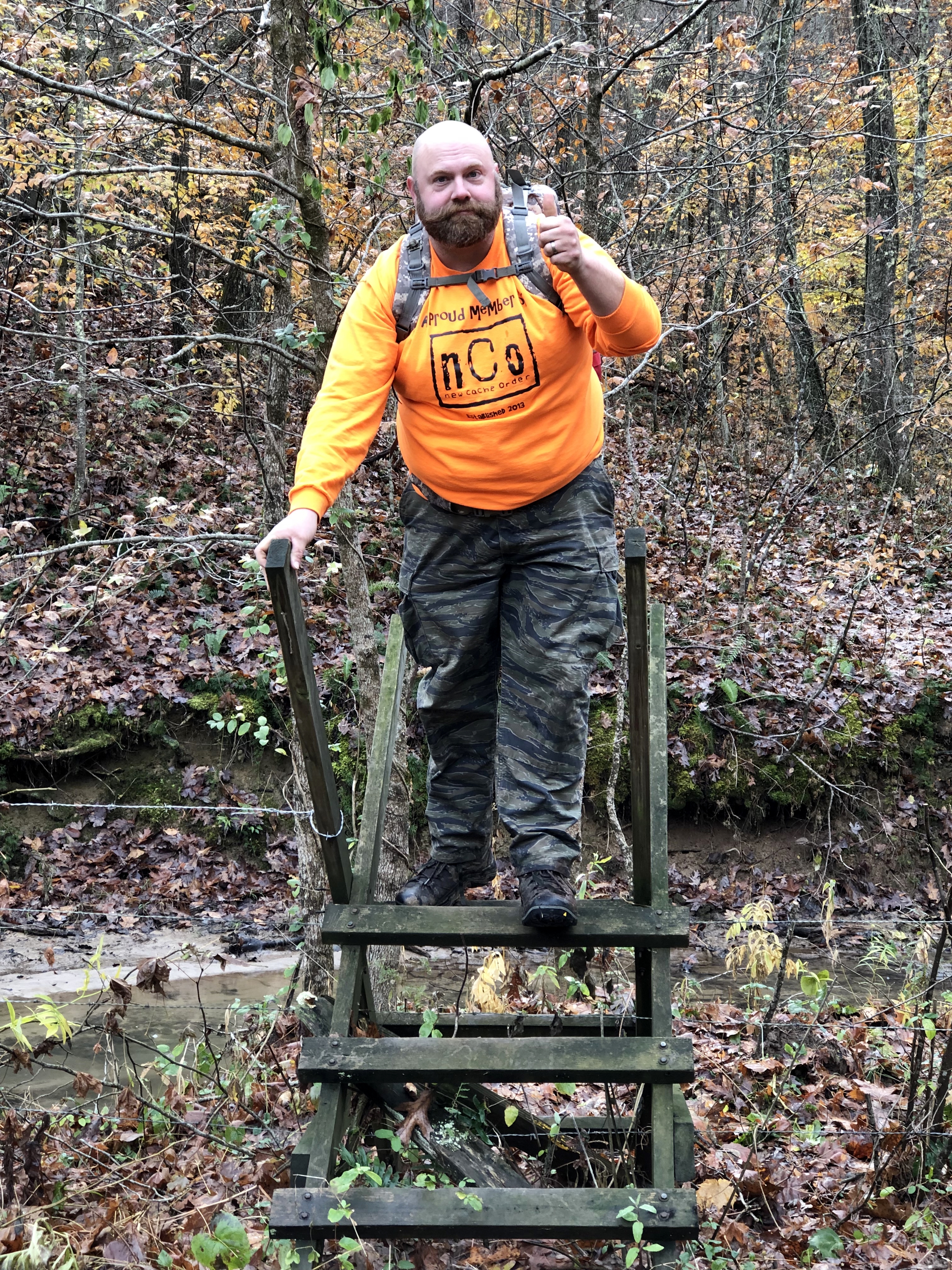
We arrived at the back gate at about 9:30 am. As we parked, the nearby resident rode up on his four-wheeler to check on us. He wanted to make certain we were not hunters. Once he saw us he remembered us from our previous visit. After he had left, we geared up, unloaded the ladder from atop the truck, and began our trek into the park.
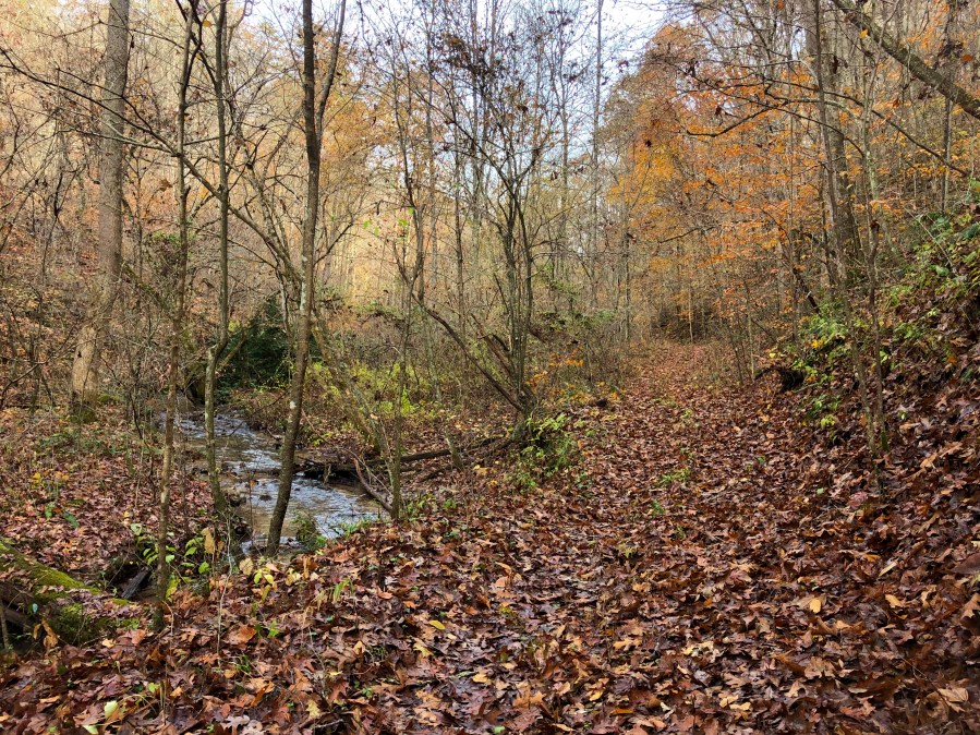
The temperature was in the low 30s when we headed out, but we quickly warmed up. As usual, I had come prepared with layers, so I was plenty warm.
We knew from previous visits that although the map says, “creek is along road” there are sections of Front Hollow where the creek IS the road. When we were here two weeks ago, we were able to walk through the shallow water. However, with many rainy days since then, the creek was much deeper now. We paused when we came to this section, and decided to take an alternate route through a nearby pasture. We went through a barbed wire fence, and looked for a way to navigate the field. However, there was another wet weather stream blocking our way. We followed what looked to be a tractor path around the field, continued through an area with fallen down buildings (barns? houses?) and waded through high grass and marshy ground and crossing another fence, all the while carrying that extension ladder. We finally reached the other side and got back on the road.
Finally, we reached the place where the cache was hidden. I was certain I knew what tree it was, and Rob confirmed that by checking it for spike scars. He extended the ladder, propped it against the tree and said, “Are you going up?” Of course I was!
I climbed up to where the cache had been hidden in a knot in the tree. There was no sign of it. Thinking I had the wrong knot, I descended so that Rob could extend the ladder higher. He nervously watched as I climbed once again. The knot hole I looked in this time was not big enough for a cache container, confirming that I had been right the first time. Apparently, the knot hole that once held the cache had filled with water over time and the cache had floated out. Once again I descended the ladder and pulled a replacement container out of my backpack while Rob re-positioned the ladder a second time. We both signed the log sheet – me with my new toy, a self-inking stamp that imprints “antbedy” in purple ink. This was my first time using it.
One more trip up the ladder, and I placed the container – a veterinary prescription bottle – in the knot hole. It protruded slightly, so I asked Rob if it was too obvious. He could easily see it from the ground. I tried turning it around so that the blue bottle, rather than the white cap, was sticking out. The lid was too large to fit in the hole so I put it back the way I had it. When I was back down, I looked and it was indeed very visible.
We both searched our packs, and Rob found a bit of black tape on a cache container, with a green geocaching sticker on it. I climbed the ladder a fourth time and affixed that tape to the lid. Back on the ground I could see that although in plain view if you know to look up, the cache isn’t quite so obvious.
Around this time we heard the engines of four-wheelers nearby. I was looking around on the ground to see if I could find the original container when Rob said, “Here come our friends.” It was the nearby resident again, and he had another man with him. We decided to leave the ladder against the tree so that they could see what we were doing. As they approached, Rob said, “You missed the fun!”
We explained to them that we were geocaching and pointed out the cache in the tree. The man we had met before knew what geocaching was because he had come across a couple of caches in the park. He told us that his brother had called him to say, “Those people are carrying an extension ladder into the park!” He said he decided to come “check on the mud puddles in the road,” but I’m sure his true reason was to see what insanity we were up to.
When we told him we would be hiking more, he offered to take the ladder back with him on his four-wheeler. We eagerly accepted his offer rather than lug it back to the truck. We may be crazy, but we aren’t stupid! We carried the ladder down to where he had parked, and then continued on our journey.
After exploring a stile that had been built nearby to assist hikers over a barbed wire fence, we decided to follow a .2 mile section of Pretty Ridge Trail across a knoll from Front Hollow to Back Hollow. This trail has not been maintained in recent years, and was tough to follow at times. As we neared Back Hollow Road, we lost the trail completely and had to wade through a marshy area. I stepped into a hole deep enough that the water was up to my ankle and a little seeped into my boot. I wished that I had worn my waterproof socks.
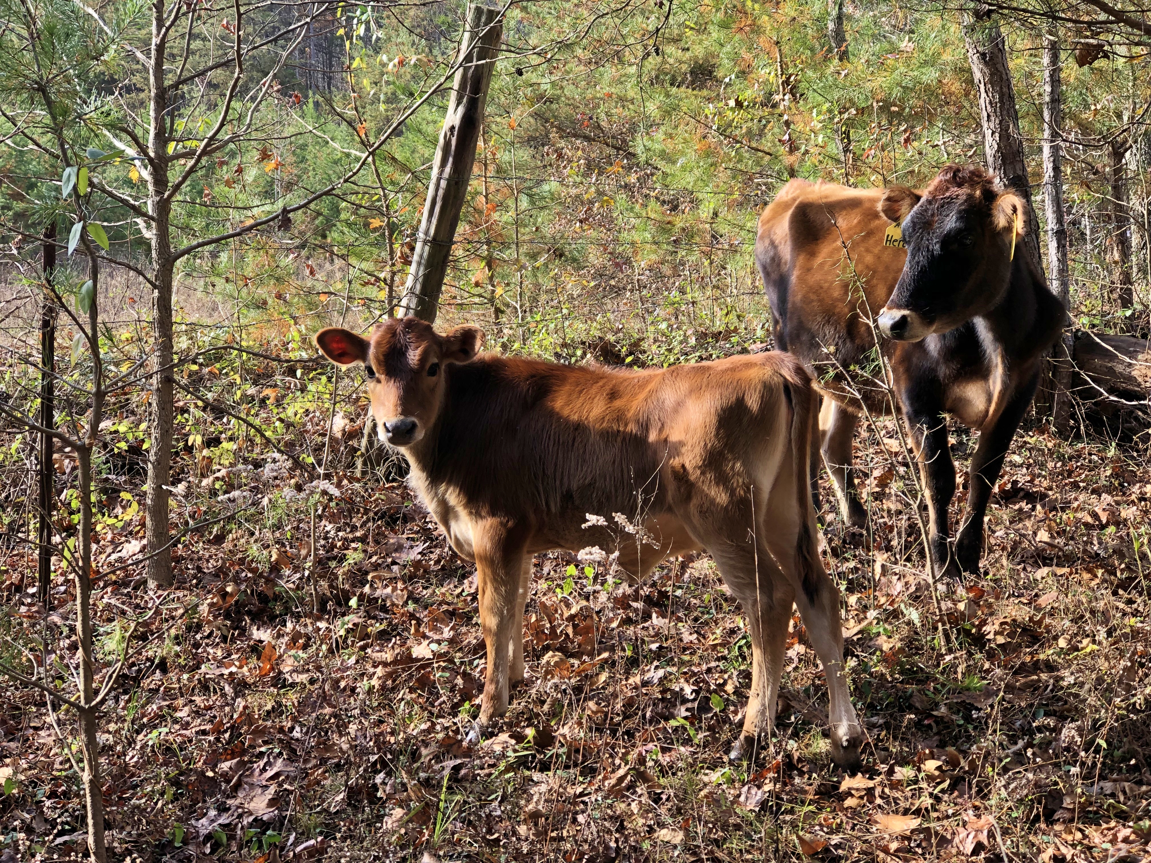
When we finally reached the road, it had degraded and narrowed to more of a trail by this point. We followed it a short distance and came to another area where the map says “creek is along road”. Once again, it was more a case that the road becomes the creek. We carefully made our way through a field, because we could see that there were cows grazing in it. We didn’t want to raise their ire, especially since Rob spotted a bull in the distance.
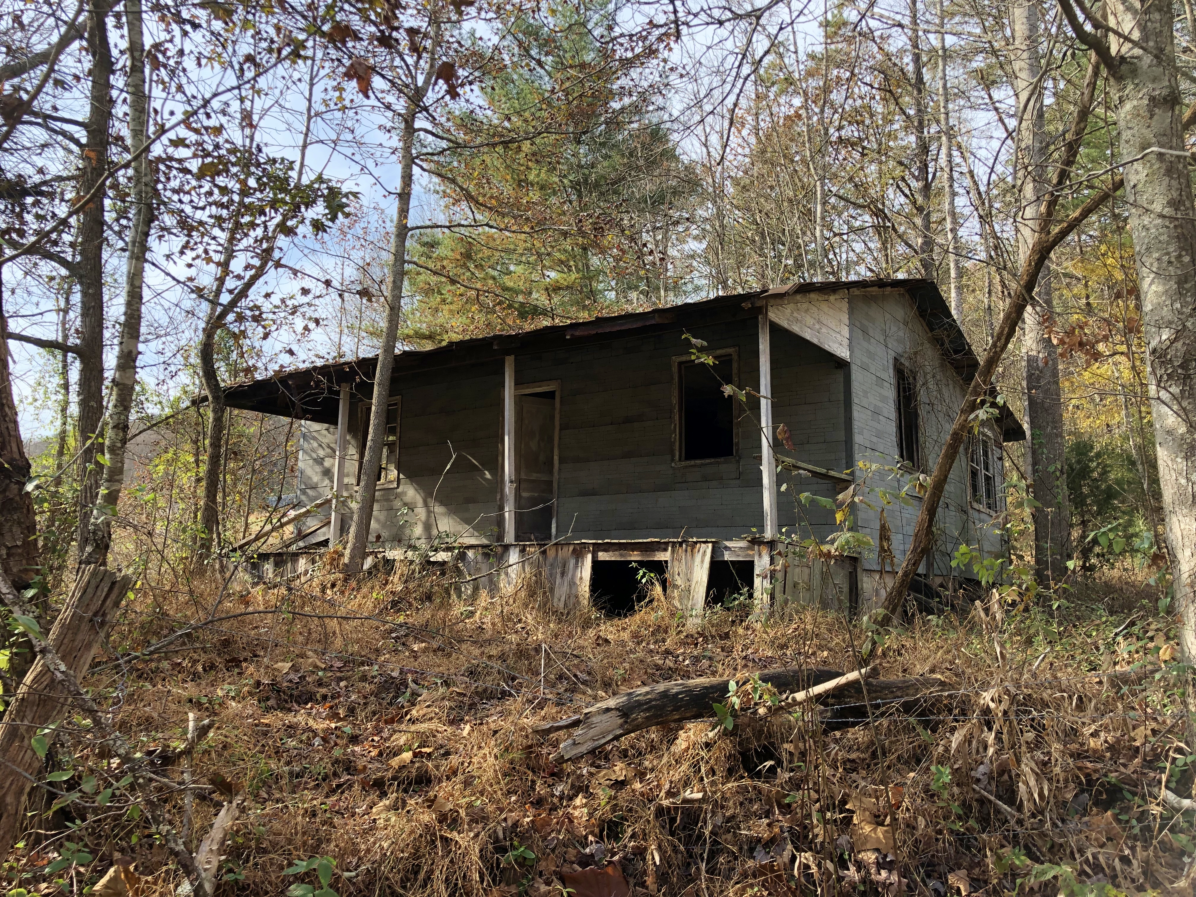
At the top of the field we could see the remains of a house and barn that are shown on the map. We had thought about hiding a cache there, but were having second thoughts since it would mean cachers having to navigate through the field where cows grazed. We decided to continue along Back Hollow Road in search of the cache that I needed to log.
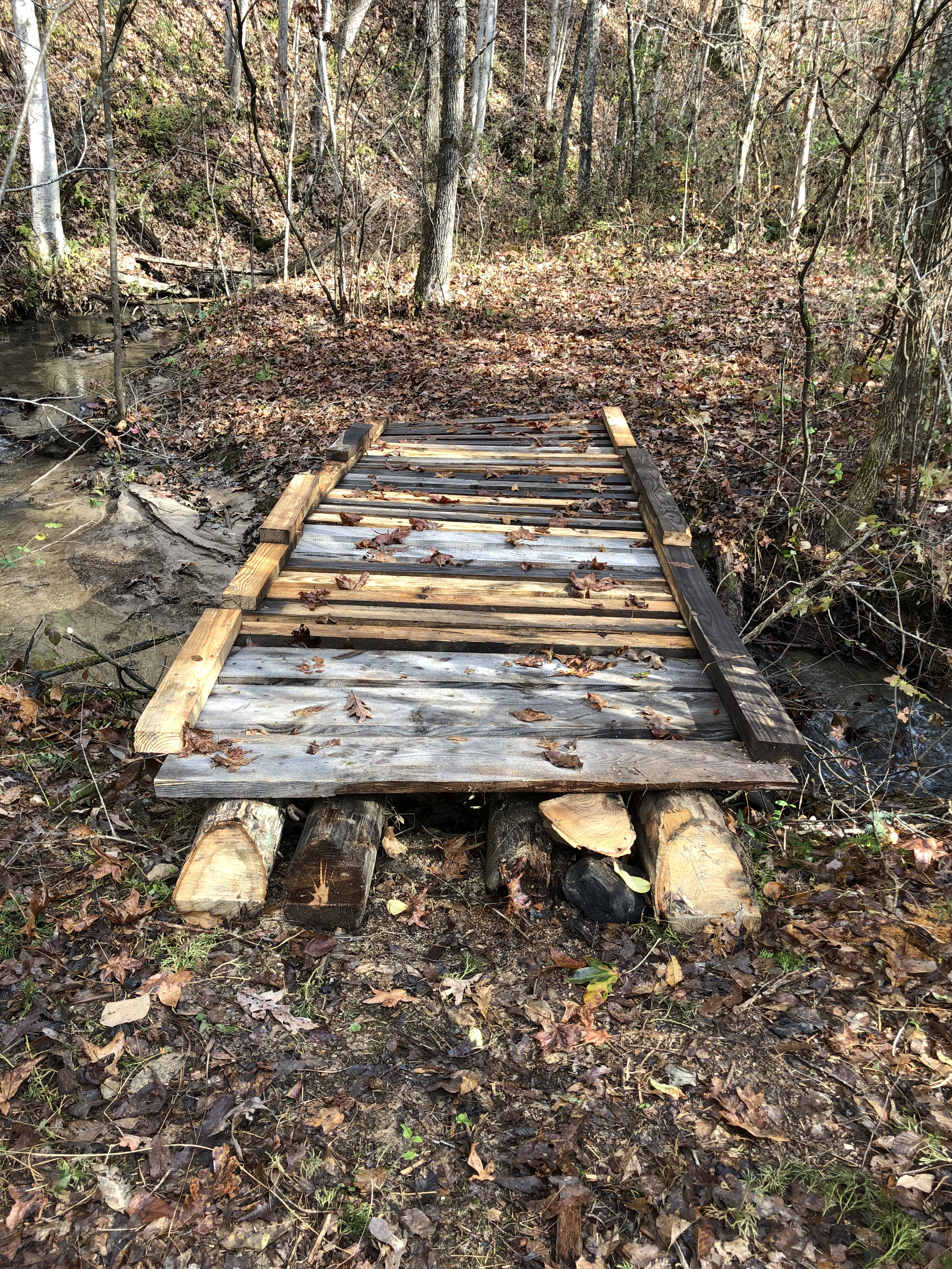
We crossed the creek, and once again were following a rough road. When we came to another creek crossing, Rob told me to look to my left and up if I wanted to see where the cache was hidden. Through the trees I could see a rock foundation on the hillside. We made our way up to it and I found the cache. It was last found in April 2016 so this was a two-year resurrection. After I had signed the log, we sat down in the “dining room” to have lunch. By dining room, I mean the fallen tree that lies across the foundation.
It was so peaceful there. As I ate I could only hear the forest sounds around us: the nearby stream, a woodpecker tapping against a tree, the breeze in the trees, and the songs of birds. We talked about how peaceful it must have been for the residents of this home, and wondered what had become of the house. There was no sign of any life other than the rock foundation and a few rotted logs.
After we had eaten, we packed up and began making our way back along the road. As we walked, I noticed a row of boxwoods along the creek. Knowing that these bushes are not native, I remarked that they had to have been planted there years ago. They have grown quite tall over the years and have grown together to form a hedge. We left the road to check on them, and I decided this was a good place to hide a cache. I had a plastic ammo can in my pack, but was worried about hiding it so close to the creek in case of flooding. Fortunately, Rob had a hanging pill bottle and let me use it.
We continued on our journey, eventually reaching the cow field and the ruins of the barn and house. We explored the area a little, and talked about whether we should hide a cache here. Rob also commented that there was now only one section of trail in the park that he had not hiked. It is a .4 mile long section of Pretty Ridge that begins at the barn and house and climbs the ridge behind them to the Kiner Hollow Trail. We decided that now was as good a time as any to tackle this section, so we climbed across another stile over a barbed wire fence and headed up.
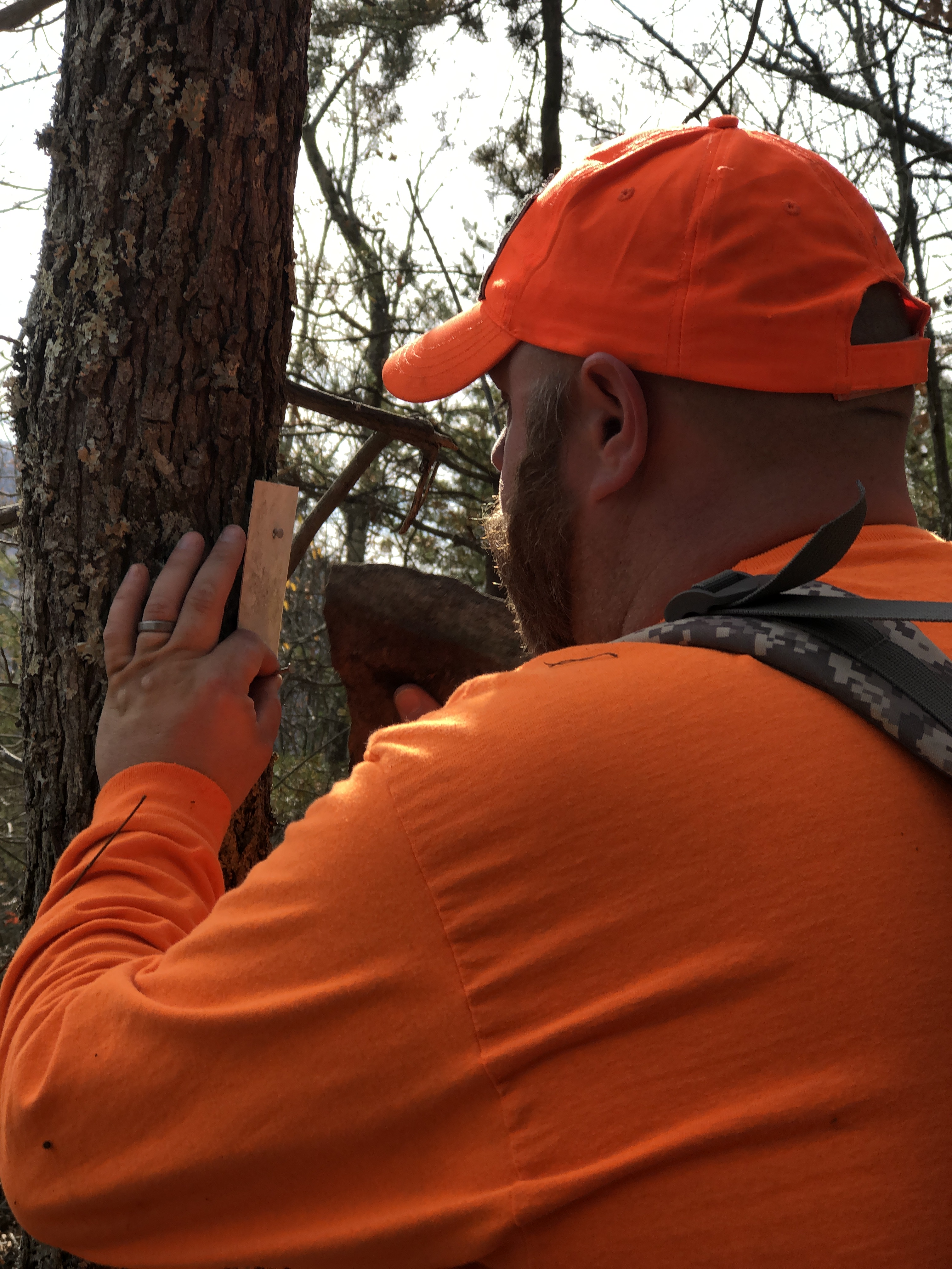
This was a very rough and steep trail. There were white blazes along the way to help us keep on track, but in some places they were few and far between making us wonder if we were still going in the right direction. In one place we found a marker on the ground, and since it still had the nails attached Rob decided to nail it back on a nearby tree. I searched the area, finally finding him a rock to use as a hammer.
After he had nailed it back, we continued climbing, complaining about the steepness of the trail but unwilling to turn back until we reached the top. As we neared the intersection with Kiner Hollow, we heard a four-wheeler. Once again our new friend had found us. We talked with him about the barn and house ruins below. He assured us that they were part of the park, and that the cows would not bother us.
We hiked back down the trail, glad that the leaves below our feet were dry. Even so, I slipped and fell once. Fortunately, I was uninjured and after regaining my feet I continued even more carefully.
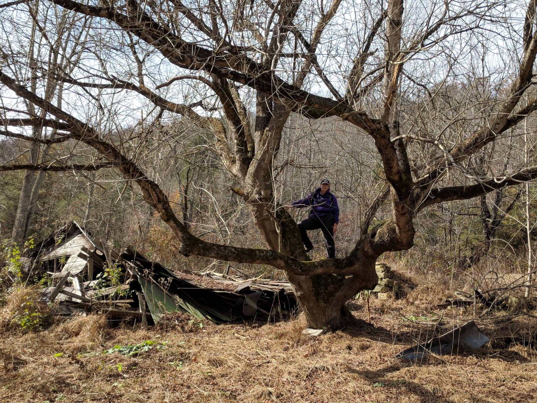
When we reached the ruins, I found a good spot to hide the ammo can I had carried on our this hike and our previous one. It was nice to get it out of my backpack. I could not resist climbing the very interesting tree next to the ruins of the house, and Rob could not resist taking my photo in the tree.
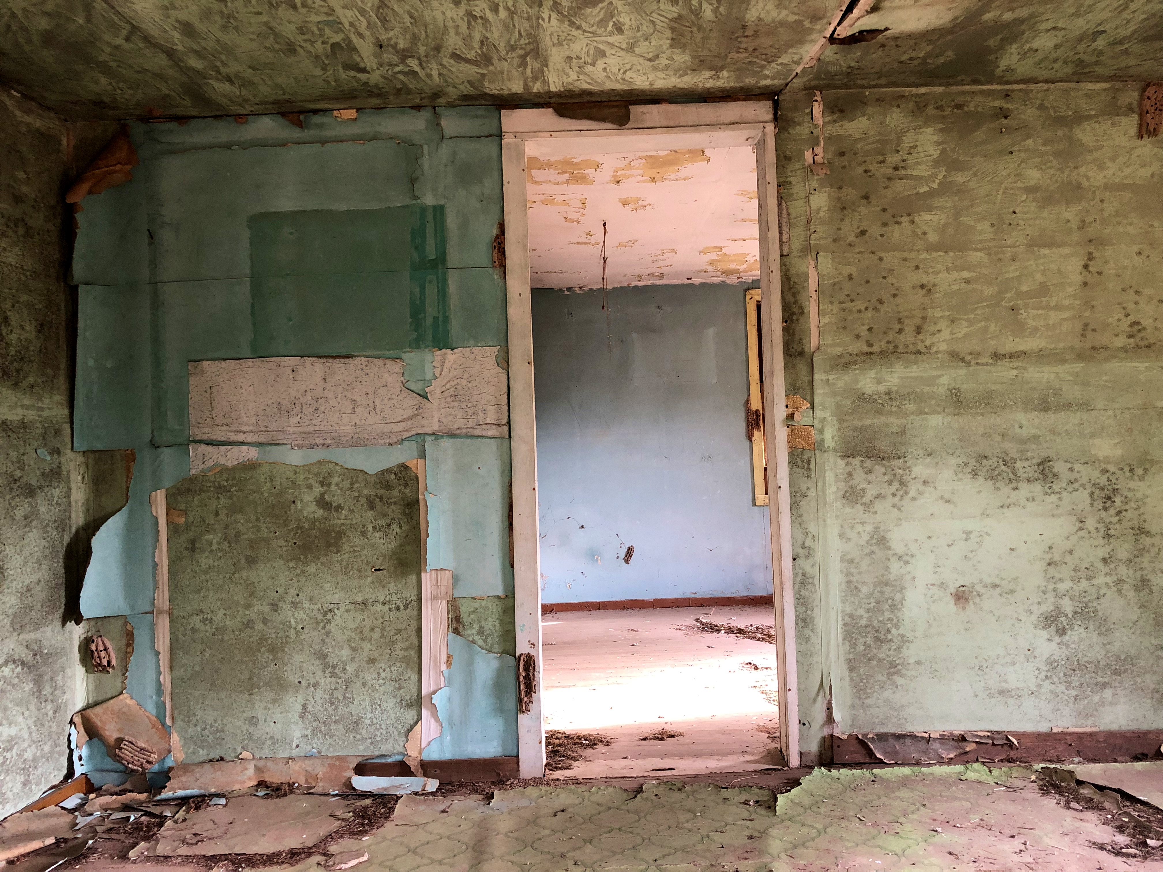
We made our way through the field and past a cow and her calf. After we had passed, the calf started to follow us, but soon lost interest. At the top of the next field was another abandoned house and barn. While they were obviously very old, these were still standing. We circled the house and looked in the windows, and then continued on our way crossing more fields.
Finally, we arrived back at Rob’s truck and found that the neighbor had not only brought the ladder back, but he had loaded it on top of the truck. We appreciated that very much.
Before climbing in the truck we checked out the remains of the sawmill. All of the machinery is gone, but there was a huge, rusty band saw lying there as well as some stacks of lumber that had been cut and never used.
This was another great hike and I was happy to have logged that lonely cache “way out Back Hollow.” Oh, and as mentioned in the bullet points above, Rob also hid two new caches. However, since they have not yet published, I carefully did not mention in my retelling of our trip when and where he hid them. That just wouldn’t be fair!
On the way home, Rob asked if I wanted to stop to look for a cache we had failed to find a few months ago. It was hidden by our friend RedRider (Lois). This time, Rob found it after a short search. It was all about looking at things from the right angle.
Once back in the car, he asked if I was interested in one more search, this time for a cache that had not been found in six years. It was a puzzle cache that he had solved some time ago, but because the terrain was very treacherous he did not want to look for it alone. I was happy to join the search for it.
When we arrived, I saw that the terrain was extremely steep and very overgrown. We walked around trying to find a gentler approach, and finally settled on a spot to enter the jungle. We had not gone far when we heard a man calling out to us. We learned that this was private property and that they had been having trouble with people trespassing. He gave us permission to continue once we explained what we were doing, but cautioned us to be very careful.
We searched for some time, fighting through vegetation, climbing over rocks and fallen trees and dodging broken glass and other trash. My GPS finally settled in one section on a steep hillside, and I searched a few likely spots carefully. Unfortunately, we were unable to find the cache and finally gave up the search. This was a somewhat sad ending to the day, but I chose to focus on the successes and fun we had had rather than this one failure.