Little River Trail – Cucumber Gap – Jake’s Creek Trail
- 8.3 miles
- 4:28 duration
- 1058 ft elevation gain
- 2 virtual geocaches found
While hiking today, I was reminded by my dear sisters that I am very much delinquent in posting to my blog. I promised to write this post quickly, and then to work on catching up to the others. So, here is a writing and photos of today’s adventure…
August 15 marks the 8th anniversary of my father’s death. My sisters had recently mentioned doing a memorial hike with all of our siblings, but one of our brothers is out of state at the moment. As the only gainfully employed sibling (i.e. they are all retired) I typically cannot hike during the week which is when they prefer to hike. So, the plans died out as quickly as they were presented. However, when I noticed a post in a private Facebook group that my sisters and I belong to that they were planning to hike today, I thought it might be nice to join them. After a rather hard day on Monday, my desire to take a personal day and hike was solidified.
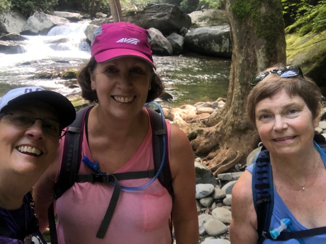
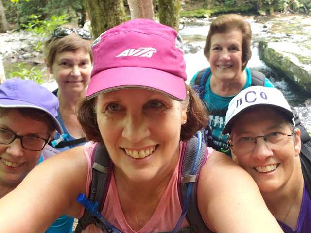
I left home at 6:30 am and met Alice and Mary Lou, along with their friends Barbara and Dianne, at Kroger in Alcoa at 8:30 am. We all loaded our gear into Mary Lou’s car and headed through Townsend into the Great Smoky Mountains National Park. We then drove on to Elkmont, the former site of pioneer homesteads, a logging town, and a resort community. Many of the resort’s cabins have been razed, but those remaining are protected as they have been listed on the National Register of Historic Places.
One of these remaining cabins is a virtual geocache. Unlike a traditional geocache, there is no container at a virtual cache. Instead, one must perform some kind of duties to log a virtual cache, such as messaging the cache owner answers to questions about what you see, and taking your photo at the cache site. Virtual or EarthCaches are the only type allowed in any National Park.
I collected the information necessary to log the virtual cache and took a selfie so that I could log it on my return home. We then made our way to the Little River trail head, and began our journey.
This is a wide, well-maintained trail, following the Little River. The beginning of the trail takes you past plots where several of the razed cabins once stood. One of these was the site of a second virtual cache, so I paused once again to take the required photo. We continued a little further up the trail, but then Alice realized that we had missed the side trail that leads to the “troll bridge.” This is a scenic spot that is often visited by hikers, and one that I had never seen. Since Dianne had not seen it either, we decided to backtrack and find it.
The bridge was a beautiful arched bridge constructed of stone crossing a small stream. It was easy to imagine trolls living beneath it. We took turns posing for photos, and then made our way back to the trail to continue our hike.
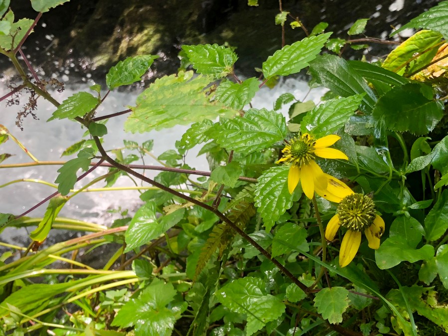
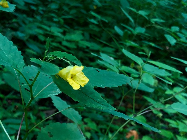
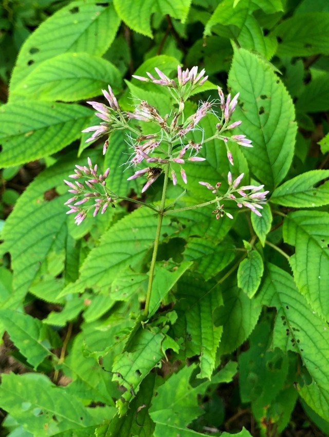
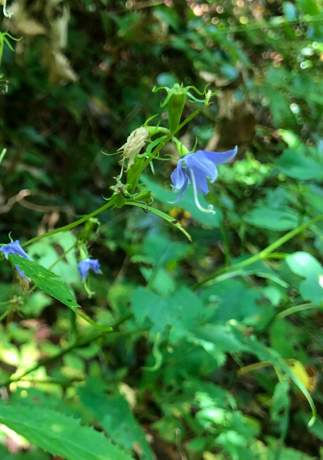
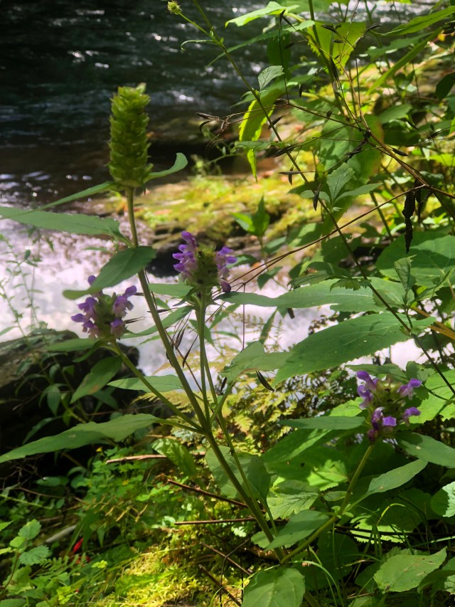
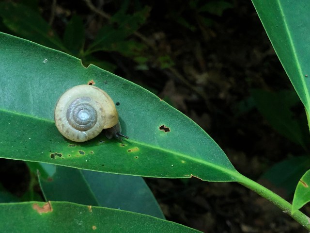
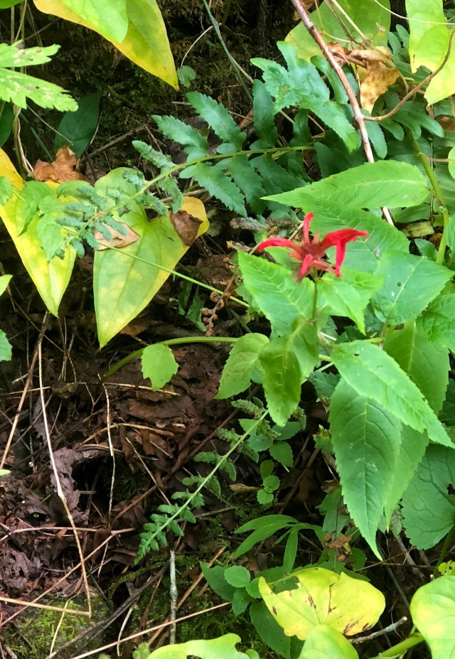
Mary Lou found a turkey feather that she wore the rest of the day. Although spring wildflowers have long since stopped blooming, there are many summer wildflowers that we enjoyed along the way. We saw pale jewel weed, Asiatic day flower (which I love, but some in the area consider it to be an invasive species), lop seed, dwarf Joe Pye weed, southern harbell, heal all, green headed cone flower, and doll’s eyes.
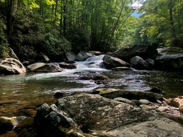
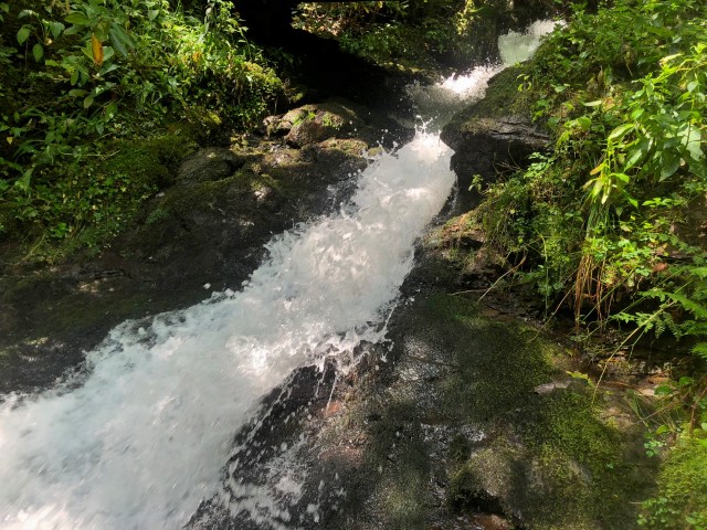
The river was beautiful, with many small cascades. Mary Lou, Barbara and I scrambled down the bank at one point to take photos. At another point in the trail, Alice shared the story of hiking there with her granddaughters, one of whom slipped and fell into the river. She tried to put her feet down, but could not touch the bottom. Rather than panic, she realized she knows how to swim, and did just that. While the current carried her downstream, she swam toward the bank and was able to find a place to climb out. Luckily, we had no such incidences today.
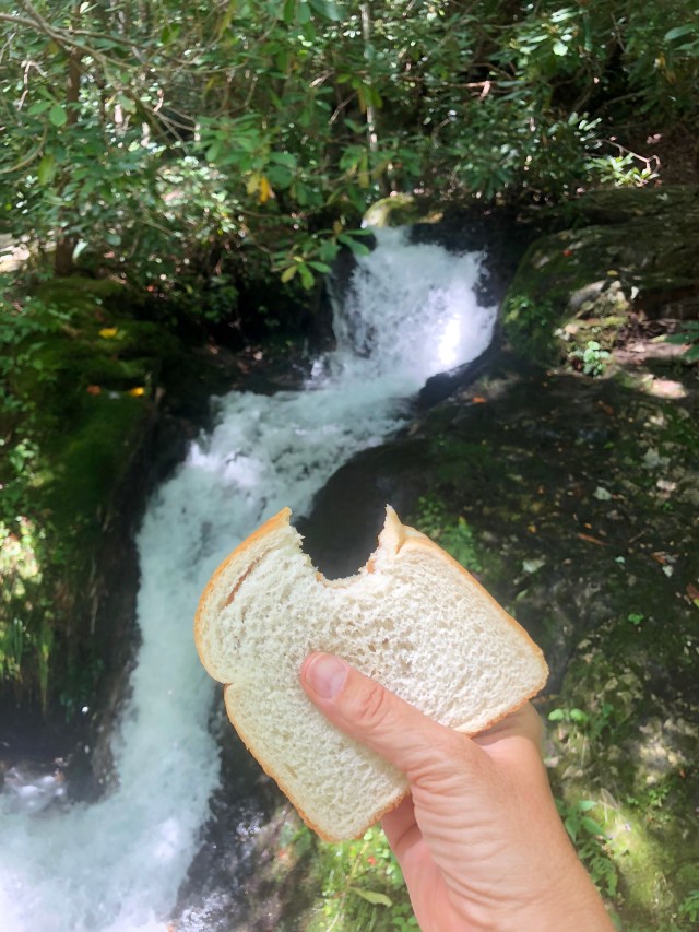
A little over 2 miles up the trail, we reached Husky Branch Falls. This water fall flows down the hillside and under a bridge before ending in the river. I climbed down next to the river to take some photos of the lowest section. Mary Lou tried to talk me into jumping in for a swim, and it was tempting, but I decided not to.
When I had climbed back up to the bridge, Mary Lou showed me a spot where I could climb up next to the falls and see more cascades above them. I did so eagerly, and was treated to some beautiful views. When I returned to the bridge, the others had already eaten their snack and were ready to move on. I had brought along a peanut butter, mayonnaise and cheese sandwich in memory of Daddy because he taught me to eat this weird sounding concoction. I munched on it as we headed on up the trail.
Soon, we reached the intersection of the Little River and Cucumber Gap trails, and took a right, continuing to climb in elevation. This trail is narrower and more rugged, but still very well maintained. Alice assured us that it would uphill just a little longer, and then we would start back down. She lied.
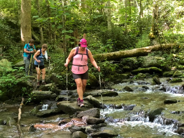
We continued up until reaching a stream crossing that Alice had told us about. According to the map, it appears this is part of Huskey Branch. There is a very good route for rock hoppers, and I made it across easily. I took a few photos from the other side as Mary Lou, Barbara and Dianne crossed. Alice had brought her water shoes and opted to change into them and just wade across. She had fallen in a creek recently, and did not want to chance a repeat performance. I crossed back to her side, and crossed back with her so that I could be close if she fell. Mary Lou was also prepared for her to fall – prepared to take a photo! Fortunately, she didn’t get that chance because we made it without incidence.
During one of those crossings I had noticed a heart shaped rock partially covered by the water, and so went back to find and take a photo of it. Mary Lou watches for and photographs hearts when she is hiking, and had missed this one.
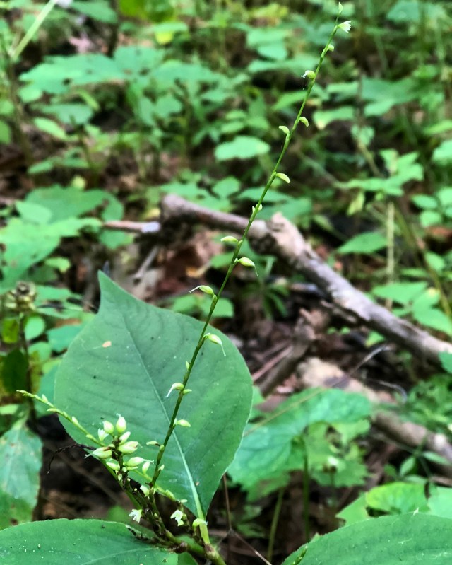
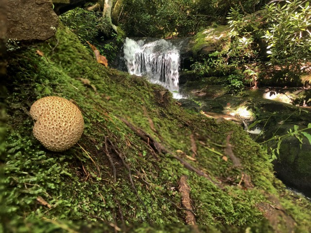
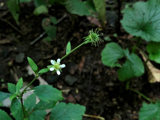
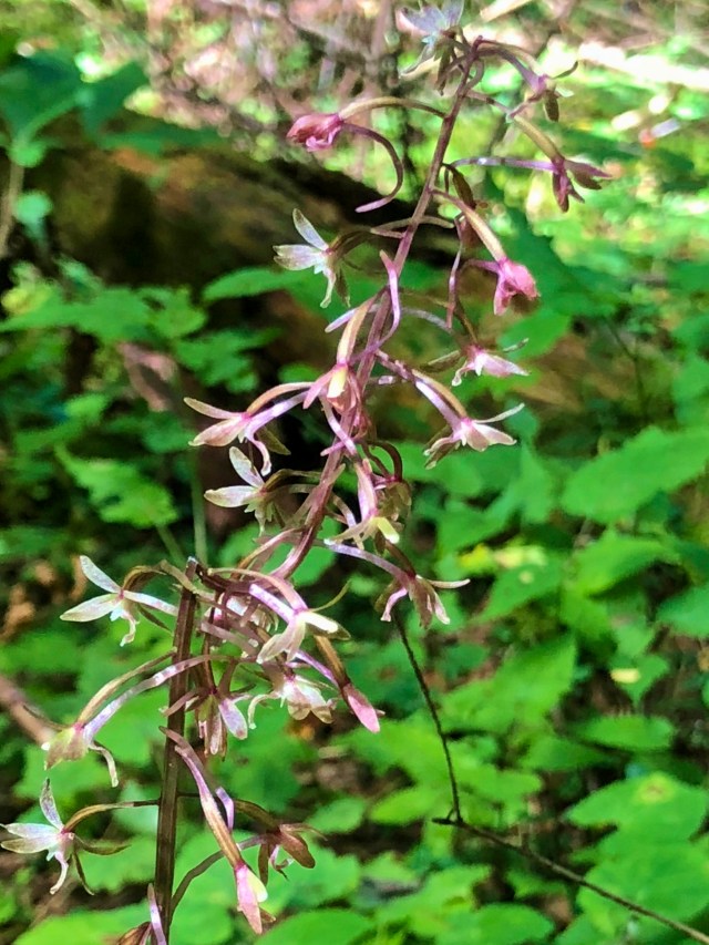
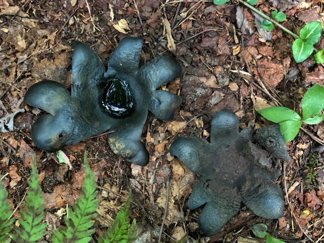
Once Alice had put her hiking shoes back on, we headed on up the trail. This section of trail had a lot of interesting fungi, as well as some more wildflowers we hadn’t yet seen. We saw cucumber root, club spur orchid, crane fly orchid, hawkweed, as well as some flowers none of us recognized. There were three places we saw bear scat in the middle of the trail, with the third spot being very fresh. We were sure to make lots of noise along the way in order to scare of any bears that might still be nearby.
This section of the hike is much quieter than what we experienced the first couple of miles. Without the sound of the river, you can hear much more of the forest. At one point we heard a woodpecker, but did not see it. There is ample shade, which was very welcome on this warm, humid day.
As we continued the uphill climb, we encountered a young couple coming down. They were doing the same loop, but in the reverse direction. They asked how much further to the trail junction with Little River trail, and in turn we asked how much more uphill climbing we had. Despite Alice’s constant reassurance that we were near the top, they said we still had quite a climb ahead of us. Fortunately, it was never very steep, so we continued to plod along.
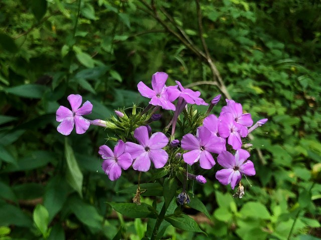
Finally, we reached the top and the trail leveled out. Soon, we were at the junction with Jakes Creek Trail, and began our descent. This trail is wide and gravel. The gravel was somewhat loose, and hard on the feet, but it was nice to be finally going down hill. We made the .7 mile trek back to parking quickly. I paused a few times to take photos of bee balm, phlox, and another tumbling cascade that passes under a bridge.
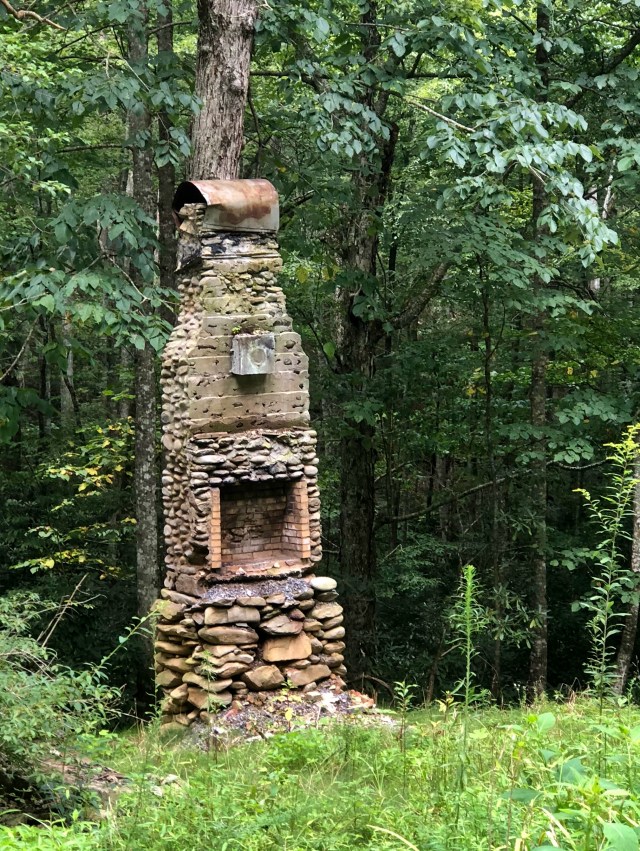
Near the bottom we saw more chimneys – all that remains of the houses along this road. One house is still standing. It was the home of Colonel David C. Chapman who led the effort to establish the Great Smoky Mountains National Park.
We arrived back at parking nearly four and a half hours after beginning our hike. My Map My Fitness app showed a total of 8.3 miles while the official distance for this hike is only 6.7. I attribute part of this difference to backtracking we did to find the troll bridge, crossing the creek extra times, and off trail jaunts to take photos. The rest is probably due to the phone’s GPS receiver getting “lost” from time to time due to the remoteness of the area we were in. Whether six, seven or eight miles, it was more than I had hiked in months, and I was pretty stiff and sore by the time I got home.
We finished off our time together with a delicious meal at Misty Morning Cafe. I splurged on a black and bleu burger and french fries, and even took Mary Lou’s advice and tried malt vinegar on my fries. It was a nice change from ketchup.
Now that I have this post knocked out, I will try to catch up on some of the others I’ve neglected to write. Stay tuned!


Loved your blog, Betty! Would love to follow your blog and learn more about geocaching! Great meeting you!
It was great to meet you as well, Barbara. I’m happy to have you follow my blog, and to teach you more about geocaching. I hope we can hike together again soon.