South Holston Lake
- 4.6 miles
- 3:24 duration
- 8 caches found (4 during paddle, 2 before and 2 after)
- 3 DNFs (did not find)
The weather forecast for this May Saturday was perfect for some time on the water, so I contacted geocaching pal porknbeans (Jane) to see if she was interested in paddling. We came up with two plans. Plan A was to paddle the South Holston River if TVA was generating from South Holston Dam. Without generation, the water flow is too low to navigate some of the more shallow rapids. Plan B was to paddle South Holston Lake.
I loaded Huck and all of my gear into my truck the night before, so that I would be ready to leave early. I checked the TVA app on Saturday morning, and they were not generating, so we decided to go with Plan B.
Actually, Jane proposed a Plan C, which was to launch from the Little Oak Campground boat ramp on the east side of the lake. This meant a longer drive, but since I had no experience on this lake, I was happy with whatever plans would get us on the water. She had already found all of the caches on this section of the lake, but was kind enough to tag along with me while I searched.
Jane sent me a GC code for a geocache that was in the campground, and I plugged that into my phone’s GPS. I texted back to let her know I would be arriving about 9:30, only to receive a reply that said she was still eating breakfast and that we should meet at 10:30. Since I was already out and about, I decided to search for a few caches on the way to meet her.
My first stop was near the Bristol Motor Speedway for what I thought would be a quick park n grab. Finding nothing, I checked the activity for this cache on the Geocaching app, and saw that the actual cache container had not been found in some time. The last “Found It” log stated that they had only found the magnet that was supposed to secure the container. Glancing back at the spot where I assumed the cache should be, I instead saw a very ugly, hairy spider. I don’t like spiders. I decided to DNF this cache and move on.
I stopped off to find two more caches along the highway, both of which required short walks from the truck. One of these turned out to be hidden by Jane, who I was on the way to meet. By the time I had found both of them, I decided it was time to head on toward our meeting spot and perhaps look for some caches closer to it.
My route took me on some narrow, winding, mountain roads. One of the geocaches along this route was named Little Oak’s Little Falls #1. I am always happy to visit a waterfall, so I decided to stop off to see if I could find it.
I parked and made my way up a small creek in search of the cache. The promised falls were actually a two foot cascade, but they were pretty. I spent about 30 minutes searching for the cache without success. It hasn’t been found since January 2013, so if it is still in place, it is likely buried deep beneath years of forest debris.
I did not log an official DNF on this cache because I don’t want to alert the Geocaching reviewers to its possible demise before I have the opportunity to go back and search again. Because this one is hidden in a national forest, the location will be lost if it is archived. It is difficult to place new caches in a national forest, and sometimes involves paying a fee, so we prefer to try to keep these older caches that were grandfathered in alive if possible.
Because it was past time to meet Jane at the boat ramp, I returned to my truck and moved on. When she arrived, I was happy to see that she had brought along Maggie, her Jack Russell Terrier. I wished I had brought Andy as well, but he probably would have gotten restless on this extended paddle. Besides, there isn’t quite as much room in the cockpit of Huck as in my green boat, so we would have been crowded.
Instead, I attached Signal the Frog® to his perch on the bow, and we headed out for an adventure.
Our first target was Cliff Island. It was a 1.56 mile paddle from the boat ramp and took us 35 minutes. The lake was very busy, with all shapes and sizes of watercraft. Fortunately, all of the faster boats gave us a wide berth so we were not in danger of being run over.
Cliff Island has long been a place that locals visit so that they can jump from the high rocks into the water. When she logged the cache there a couple of years ago, Jane posted a photo in her online log showing the Key Club from Tennessee High School dating back to the mid 1970s taking the plunge.
As soon as we had tied up our boats, Maggie dashed up the steep bank onto the island, with Jane close at her heels. She was glad to be on terra firma, but was also highly interested in the goose nest full of eggs near our landing point.
Mother Goose was on the island, and was not happy that we had come to visit. She stalked back and forth squawking at us. We gave her plenty of space, and began searching for the geocache.
Jane and BackWoodsAng (Ang) had replaced the missing container on their visit in 2016. It had not been logged since then, and we discovered that it was missing again. Fortunately, I had brought along some supplies, so I made my way back down to the boats to grab my dry bag. Mother Goose decided I was getting too close to her nest again, and began hissing at me. I assured her I meant no harm to her and her unborn babies.
By the time I had finished replacing the geocache, a pontoon boat had pulled up close to the island. Two young men swam from it and climbed up to take their turns jumping from the cliff. I shed my long sleeve shirt and pants, having worn swimwear underneath. After they had jumped a few times and moved on, Jane paddled into position with her phone’s camera at the ready. I performed a flawless (cough, cough) cannonball, video of which you can view here.
From Cliff Island, we paddled across the main channel to Gilligan’s Island to search for another cache. Jane and Ang had also replaced this one on their visit in 2016. The water level of the lake was much higher than it had been on their visit, and this island showed signs of having been flooded. The large sign marking this as the 2 mile point from the dam was lying on the ground, and a good deal of debris covered the island. It was also covered in a healthy crop of poison ivy.
This cache had gone missing as well, so I replaced it taking care not to trample the nearby nest full of duck eggs. Mama Duck was not nearly as aggressive as Mother Goose, and just paddled in the water nearby.
Because this tiny patch of land is in the middle of the heavily traveled waterway, our kayaks took a real beating while tied up here, and mine took on a fair amount of water. The traffic was constant. We laughed at the site of a house boat chugging by. I was impressed at how quickly the rather ungainly craft could travel.
We decided that it was time to paddle back in the direction of the boat ramp, with plans to stop off on two additional islands for caches. By this time we had traveled 2.3 miles and been gone nearly two hours.
We paddled a little over a mile to an island that had the sign marking a mile from the dam. The waves crashing against the rocky shore made exiting very difficult here, but we both managed to do it somewhat gracefully. I dragged my kayak up onto the rocks far enough to empty out some of the water that had collected on our previous stop. By the time I had done this and made my way up to the sign, Jane was holding the cache and handed it to me to sign the log.
We left this island and paddled to another that was within sight of the boat ramp. I exited my boat and commented that it was not as difficult as our last stop. I turned just in time to see Jane splash down on her butt in the water. She says I jinxed her.
We tied up our boats and made our way up a trail toward the center of the island. Suddenly, I noticed something through the trees, and realized that our path was going to take us right by an occupied campsite. As we walked closer, a trio of dogs alerted their owners to our presence. Jane scooped up Maggie, knowing that she would growl at them and possibly provoke them into a fight.
We called out a hello to the humans, and greeted the canines with pats on the head, and then continued toward the cache location. The cache was hanging in a tree – right next to a tent. Fortunately, the tent was unoccupied at the moment. I signed the log and took some pictures, and then made my way back to the trail.
I introduced Signal to the dogs, and one of them tried to get a little too friendly – wanting to chew his head off. I rescued him and continued up the path where I heard Jane chatting with the campers.
She had explained that we were geocaching, and he remarked that he had heard of it. In fact, he is a chiropractor and he had given a patient permission to place a geocache in his office parking lot. As we talked more, we made the connection that the patient he mentioned was our friend Rudekoolaid (Angela) and that another of his patients was Captain Jack of Cache Cracker Jacks (Tom).
We said our goodbyes and made our way back to the boats. It was a short paddle back to the boat ramp where we ended our excursion. We were sore and tired, but happy to have enjoyed a good time on the lake. Signal was wet from being splashed all day, so I put him on the dashboard of the truck in the sun.
After we had loaded our boats into our trucks, we decided to go in search of a cache hidden nearby that neither of us had found. I drove toward the coordinates with Jane following, but soon the distance began to increase instead of decrease so I pulled over to check the cache page. I discovered that this was not a cache that you could drive to. Instead, it was on a hiking trail that made a 1.5 mile loop. We decided we were not interested in hiking after our long paddle, so would leave that cache for another day.
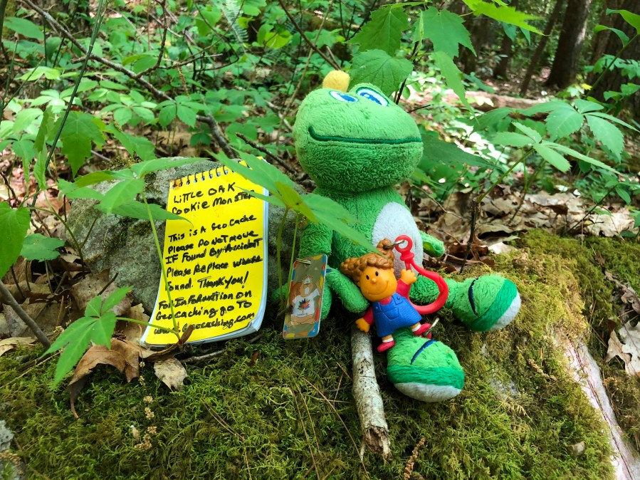
On the drive back, I stopped three times for geocaches. Jane joined me in looking for the first. It was about 200 feet from the road along a path. A few spring wildflowers were still blooming here, making it a beautiful spot. I was amazed to see that the original container – cookie dough tub – was still in excellent condition, considering it had been hidden in 2006.
The second cache was a quick park and grab right next to the road. The third was a bit more challenging. I spent about 20 minutes chasing the GPS signal through the woods, wandering in circles, and looking at every stump I could spot because that is where the hint indicated it was hidden. It had been found recently by my friends Ang and Reis’s Pieces (Scott). I would have texted them for help, but I didn’t have a signal on my phone.
I finally gave up the hunt and made my way toward home. Later in the evening I texted Ang who told me that the cache was closer to the creek than where I was looking. I will give it another try on my next visit to the area.
By the time I arrived home, I was too tired to even unload my boat and gear from the truck. I have certainly done longer trips with Huck, but since this one was on flat water, I had to paddle much more than usual. But, it was a beautiful and fun day, so I didn’t have any regrets despite the fatigue and sore muscles.


