Steels Creek Trail/Upper Creek Falls/Fireman Falls, NC
Steels Creek:
- 6.6 miles
- 5:11 duration
- 687 feet elevation gain
- 2 sets of waterfalls
Upper Creek Falls:
- 1 mile
- 30 minute duration
- 90 feet elevation gain
- 2 waterfalls
Fireman’s Falls
- 100 foot hike
- 5 minutes duration
- 10 foot elevation gain
- 1 waterfall
- 1 Earth Cache
I received an invitation from Rob to join a small group hiking to a spot in North Carolina that our friend Berta has visited many times. It was a series of waterfalls that she called The Kettles. Berta was to be our guide, and joining us were Rob’s brother Richard and our friend Doreen. Richard and Rob picked me up early Sunday morning to make the drive over the mountain to Newland, NC to meet Doreen and Berta.
Unfortunately, Berta was having some health issues and wasn’t going to be able to join us on the hike. However, she led us to the trail head so that we would know how to get there. Richard had done this hike before, but it was many years ago. Doreen had hiked it with Berta, but didn’t remember a lot about the route.
In emails we exchanged prior to the hike, Berta had sent a link to a website and said this was the area we would be hiking in. It was for Steels Creek Falls, and while doing some research on it I discovered another website for the Hiking Project. This site includes a phone app that allows you to follow trails using your phone’s GPS and even map your own routes. I downloaded the Tennessee and North Carolina trails in preparation for this hike and the one I did on Friday along Kephart Prong Trail.
When we arrived at the trail head I noticed a sign saying that this was part of the Mountains-to-Sea Trail. This trail is about 1,200 miles long and stretches from Clingman’s Dome in the Great Smoky Mountains to Jockey’s Ridge in the Outer Banks.
We set off down the trail after telling Berta goodbye. By “down the trail” I literally mean DOWN. The first several hundred feet were a pretty steep descent, and then we continued to hike down, down, down for nearly a mile. Of course, we knew this would mean hiking up, up, up at the end of the day, but Berta had told us it was only about a four mile round trip so we felt confident we could make it.
Along the way, Doreen pointed out many different kinds of mushrooms. She knew the names of most of them, but I don’t remember much of what she told me. I do remember at one point she showed me black trumpets and said that they were a delicacy and would cost big bucks in the grocery store.
Once the trail leveled out we had four wet foot creek crossings. Berta had told us to expect five crossings so we had all come prepared, wearing sandals to hike in. All along the way were helpful white blazes that let us know we were still on the MTS trail.
We eventually came to a split in the trail where we also had to climb over some fallen trees. We then continued following the white-blazed trail. Shortly after that dead fall I noticed some cascades through the trees to the left of the trail and looked at them longingly as we passed by. I hoped that I would get to stop and take some pics on the way back.
After going a bit further, we paused for a discussion about whether we should keep going or if we had missed a turn at some point. I pulled up my Hiking Project app, and pointed out the icon on the map for Steels Creek Falls. It was still a good distance away and on the map it appeared we would have another descent since there were several switchbacks.
We continued on down the trail and soon came to those switchbacks. As we went down, we once again knew we would need to climb back up later. At one corner, we saw falling water off in the distance through the trees that looked pretty amazing.
At the bottom of the switchbacks we came to a level camping area, and stopped to discuss which way we should go. I once again pulled up the app, and we decided to continue following the trail as we were not yet to the icon on the map indicating the falls. Plus, we had not yet done our fifth creek crossing as instructed by Berta.
Richard had in his mind a picture of what we would see when we arrived at The Kettles, and he had not yet seen that spot. I remembered thinking about how Rob had told me it would be a four mile round trip, easy hike. But, he and I have lied to each other before about distance and difficulty of a trail. Usually not on purpose, but because our memories from prior hikes were faulty. Doreen kept commenting that she felt we had missed a turn because the route we were taking did not seem familiar to her.
Eventually, we reached a spot on the trail that matched up with the waterfall icon on my app. Through the woods to the left we could see water, and we could see faint footpaths leading down a steep embankment toward the water. But, both Richard and Doreen agreed that this did not look familiar to them.
We continued down the trail, thinking there would be a level path leading back up to the falls, but never saw anything. Finally, Doreen stopped and called Berta. I’m not sure what magic trick she pulled to get a signal, because I certainly didn’t have one. Berta told her that if we could see The Kettles through the trees, we had gone too far and that we needed to backtrack above them, cross the creek, and approach from the other side.
We went back up the trail, passed the falls, and began looking for a place to cross the creek. We crossed in a couple of spots, but couldn’t find a trail on the other side. We went back and forth some more trying to decide what to do. Doreen called Berta again and found out that we had gone much too far. She said that we should not have gone past the switchbacks that we had come down. Oh great!
We decided that the cascades we were seeing through the trees were too enticing to pass up, so we braved the steep climb down the hillside to explore them. We were certainly glad we had, because we found ourselves on a wide, sloping rock that jutted out into the creek above and below some beautiful waterfalls.
Across from us was a boulder the size of a dump truck that seemed to be precariously balanced above the creek. Above us the falling water had carved out huge pot holes filled with pools of running water. And, below us was a chute of rushing water that must have been glorious to behold from below, if only we could figure out a way to get there. What we were seeing matched up with our memory of the photos we had seen online of what was called Steels Creek Falls, but Richard and Doreen agreed that this was not The Kettles.
After taking a few pictures here, we decided to climb back up to the trail, and retrace our steps to find The Kettles. We agreed that even if we didn’t find them, it would be worth the trip to observe what we had just seen. The anticipation of seeing more beautiful falling water gave us the energy needed to make the ascent through the switchbacks.
Finally, we arrived back at the spot where I had seen water through the trees a few hours before, and decided that this was indeed what we had been looking for all along. We continued back up the trail past it as instructed by Berta, climbed back over one of the fallen trees, and went toward the creek through a camping area. We waded into the creek, and suddenly things looked more familiar to Doreen.
As we were wading down the creek to the top of The Kettles, we heard someone call to us from the trail above. A young man came to the side of the creek and shouted to us that if we were trying to get to the waterfall, we should come back to the trail and that were was a side path right down to it.
Rob and I made our way back across the creek, fought through some heavy overgrowth, and finally got to the trail. The young man told us that you could wade down the creek to reach it, but that was the hard way. He told us where to find the path we needed, and then headed back up the trail with his party, including a young woman who was hiking barefoot!
We heard Doreen and Richard shouting for us as we found the footpath, and as we got down to the waterfalls saw that they had reached them from above and were shouting to tell us they had found them. Finally, we were where we had wanted to be all along!
The Kettles, or Tea Cups Falls as I later learned they are called, is a series of beautiful cascades falling into very deep pools of water, followed by a wide sliding into another pool. Doreen took a swim, ate a quick lunch, and then headed back to her car. She needed be home to care for a dog she was sitting for.
The guys and I spent quite a while here taking pictures, eating our lunch, and enjoying the beauty. Richard swam in some of the deep pools as well, and could not touch the bottom. Rob and I opted to stay dry so that we would not have a soggy hike back to the truck.
The hike back up the trail was a climb as I had expected, but we made it in fairly good time. By the time I was at the top, I was wishing those cool pools of water were there at the parking area since I was now quite warm. I changed out of my hiking sandals into crocks, and put on a fresh, dry shirt before we left. We had spent over 5 hours on the trail and hiked 6.6 miles, much more time and distance than we had anticipated. But, we agreed that we were not mad about the opportunity to see two great sets of falls.
As we were driving back up the forest road, we spotted another waterfall through the trees, and discussed looking for a geocache nearby. But, getting a closer look at the falls and looking for the cache would both have involved bushwhacking on steep terrain, so we decided to leave those adventures for another day.
Once we reached the main road, and headed toward home, we decided to stop off for a look at Upper Creek Falls. Richard remembered this as being right off the highway. Rob saw that there were a couple of geocaches here, so we were game for a stop.
When we pulled into the parking area full of cars, we saw two signs. One pointed to Upper Falls and the other to Lower Falls. We decided to check out the Upper Falls, and followed the indicated trail. Rob’s compass showed that the first geocache we were searching for was just .15 mile away. AS. THE. CROW. FLIES! That .15 miles became much longer as the trail went on and on, back and forth, and down, down, down. Again with the down! And, in case you have forgotten, I had already changed into crocs, which aren’t the best hiking footwear on a rough trail.
We finally saw a set of steps leading down to the creek, crossed the creek, and began looking for the geocache. But, the GPS signal was very jumpy and we didn’t want to spend too much searching so we gave up and explored the waterfall instead.
The upper falls are pretty but not very impressive. There appear to be a couple of slides and some swimming holes that seem to be popular with the locals. We did a bit of bouldering, looking for the best photo ops, and made our way down through the creek toward the stairs back to the trail.
Before heading back to the truck, we decided to walk downstream a bit to see if we could spot the lower falls, and found ourselves at the top of them. We didn’t want to get too close to the edge, but were able to snap off some pics. We then made our way back up the trail toward the parking area. I learned later that we could have followed a trail on the opposite side of the creek down to the base of the falls, cross the creek again, and then follow the trail up to the parking lot from there.
I decided to map our walk back to parking, and it turned out to be a little over one half mile. Uphill. In crocs.
As we headed toward home, we decided to stop and grab some supper. Richard spotted an interesting looking spot and made a u-turn to check it out. It was called Mountain Crossing Mercantile and so we went in to get some sammiches. No, I didn’t spell that wrong. Check the pic below.
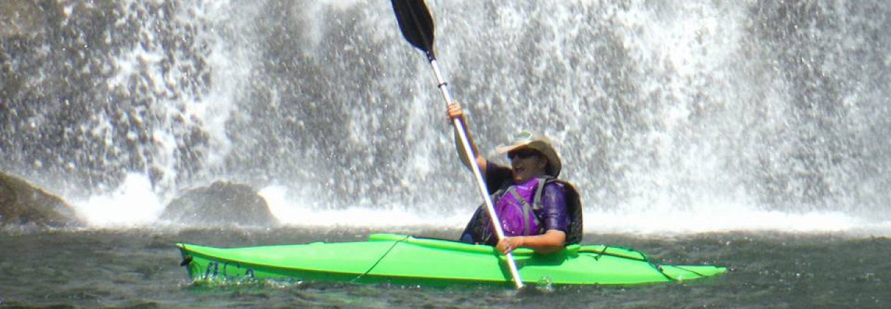
After our meal, we climbed in the truck and headed toward home once again. But, as we were driving through Newland we decided to make one last stop at Waterfalls Park. Unlike Upper Creek Falls, this little waterfall really was right next to the road. We took some quick cell phones pics, Rob and I gathered the info we needed to claim the Earth Cache there, and we returned to the truck for our trip home.
It was a long day, but a great one with many beautiful sites. There is so much more to explore in this area, and I look forward to returning here.


Looks like a fabulous day. Love your photos