
Steele Creek Park
- 5.63 miles
- 4:49 duration
- 1,325 foot elevation gain
- 39° L/42° H
- 3 geocaches found
- 1 DNF (Did Not Find)
LakeBum (Rob), Andy the geopup and I decided to return to Steele Creek Park to log caches on the northeast side of the lake. We met up at my house at 8:30 am and made the drive to Bristol.
Before our hike, we visited the Bark Park to look for a cache. Andy was not impressed by the big, white dogs that barked at us through the fence as we skirted the park. Once we were safely past them, we entered the woods in search of the cache.
Unfortunately, none of us could sniff it out, making this our one DNF of the day. After giving up the search, we crossed the trail to check out an abandoned structure crossing the nearby creek. It looked to have been some kind of bridge, but wasn’t wide enough to have carried vehicles. We speculated that it may have been to carry pipes of some kind across the creek.

We walked through the dog park on our way back to the truck, but Andy was too concerned about the big dogs to run and play.
We moved the truck to the parking lot at Rooster Front Park and started our hike along Lakeside Trail at 9:41 am. The temperature was a crisp 39° and the skies were partly cloudy. I pulled my hood up to protect my ears from the cool breeze.
I used the leash belt I bought several years ago, wearing it around my waist and looping the handle of Andy’s leash through it. This left me with both hands free as we walked. In my left hand was my faithful cedar hiking stick that has traveled many miles with me the last two years.

We passed above the waterfall, allowing me to see it from a different angle than previous visits. Because it had rained all day on Saturday, it was flowing nicely.

Shortly after the waterfall, we came to a trail junction and turned right onto Fox Ridge Trail. It was a very steep climb, and the trail was washed out making it rough going the first fifty feet or so. From there it was a steep, steady climb for about .2 mile. When the trail finally leveled out and took a left hand turn, Rob said, “The cache is over there somewhere.”
This first cache was one that he had found almost four years ago. We moved in the direction he had pointed and began searching. The cache had last been found in May 2018 and had been DNF’d in January 2019. Rob was ready to give up the search and move on, when I poked my stick in just the right place and heard a “clunk”. I dug around a little in the leaves and dirt under a rotting log, and produced a small metal box.

The hinges on the box were a bit rusty and resisted my efforts to open the lid. I finally wrestled it open and found the contents to be in fairly good condition. I signed the log book, took a few photos, and then had to fight the lid again to get it closed.

Rob and I discussed our plan of attack for the other two caches in the area. We decided to continue along the Fox Ridge Trail “to get some miles in” in Rob’s words, circling around to the farthest cache, then catching the nearer one on the way back. This looked like a good plan on the map. In reality, maps rarely show the terrain one will encounter between point A and point B.
The trail climbed 300 feet in elevation over the next half mile. As usual, we complained every step of the way but continued plodding along. We finally reached the highest point, descended a little and began to climb again. We reached another high point a little over a mile into our hike, and paused here so that I could hide a cache.
As I took off my pack and set it on the ground, I noticed that Signal the Frog was trying to make another grand escape. He has been known to do this from time to time when we are hiking. This time he was barely hanging on by his toes to the pocket he was supposed to be riding in. I tucked him back in safely and told him to behave.


We had noticed on the map that the trail at one point seemed to run parallel to a road. A short distance from where I had hidden the cache, we caught a glimpse through the trees of a forest road – unpaved and ungraveled – as well as No Trespassing signs and a gate. A little further along was a paved road and houses. They must have a spectacular view from up on that hillside, but I’m sure it is no fun getting in and out in the winter.
One of the houses was across the street from a gate leading into the park. I said it must be really nice to be able to walk out your front door and onto these hiking trails. Rob replied that they probably never do, like people who live on a lake and never use it.

We soon came to the end of Fox Ridge Trail, and turned left onto Powerline Trail. True to its name, this short .3 mile trail passes under high power lines. We then came to an intersection that was a bit confusing as many trails came together in the same area. We finally determined which trail was the one we wanted, and turned left onto Rock Cut Trail.
We had a steep and rough descent over the next .3 of a mile. There we reached a rock cut that obviously gives this trail its name. Rather than continue on the trail through the cut and around a sharp turn to the right, we continued forward on an unmaintained and unmarked manway.

This manway took us along a narrow ridge. To our right was a very steep drop off to the Steele Creek Park Lake. To the left was a somewhat less steep slope into a valley. We followed this ridge for about .2 mile to where it ended, and began searching for the geocache hidden there.

We searched for quite a while before I finally spotted it in plain sight – if you were on the right side of the log it was under. Once I opened the container I found some trinkets inside, but no log sheet. Fortunately, I had a small log book in my pack that was the perfect size for the cache.

After placing the cache back in its hiding place, we sat down to eat lunch since it was a few minutes past noon. I let Andy off leash so that he could roam a bit, and he was very good to stay between Rob and I while we ate.
I had brought homemade chicken and wild rice soup in my thermos. I spooned some of it into the lid for Andy, and then ate the rest directly from the thermos. He ate a few bites, but must have decided he didn’t like it. We each offered him other tasty treats from our lunches, but he was more interested in exploring the area. He didn’t even want the water I offered him. Silly dog.
Earlier I had mentioned that I should try to rig up a saddle for Signal so that he could ride on Andy’s back. While we were eating, I tried looping Signal’s legs through the rings on Andy’s harness. He wasn’t thrilled with the green frog on his back, but did stay still long enough for me to take a picture before bucking him off.

Once we had finished eating, Rob and I checked the maps on our phones and brainstormed plans for reaching the final cache of the day. It was only about half a mile away, but by trails would be much further.
We finally settled on a plan. We would backtrack along the ridge to where we had left the Rock Cut Trail, and then follow a creek from that point down into the valley. That creek ended at the lake where we could then follow the Lakeside Trail around to a point where we could re-enter the woods along another creek in another valley and search for the cache. We weren’t sure this was the best decision, but it seemed like a better idea than hiking an extra mile or so just to stay on the trails. Besides, if we wanted to stay on the trails we would have to make that tough .3 mile climb back up Rock Cut Trail.
Pleased with our decision, we set out to find the cache. Walking along the ridge and observing the steepness of the terrain into the valley solidified our decision to go to the trail and then down. Once we reached the trail, the slope along the creek through the valley was gentler.
This did not mean it was easy going. While the creek was not big or deep, it was very rocky. The slick leaves over and around the rocks made the footing tricky and I tripped and slipped several times. I eventually let Andy off his leash again so that I would not fall on top of him or get pulled down by him.
We had been following the creek for what seemed a very long time, and were not even halfway to the end. We noticed a wash up the hillside toward the trail that ran along the next ridge, and discussed following it. It didn’t look so bad. “Follow one bad decision with another?” Rob asked. I would rather go up steep, rocky terrain that continue slipping and tripping down along a creek so I said, “Sure. Why not?”
And up we went. It was brutal; much steeper than it looked from below. We had only gone about 30 feet when I said, “I should make other people do this by hiding a geocache here.” I was only halfway serious, but within a few steps Rob said, “That looks like a good geocache tree.”
He was right, so I stopped to hide a cache there, laughing at the thought of the poor souls who will choose to search for it. I will be calling this cache “Choices”.

We continued our climb, and at times were literally climbing hand over foot up the rocky wash. I said I was thinking about moving out of the wash to angle up the hill at a gentler slope. Rob thought I meant up the steep hill to the right, but when he realized the hill to the left looked more friendly, he decided to do the same.
Finally, we reached the trail at the top of the ridge and stopped to celebrate. We did not spend much time on the trail, however. The next cache we sought was almost straight down the other side of the mountain. I mean ridge.
As we made our way down, Rob’s phone rang and he stopped to chat with his mom for a bit. When he was finished we continued down to the bottom. Along the way we spied a deer running through the woods. Andy was still off-leash but stayed put rather than chasing it when Rob told him “NO!” He is such a good boy.
I reattached his leash for the rest of the trip down. Hiking with a leashed dog isn’t too bad on a nicely maintained trail. Bushwhacking through the woods with a leashed dog is a bit more challenging. Especially when said dog goes under the logs you must go over, or goes in the wrong direction around an obstacle. I also found myself having to turn in a circle occasionally, unwinding his leash when it wrapped around my legs.
At the bottom of the hill, we began searching for the geocache. This was an older cache that had been adopted in recent years by our friend Lob the Huntsman (Ray). He had determined that the cache was missing and had replaced it. It had only been found once since then, in November 2017.
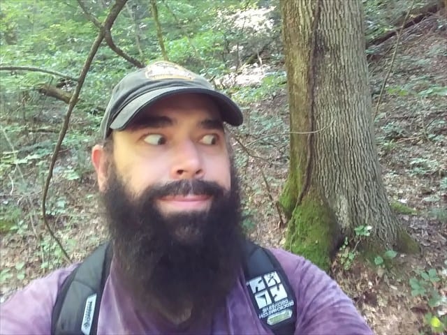
The GPS signal in this valley was very “bouncy” making it hard to pinpoint the location of the cache. Ray had provided a spoiler pic when he replaced the cache, and it showed him cutting his eyes toward a tree in the background with a vine growing up it and moss on the exposed root. Rob spotted a tree that he thought matched that pic and we made our way to it. Searching all around it did not expose the cache. I looked at the photo again and told Rob that this was the wrong tree because the vine curved in a different direction. We spread out and checked every tree in the area that had vines on them.
After searching for about 40 minutes Rob pointed out that the spoiler picture Ray had posted was a selfie, and that the lettering on his hat and clothing was backward. I looked more closely and realized he was right, and that the picture did indeed match the original tree we had searched.

Rob texted Ray and learned that the cache had been hidden in a hole at the bottom of that tree, but it was obviously gone now. With his permission, we replaced the hide with a pill bottle I had in my pack.

We were good and tired by now, and ready to head back to the truck. We followed the creek out of the valley, coming to the trail within 10 minutes. Our journey would have been so much easier if we had followed our initial plan of making our way to Lakeside Trail and following it around to re-enter the woods at this point.
Another 10 minutes had us back at the truck and I gratefully climbed in. I munched on an apple as I drove us home. Andy, who had been excited and whining most of the trip to the park that morning was now passed out in the back seat. I was looking forward to getting home so that I could do the same.
Another “shortish” hike had turned into nearly five hours of tough terrain, but had netted me three more smilies on the map and two new hides. That evening as she watched me struggle to walk after standing up from the couch, Deban asked if it was really worth it to hike so far. I told her that it wasn’t the distance today, but the rough terrain that had done me in. But, yes. It was totally worth it!

