
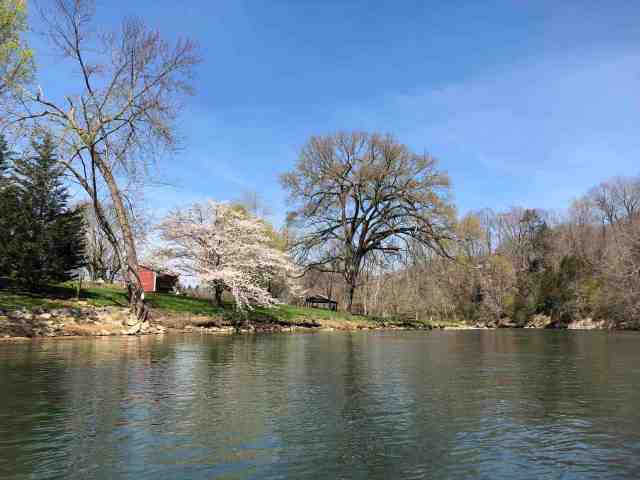
Watauga River ~ Blevins Road to Riverview Drive
- 6.76 miles
- 3:59 duration
- 63 degrees
My friend Rob had been telling me for a month or more that his brother Richard was planning a paddle trip on this date. Since it was a weekday, I wasn’t sure I could join them, but then realized I still had a comp day on the books after my recent continuing education trip.
On Tuesday, Rob texted me to say that we would make this an afternoon paddle to take advantage of the warmest part of the day, followed by dinner at Pizza Inn. This was fine with me because I would be able to work half a day to catch up on some things. I planned to forego the dinner part and eat with my family, but was happy for an afternoon paddle. When I got home from work on Wednesday, I loaded my boat and gear in the truck so that I could leave directly from the office on Thursday.
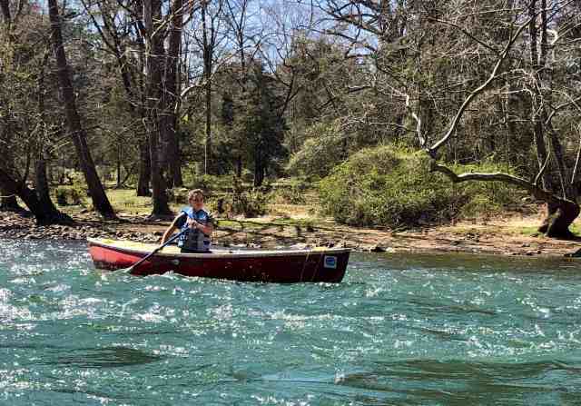
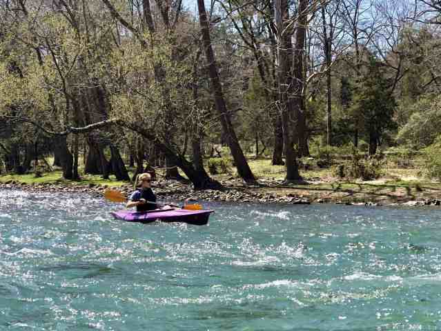
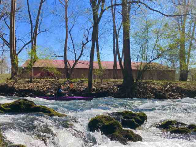
I met Rob at the take out point at 12:30 and we put my gear in his truck. We then left my truck there and made our way to the launch point at the Blevins Road boat ramp. There we met Richard, his daughter Julia, and her friend Elizabeth. I was happy to see that Elizabeth would be paddling a kayak so I wouldn’t be the only yakker in the group.
The day was warm and sunny. The river water was crystal clear and flowing well. although the water level was a bit low. TVA was not generating at Wilbur Dam (which would have produced higher water levels) but they were sluicing – dumping water from Wilbur Lake to keep the lake level down. As usual, the water temperature was quite cold.
As I carried my boat to the water, a fisherman seated nearby asked if we could launch a little further downstream. He said he was catching some big fish from his spot, and didn’t want us to scare them away. I obliged and moved downstream about 30 feet.
Before we got into the boats, I heard Richard giving Elizabeth a few safety pointers before we got started. His most important advice is, if you overturn your boat, just point your feet downstream and float until it is calm enough to stand or swim to shore. Never try to stand and walk in the rapids because if your foot gets caught under a rock the current might push you face down and you will drown.
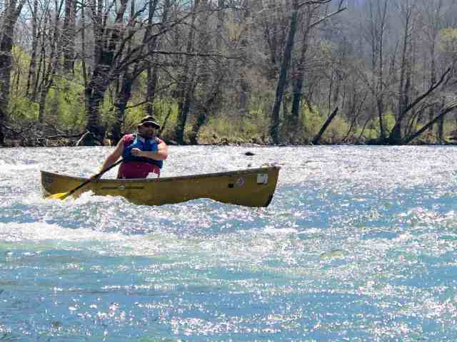
We began paddling downstream at 1:20. And by paddling, I mean we mostly lazily floated along, using our paddles to steer. This was going to be a relaxing, laid-back trip.
I settled in to my boat and soaked in my surroundings: the warm sunshine, the fresh air, the crystal clear water, and a blooming fruit tree.
I spent a long time floating along and watching small birds around multi-holed birdhouse on a tall pole next to the river. They chirped at each other as they alternately landed at the birdhouse, swooped through the air nearby, and dived at each other. I don’t know if they were playing, or if they were arguing over who got to build a nest in what hole.
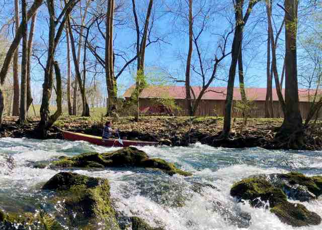
We passed through the first rapid without any problems. I pulled over to the side to investigate water flowing from the rocks in a place I had never noticed. On further examination, it appeared to be seeping out of the earth between the bedrock and the limestone cliffs. We had a great deal of rain in February and early March, so this is an indicator that the ground is still saturated.
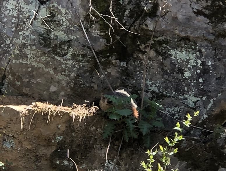
Further downstream Rob was staring at the shore and finally said, “There he is.” I asked what he had seen, and he told me he had heard noises and finally spotted a groundhog. I grew closer and saw the chubby little fellow eating some leaves along a rock face. He was shy, so I had trouble getting his photo, but if you look closely at the patch of dark green leaves in the center of the photo, you can see him peaking out.
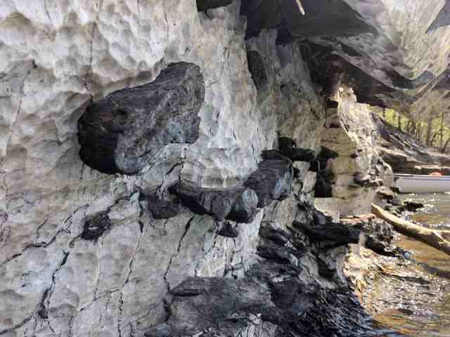
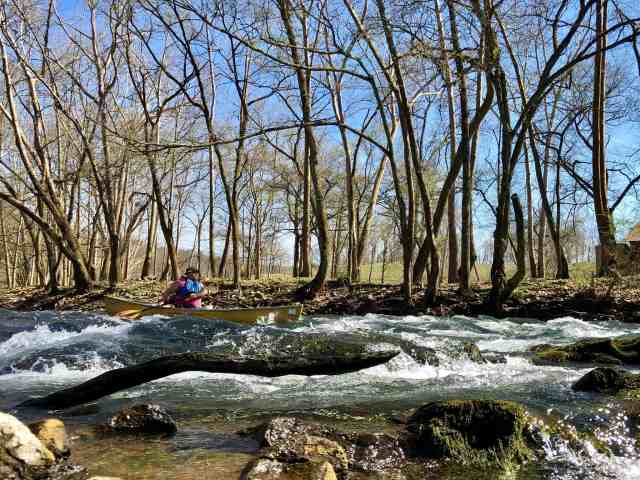
Richard and I went first through the next set of rapids, and then pulled over in a calm spot next to what is known as Moody Cliff so that we could take photos of the others as they passed. Rock cliffs reach from the water line to tower about 100 feet above you. As we waited for the other boats to pass, I noticed something very interesting about the rock face next to my boat. Most of the rock here is light colored, and obviously a somewhat soft rock – probably limestone. Jutting out from this softer rock was a harder black rock of some kind. The river had washed away the softer limestone to reveal this dark rock that was embedded inside. I wish I knew more about how to identify rock so that I could know what type this is. Whatever it is, it produced a nice hand-hold so that I could steady my boat while taking photos of the others in the group.
Traveling a little further downstream, I spotted something swimming in the water. It was moving too fast for me to get a photo and soon disappeared under the overhanging bank. Rob and I were discussing what it could have been when I saw another one running along the bank with a huge wad of wet grass in its mouth. Rob confirmed my initial thought that it was a muskrat. It was apparently headed to its nest with new building materials.
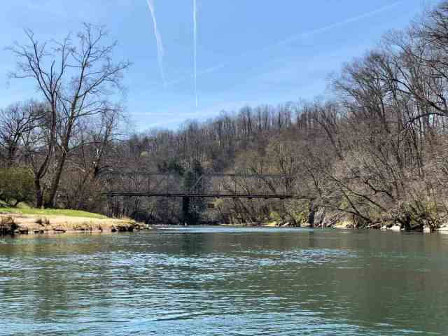
We passed under the picturesque Smalling Bridge 45 minutes into our trip. Rob checked to see if the geocache he had hidden on a bridge support was still there, but it appeared to be missing. He will need to bring along a replacement on our next trip.
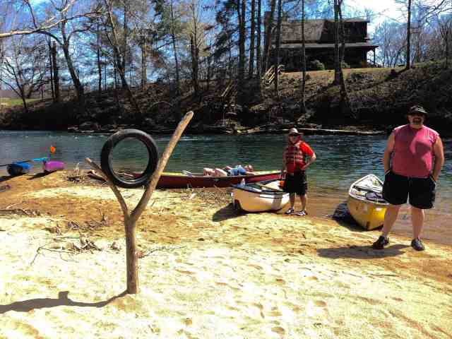
We pulled over at a beach just beyond the bridge for a snack break. This turned into an extended stop of nearly forty minutes. The teenagers were enjoying the warm sunshine while the adults chatted. Someone had wedged a spare tire into a forked branch on the beach, and I played at framing shots of the kayaks through the tire (see featured photo at top of page)
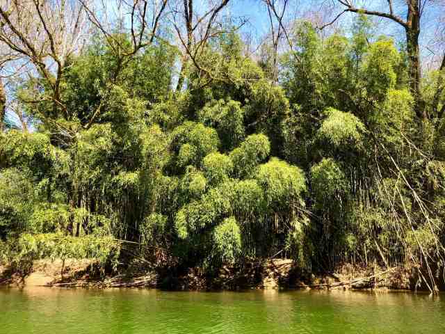
Once on the river again, we paddled past a beautiful bamboo forest. There are several places along the river that have thick growths of bamboo, but I believe this is the largest.
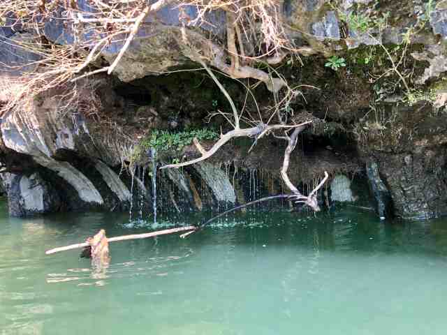
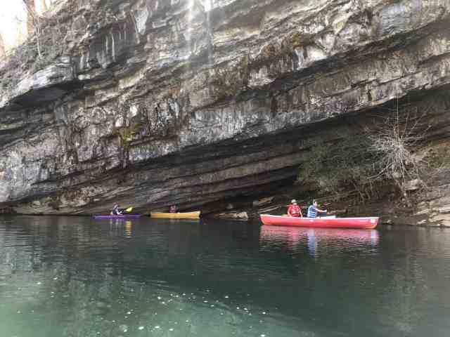
We then paused at a favorite spot on this route, a huge rock shelter that you can paddle into. There is always water dripping from the rocks above, and Richard told Elizabeth that tradition said she had to paddle through the “rain” as an initiation into our paddling group.
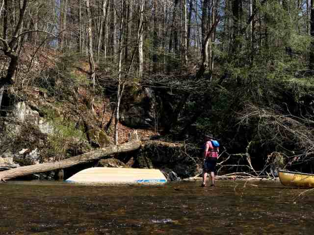
As we passed Betty Range Cliff, the water grew quite shallow. I noticed that the others had pulled over to the side of the river, and stopped to see what had attracted their attention. There was an overturned motor boat next to the bank. Rob got out to take a closer look, and he and Richard discussed how it could be “rescued” from the river. One option was to come just before TVA started generating at Wilbur Dam and turn it over while the water was shallow. Then, they surmised, it could be floated right out of the cove it was in. The trick would be, figuring out how to turn it over since it is probably very heavy with the outboard motor still attached. We wondered if it will still be there on our next trip down this river, or if the owners will be able to retrieve it.
As I said, the water was very shallow here, and I got hung up on the rocks. I eventually had to get out of my boat and drag it to deeper water before I could climb back in and continue on.
Just downstream is a tiny island where I hid a geocache in July 2016. The original ammo can and its replacement both disappeared from this location, so last summer I replaced it once again with a small bison tube, hanging from a tree. I looked as I paddled by, but did not spot it, so this cache may be missing again. I will probably replace it one more time on our next trip, but if it goes missing again will archive it. Apparently, this tiny island doesn’t like my caches!
Just past this island the river grows shallow again. Everyone else had gone down the right side and made it through the shallows without any problems. I knew there was a deep current on the left side close to the bank, so tried to make my way over there, paddling hard to get up enough speed before the shallows. I didn’t make it. My boat once again got stuck, and I had to get out and pull it to deeper water. As I got back in, I spotted some pretty purple flowers covering the ground along the bank, and wondered what they were. But, the current was too swift here to investigate so I continued downstream.
In fact, the current was so swift that I didn’t have time to put my spray skirt back on. I knew I was going to regret that, but couldn’t change the circumstances so just started paddling to try to avoid the deepest waves. No bueno. I splashed through a big wave and water poured into my boat. Cold water. I sputtered and kept paddling, hitting another wave. More cold water.
The rest of the group had pulled over to wait on me. I nudged in to shore, got out and spent a few minutes emptying the water from my boat. Fortunately, it has a drain plug on the side, so I opened it, pulled the boat up onto its side, and waited for the water to drain. In the meantime, I took stock: Shirt wet? Check. Pants wet? Check. Feet wet? Check. Underwear wet? Check. On a warm, summer day I wouldn’t have minded it as much, but with the temps in the 60s, it was a tad chilly to be wet.
Continuing down the river, I went ahead of the group, being the first to paddle through Goat Rapid. This is always a highlight of the trip – a short but fun rapid named by our friend Berta years ago. I usually steer for a big hole to enjoy the splash it produces. Since I was already wet enough, I went as far left as possible to take the more gentle route. Once through the rapid I paddled back upstream and eddied out behind the rocks in the center of the river so that I could take pictures of the rest of the group.

We continued on through the Wave Train, a rapid that usually produces a roller coaster type ride. With the low water level today, it was just a few ripples. A fisherman was standing in the water here, but he was well out of the way of our route.
There is one more little fun rapid before the Wagner Road takeout. I usually go to the left of the island here, but today I took the right side. I will probably stick to the left on future trips because it is more fun.
From here it is a slow, gentle paddle to the Wagner Road ramp. We stopped here so that the canoe paddlers could stretch their legs. I just laid back in my kayak and enjoyed the sun.
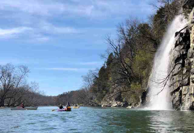
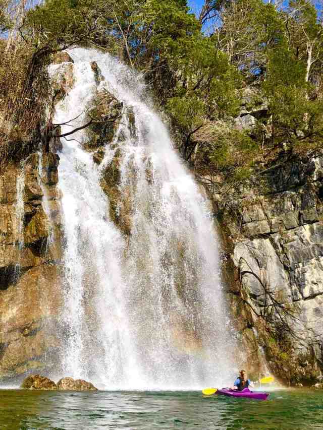
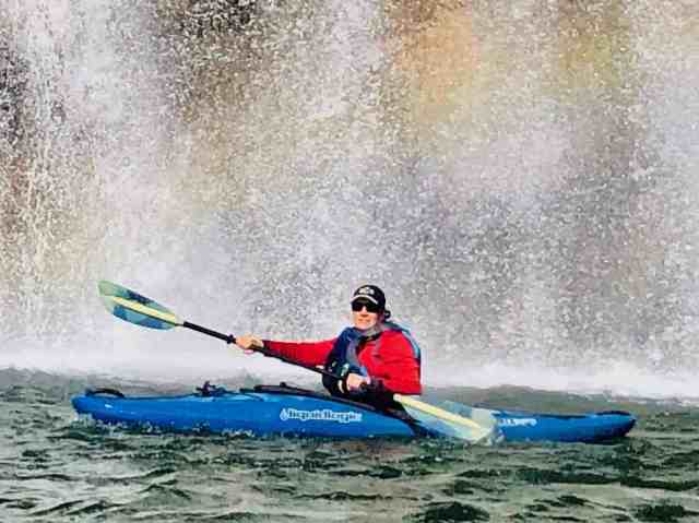
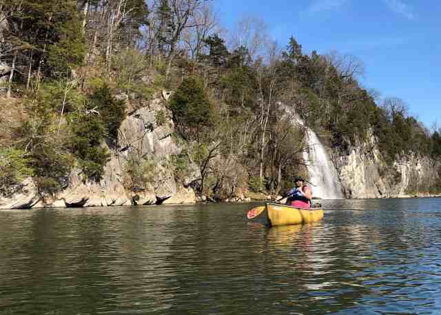
From the Wagner Road ramp it is a short paddle to Quarry Falls, a highlight of every trip on this river. No matter how many times I see these falls, I enjoy the view and have to take countless pictures. This is actually an artificial waterfall that only flows when water is being pumped out of the nearby quarry. They were running at full force today.
Usually I would paddle under the falls, enjoying the pounding water. I even considered putting on the rain jacket I had in my dry bag, but eventually decided to just enjoy the falls from a safe, and dry, distance. I made several passes near them to allow Richard to take pictures of me. I also took pictures of the teens in front of the falls. Having a person in the photo really shows how big these falls are.

When we were finished playing here, we paddled downstream a short distance. The girls pulled over to the shore and switched boats, each wanting to experience what it was like paddling a different kind of boat. Rob and I paddled on so that he could look for a cache that I had hidden last June.
Called “The Widowmaker” this cache had not yet been found. I had hidden it in a dead tree (hence the name “Widowmaker”) that stands tall next to the river. When I hid the cache, I used a large fallen limb from the tree to climb up onto the bank. This worked well going up, but I had a moment of panic coming back down and froze on top of the branch, teetering about five feet above the water unable to move. You can read more about that experience here.
Today I sat in my boat while Rob got out to search for the cache. He opted to climb up the slippery bank, grumbling at me the whole time. He made his way to the tree and began looking for the cache without success. I was giving him direction from the boat, based on my memory of the hide. Of course, it was nine months ago that I had hidden it, so that memory was fuzzy.
I finally decided to climb up and help him. I maneuvered my boat past that wicked branch I had used to climb up last time, opting to NOT go that route again. I got out of the boat and began climbing up the slippery slope. Rob asked if my boat could float away, and I assured him that since it was between two limbs that had fallen, it would not go far.
Once on the shore, I looked for the cache and confirmed that it was gone. I remembered that I had a spare pill bottle in my dry bag, so slid down the bank to retrieve it. Of course, my boat had floated just out of reach. It was not in danger of floating downstream because of the fallen limbs, but it was still several feet away from where I was standing, and the water between was about four feet deep. I picked up a big branch and used it to try to drag the boat toward me. This worked well until the paddle snagged on one of the limbs and kept it from coming any further. I contemplated crawling out on the limb, but decided against that idea. While I was deciding what to do, the boat floated free from where it was snagged, and I was able to drag it within reach with the branch.
I pulled the dry bag out and found the pill bottle in the bottom of my bag. Unfortunately, it didn’t have a log sheet in it, but I threw it up to Rob anyway and let him hid it in the tree trunk, deciding to put a log sheet in it on our next trip.
All this time, I had been standing in ankle deep water. I was wearing my SealSkinz socks under my water shoes. These socks are waterproof – to a degree. When you stand in water for 10 minutes, it finally begins to seep in. Fortunately, although my feet were wet, they weren’t too cold because of the insulating properties of the socks.
When I was ready to climb back in my boat, I discovered that I had stood in the soft mud for so long that my feet were firmly embedded several inches. I had to pull them out one at a time and swish them in the water to rinse some of the mud off my shoes.
It was about that time that Deban called. She asked if I was off the river yet. I looked at the time on my phone and saw that it was already after 5:00! I told her that we had about 20 more minutes to go, and that I probably wouldn’t make it home in time for dinner. We still had to run the shuttle and load up boats.
Once back in our boats, Rob and I paddled the short distance to where the rest of the group was waiting at the takeout. I then drove Rob and the girls to Blevins Road ramp to retrieve the other two vehicles while Richard stayed with the boats.
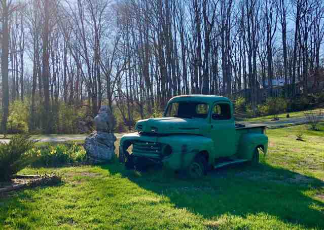
Along the way, I paused to take a picture of a cool old truck that we had seen earlier in the day on our way to the ramp. We knew that Richard would be disappointed he missed seeing it.
We returned to the take out point with all of the vehicles and loaded up the boats. During the drive I had called Deban and she told me to go ahead and eat with them since I wasn’t going to be home in time for family dinner. With the boats loaded, we drove to Pizza Inn, where I ate far too much.
This was a great first river trip for the year. I hope it is just the first of many more to come.
