Bay’s Mountain Park
- 10.5 miles
- 6:45 duration
- 1387 ft. elevation gain
- 9 geocaches found
- 9 geocaches visited (previously found)
LakeBum (Rob) and I made plans for today’s hike several weeks ago. This was to be the day we would finally log a very special cache, GC3NCQQ – Adventure Awaits: Frequent Flyer Miles. It would also be the day that Rob found his 2,000th cache. Being the great guy that he is, Rob also said this was a good chance for me to log some of the few far-flung caches in the park that I had not yet found. Earlier in the week, he sent out an invitation to others in New Cache Order to join in on his special day. Coach_L42 (Thomas) and Redn3ck (Steven) accepted that invitation.
The four of us, Signal the Frog® and my geopup Andy, met at Bay’s Mountain Park at 8:30 am and were on the trail by 8:40. The forecast was for scattered showers, but we had come prepared and ready to brave the weather.
From the Nature Center, we crossed the dam and followed Lake Road a short distance to Lake Side Trail, then made our way around the lake. Rob and I had already found all of the geocaches along this route, but they were new to Thomas and Steven, so we made frequent stops along the way so they could log them.
At one point, we heard a few raindrops falling through the trees. I pulled my rain jacket out and announced loudly that I was putting it on. This usually works to scare off the rain, and today was no exception. Within moments we heard no more rain, and after hiking in my rain jacket for about thirty minutes, I decided that I could safely shed it.
Once on the other side of the lake, we began the steep ascent up Fire Tower Trail. I was glad for a young, spry pup attached by his leash to the belt around my waist as he tugged me along up the trail. I was also glad for the two caches along this trail that Thomas needed to stop and log, because that gave me a chance to rest. As we neared the top, I said to Rob, “I am NOT hiking down Indian Pipes and up Back Hollow today!” We had done that after our last trip to this side of the park in December. The way that my legs were feeling as we slogged up the Fire Tower Trail, I didn’t think I had the energy to add those extra miles and the elevation change that would entail.
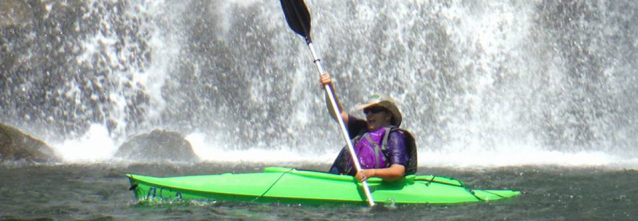
When we finally reached the Fire Tower, I handed Andy’s leash over to Rob, and joined Thomas and Steven in climbing the 60′ tower. I have been to the top before, but the climb is well worth the views. We also needed to gather information at the top in order to determine the coordinates for a puzzle cache nearby, aptly named Acrophobia (fear of heights). Andy was not happy that I went up without him, but the steps were far too steep and narrow for him to navigate.
Once we had descended, we hiked east along River Mountain Road to find the puzzle cache. After successfully locating it, we continued in that direction to find four more caches that I had not yet logged. We then turned around and hiked back past the Fire Tower toward today’s ultimate goal, the Frequent Flyer cache. We stopped once more for me to log another cache I lacked, and again for Steven and Thomas to find one that Rob and I had found on our last trip.
Finally, after four hours and a little more than five miles into our hike, we arrived at the Frequent Flyer cache. This is a challenge cache. To qualify for it, one must first log at least 20 caches hidden by the legendary DMflyer that have a terrain rating of four or higher. When we last visited this cache in December, I had already qualified for it with 24 finds. However, I chose to wait until today to log it with Rob since many of the miles I have hiked to reach those caches were with him. By the time we hiked here today, I had found 31 T4 or higher caches hidden by DMflyer. I guess you could say I’m an overachiever.
Rob had very carefully planned his geocaching for the last few months, so that he could also make this find a milestone cache. It was his 2,000th find.
After logging the cache and taking the traditional photos, we enjoyed some well earned nourishment. Andy really enjoyed sharing my bacon jerky. When it came time to discuss what route we would take back to our vehicles, Rob said, “Well, Betty said we can’t go the way I wanted to.” I told him I thought I could handle the extra distance now that the worst was behind us. He suggested that we go down Indian Pipes and Pretty Ridge to Back Hollow, and then take Cross Ridges over to Front Hollow. Knowing there was a cache on Indian Pipes that Rob hid during our last trip, and another on the Cross Ridges trail I needed to log, I was happy with that idea.
We made pretty quick work of the trip into Back Hollow where we visited Bill Simpson’s cabin so that Thomas and Steven could find the geocache there. We then began the long, gentle climb up the Cross Ridges trail. For the first time on our trip, Andy started to lag behind, walking at my heel rather than five feet in front of me. At first I thought he was tiring of our hike, but eventually realized that he was sensing something about this trail that made him nervous. About half way up, he perked back up and was back to his normal posture and speed. I’m not sure what had him spooked, and don’t really want to know.
Along this trail, I also saw the first wildflower I have seen this year in Tennessee – Blood Root. I had seen some in South Carolina a few weeks ago, but they are further south and experience spring earlier than we do. I saw many more Blood Root blossoms as we continued up the trail.
When we reached the point where the Cross Ridges Trail crests the ridge, we saw a woman and her dog coming down the Cherry Knobs Trail. We spent some time chatting with her, and gave the dogs the opportunity to get to know one another. Although he was a bit shy with the other dog, Andy seemed sad as he watched them head down the trail the way we had come.
We logged the cache at this point, and then hiked down the other side of the ridge into Front Hollow. We then followed Front Hollow Road up to Ledbetter Gap, and then took the Lake Road back to the dam and ultimately our vehicles. We passed several caches along this last stretch that Steven and Thomas had not yet logged, but they decided to save them for another day.
This hike was much longer than I had anticipated for the day, but it was a great day. We encountered no rain other than the few drops early in the hike, and the temperature was cool but not cold. We arrived at our vehicles tired but happy.
I am now down to only five caches in the park that I have not yet logged, with the exception of a very difficult puzzle that I don’t expect to ever solve. I look forward to the day that all of the icons on my map in that area have turned to yellow smilies.


