Buffalo Mountain Park
- 4.56 miles
- 3:30 duration
- 882 elevation gain
- 3 geocaches found
It had been over a month since I’ve been on a hike of any distance, and I was itching to hit the trails again. Most of my geocaching adventures lately have involved park and grabs or short jaunts into the woods – and usually in the rain. Today was the first weekend day in about a month without rain, so LakeBum (Rob) and I made plans to find some of the few remaining caches in Buffalo Mountain Park that we had not yet logged.
This was the inaugural trip of my BRAND NEW cedar hiking stick. As reported last month, I lost my original stick after our New Year’s Day hike. When he learned what had happened, my good friend Ang (who had made the original stick) told me that he was currently working on a new one and that it would be mine. My friends ROCK!
Ang delivered the new hiking stick to me a couple of weeks ago. Also crafted from cedar, it is even more beautiful than the original. I am in awe of the craftsmanship he put into it.
We started our day at 8:30, heading up the Hartsell Hollow Trail. This trail follows Catbird Creek up into the heart of the park. We have hiked this trail before to log other caches, but had never attempted to find a Multi-Cache near the end of the trail because we knew that the first several stages of it were missing. However, our friends who adopted the cache from the original owner provided us with the coordinates for the final stage, and another friend who found it last spring gave us some pointers on how to find it.
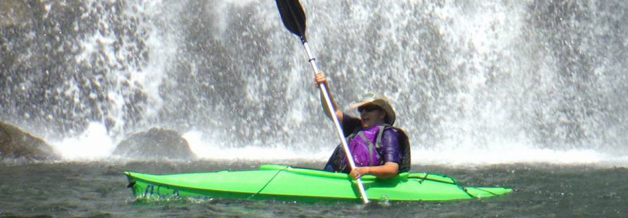
As soon as we started up the trail, we saw that Catbird Creek was flowing at a much higher level than I’ve ever seen it. In fact, water was flowing across the first foot bridge. We knew right away that this was going to be a wet foot hike, which was not good news for Rob since his boots have begun to leak. Not only were there numerous creek crossings, but there were times that the trail became one with the creek.
I was enthralled with the beautiful cascades we saw, and stopped many times to take photos. I wished I had brought along my Nikon, but had to be content with capturing the beauty with my iPhone camera. This did give me the chance to play with a trick I learned watching videos on Facebook for capturing long exposure photos on the iPhone. I was not at all satisfied with the results, so won’t be posting any of them here.
When we reached the end of the Hartsell Hollow Trail, we saw the first pink blaze signifying that we were at the beginning of the Noggin Trail aka “Trail O’ Heart Attack.” On our last visit to the park, we hiked up this trail, and it was brutal. Rob kept stopping to check his pulse that day, and I was a little concerned about having to use my CPR skills on him.
Today, we only followed the Noggin Trail until it began to head up away from the creek, and then creek-walked until we neared the coordinates for the cache. Our phones kept pointing us in different directions, so I finally put mine away and began to look for something resembling the spot that our friend had described.
Seeing a likely looking spot, I climbed up the steep hillside to look. Not finding the cache in the first spot, I moved on to a nearby place and began digging through the leaves. I suddenly spotted a rock with an X of tape. X marks the spot! Under the rock was the ammo can. I shouted to Rob that I had found it, posed with the can for a photo, and then opened it. It had a great selection of swag, including a tiny Mickey Mouse snow globe, a Transformer and a Darth Vader head. I had not carried anything with me to trade, so left all of the swag behind.
After signing the log book, I replaced the cache and we headed back down the trail to the parking area. We stopped off at the truck to collect our backpacks, and then followed the gravel service road up toward our next target.
After about 1/3 mile we left the service road and followed an unnamed trail up to the top of a ridge we had not visited before. At the top of this ridge was another geocache that we wanted to find. I was able to spot it from about 30 feet away. This was another nice ammo can, but it only had the log book inside – no swag. We signed the log and then made our way back down to the gravel road. We followed it a short distance uphill, before taking another unnamed trail down into the valley. We had hiked this way last year in search of another cache, but our goal for today was even further into the valley.
Once we reached the creek that runs through this valley, we followed it along an unused service road. This path is no longer maintained, and we spent a lot of energy ducking and crawling under or climbing over fallen trees. At the 3.5 mile mark of our journey, we reached our third cache of the day. This was a cache resurrection for us, as this cache was last found over three years ago. Rob made the find this time, and while he signed our names to the log, I played with some of the swag we found inside.
We paused afterward to have a snack, giving us the energy we needed to make the hike back up the rugged trail. It wasn’t as bad as we anticipated, and soon we found ourselves once again on the gravel service road and heading back down to the truck. Along the way we stopped twice to chat with hikers coming up the road, and to answer their questions about the trails available further up the road. With such a beautiful, warm day, the parking lot was full once we got back. It is good to see so many people enjoying this nice park.
We now have two more geocaches to find in Buffalo Mountain, but they are both on a trail that leads from the park down to Dry Creek Road. We decided to save this journey for another day. We’ve been told there may be a third cache in the park that we haven’t found – the final for a puzzle cache. However, we have not solved that puzzle so don’t know exactly where it is. In fact, since it was published in 2012, it has only been solved and found by one person. I hold little hope of ever being able to log it.
This first hike with my new hiking stick was a good one. I like it even better than the original. It is lighter, and the grip is more narrow. The forest where Ang harvested the wood for it was very dense, so the tree it was from grew very slowly. This is evident in the tight rings and deep red heart that you can see on its top. It is a thing of beauty, and I look forward to logging many more miles with it.


Am also looking forward to more hours of daylight and more hours of geocaching. Can understand how good it felt to get out on a good hike. Great news about your hiking stick, looks lovely. Wishing you hundreds of miles of scenic and fantastic hikes and geocaching, of course.