South Fork Holston River – Fort Patrick Henry Dam to John B. Dennis Drive/Church Hill to Laurel Run Park
- 6.26 miles
- 4:29 duration
- 3 caches found
- 3 caches hidden by me/4 caches hidden by LakeBum
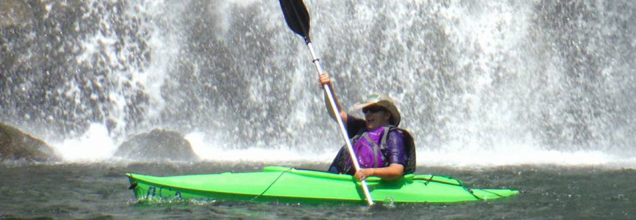
LakeBum (Rob) and I had multiple missions today that would require us to paddle two separate sections of the South Fork Holston River. We started out the morning by putting our boats in at the boat ramp just below Fort Patrick Henry Dam. I mentioned that I had never found a cache a little ways up river from the ramp. Since TVA was not generating this morning, we decided it was a good time to paddle upstream so that I could log that cache.
We paddled .25 upstream and exited our boats onto Wexler Island. We then bushwhacked to the cache site. It was only while I was signing the log did I realize that this would be a cache resurrection as well. A find is considered a cache resurrection if the cache has not been found for over a year. This cache had last been found in March 2016 – 13 months ago.
After returning to our boats, we headed back downstream. This was easier said than done, since the water level had dropped since our trip up. I ran aground and had to get out and drag my boat to deeper water.
Just after passing the boat ramp, we pulled in again on the opposite shore so that I could hide a cache. Caches are required to be 528 feet (.1 mile) apart, and there was a small sliver of real estate available there to hide one. A little further downstream, we stopped once again so that Rob could also hide a cache.
We then made another stop to find the new Cache Cracker Jacks cache. It was hidden in an great location that I will not disclose here. This is a puzzle cache with a few different layers that must be solved to learn the coordinates for the cache location.
We stopped two more times on the rest of this leg of the journey, so that each of us could hide another cache. Along the way we enjoyed the sight of wildflowers such as Little Brown Jugs, Virginia Bluebells, Bellwort, Stone Crop, Sweet White Violets, and Golden Ragwort. We also saw the usual water fowl and turtles. The fish were jumping, and we saw many people fishing from the shoreline, from boats, and wading in the shallows.
We exited the river at the John B. Dennis bridge where my truck was parked. We loaded up the boats on my truck, and drove up to our starting point to retrieve Rob’s truck. From there we drove to Laurel Run Park near Church Hill to drop off Rob’s truck at the ending point for our second leg.
As I drove along the entrance road to Laurel Run Park, I began seeing a multitude of wildflowers blooming on the hillside. Back in November, a wildfire burned around 300 acres in Bays Mountain and Laurel Run parks, including this hillside. The fire left many of the larger trees standing, but cleared out all of the underbrush and ground cover. This allowed sun to reach the forest floor this spring, which encourages the growth of native species. The fire also turned dead trees and decaying plant matter into ashes, providing nutrients for the wildflowers. All of this resulted in a particularly spectacular display this spring.
I pulled off to the side of the road, and within a 100 foot stretch, I was able to see Trillium, Larkspur, Purple Phacellia, Buttercups, Solomon’s Seal, False Solomon’s Seal and Columbine. Seeing this gorgeous display almost made up for the fact that I missed hiking in the Smokies on Friday. Almost.
After dropping off Rob’s truck, we drove back up to Church Hill to the A. S. Derrick Park boat ramp where we once again entered the river. Our first stop was on an island just downstream from the park. Our mission here was to find a cache that had last been logged in January 2015, our second cache resurrection of the day.
This island is labeled on maps as Negro Island, but I have not been able to find any history explaining the origin of the name. Once we arrived at the island we made our way across following our compasses toward the coordinates. There was a pop up tent style hunting blind set up in the woods, but fortunately no one was in it. Ironically, the blind was set up right next to the tree where the cache was hidden.
After leaving this island, we paddled downstream toward Hawkins Island, and followed a narrower channel around the left side of the island. Rob had noticed on the map a smaller island in this channel, and he wanted to explore it in hopes of hiding the third in his series of challenge caches there. To be able to log a find for this cache, one must have previously found at least 75 geocaches with the “boat required” attribute. On this island we discovered an abandoned wooden structure that appeared to have been a camping platform/hunting blind, and he successfully found a good hiding place for his cache.
We then continued down this side channel, enjoying the scenery along the way, including some more hunting blinds. As we were paddling, I noticed a large patch of red midway up a steep embankment, and had to stop to investigate. It turned out to be Fire Pink wildflowers, and I also found Dwarf Crested Iris nearby. I decided to mark the spot with another new geocache.
By now, it was nearly 3:00 pm so we paddled on to our take out spot at Laurel Run Park. After loading the boats, Rob hid one more cache near the boat ramp, and then we made our way back to Church Hill to retrieve my vehicle. We agreed that it was a very successful day indeed, and both returned to our homes happy and tired.


Pingback: May 14, 2017 – antbedy